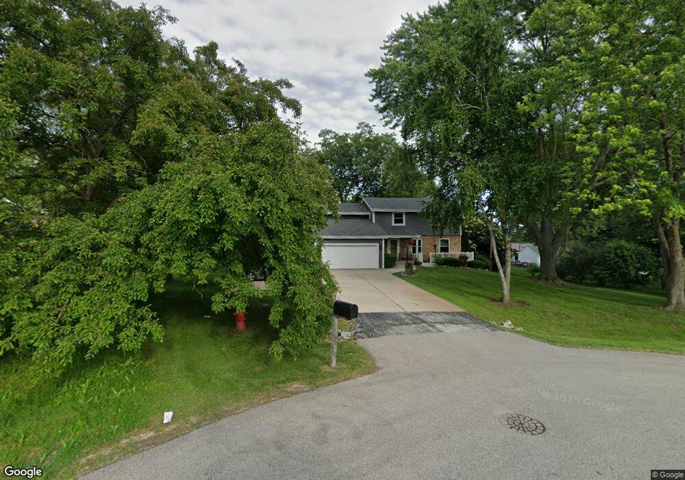
N55W14087 Carol Ct Menomonee Falls, WI 53051
Estimated Value: $501,000 - $539,000
5
Beds
3
Baths
2,283
Sq Ft
$228/Sq Ft
Est. Value
About This Home
This home is located at N55W14087 Carol Ct, Menomonee Falls, WI 53051 and is currently estimated at $520,603, approximately $228 per square foot. N55W14087 Carol Ct is a home located in Waukesha County with nearby schools including Valley View Elementary School, North Middle School, and Menomonee Falls High School.
Ownership History
Date
Name
Owned For
Owner Type
Purchase Details
Closed on
Sep 11, 2015
Sold by
Moser Richard A
Bought by
Zimmerman Rodney A and Zimmerman Michelle T
Current Estimated Value
Home Financials for this Owner
Home Financials are based on the most recent Mortgage that was taken out on this home.
Original Mortgage
$256,257
Outstanding Balance
$205,235
Interest Rate
4.5%
Mortgage Type
FHA
Estimated Equity
$315,368
Purchase Details
Closed on
Feb 28, 2013
Sold by
Moser Richard A
Bought by
Zimmerman Rodney
Create a Home Valuation Report for This Property
The Home Valuation Report is an in-depth analysis detailing your home's value as well as a comparison with similar homes in the area
Home Values in the Area
Average Home Value in this Area
Purchase History
| Date | Buyer | Sale Price | Title Company |
|---|---|---|---|
| Zimmerman Rodney A | -- | None Available | |
| Zimmerman Rodney | $27,469 | None Available |
Source: Public Records
Mortgage History
| Date | Status | Borrower | Loan Amount |
|---|---|---|---|
| Open | Zimmerman Rodney A | $256,257 |
Source: Public Records
Tax History Compared to Growth
Tax History
| Year | Tax Paid | Tax Assessment Tax Assessment Total Assessment is a certain percentage of the fair market value that is determined by local assessors to be the total taxable value of land and additions on the property. | Land | Improvement |
|---|---|---|---|---|
| 2024 | $4,446 | $394,400 | $113,600 | $280,800 |
| 2023 | $4,278 | $394,400 | $113,600 | $280,800 |
| 2022 | $3,861 | $240,900 | $78,100 | $162,800 |
| 2021 | $3,695 | $240,900 | $78,100 | $162,800 |
| 2020 | $3,889 | $240,900 | $78,100 | $162,800 |
| 2019 | $3,719 | $240,900 | $78,100 | $162,800 |
| 2018 | $3,904 | $240,900 | $78,100 | $162,800 |
| 2017 | $4,043 | $240,900 | $78,100 | $162,800 |
| 2016 | $4,114 | $240,900 | $78,100 | $162,800 |
| 2015 | $4,124 | $240,900 | $78,100 | $162,800 |
| 2014 | $4,393 | $240,900 | $78,100 | $162,800 |
| 2013 | $4,393 | $240,900 | $78,100 | $162,800 |
Source: Public Records
Map
Nearby Homes
- N52W14491 Aryshire Ct
- Lt7-8 Lucille Ln
- N60W13464 Tall Oak Ct
- N48W14336 Hampton Rd
- W144N4822 Stone Dr Unit C
- W156N5364 Bette Dr
- W136N6291 Hummingbird Way
- N64W14282 Mill Rd
- N64W14182 Mill Rd
- N63W13412 Hummingbird Way
- 4685 N 150th St
- W162N5492 Westwind Dr Unit 2
- 5861 N 121st St
- N65W14542 Redwood Dr
- W130N6462 Crestwood Dr
- 12012 W Florist Ave
- W140N6628 Florence Ave
- 4685 Pilgrim Rd
- N66W14402 Ash Dr
- 11708 W Bobolink Ave
- N55W14083 Carol Ct
- N55W14112 Carol Dr
- N55W14096 Carol Ct
- N55W14082 Carol Dr
- N55W14146 Carol Dr
- N55W14040 Carol Dr
- N55W14124 Carol Ct
- N55W14152 Carol Ct
- N55W14119 Carol Dr
- N55W14145 Carol Dr
- N55W14175 Carol Dr
- N55W14206 Carol Ct
- N54W14033 Carol Dr
- N54W14063 Carol Dr
- N55W14207 Carol Dr
- W141N5458 Van Buren Dr
- N54W14174 Van Buren Dr
- N55W14238 Carol Dr
- N54W14208 Van Buren Dr
- W141N5446 Van Buren Dr