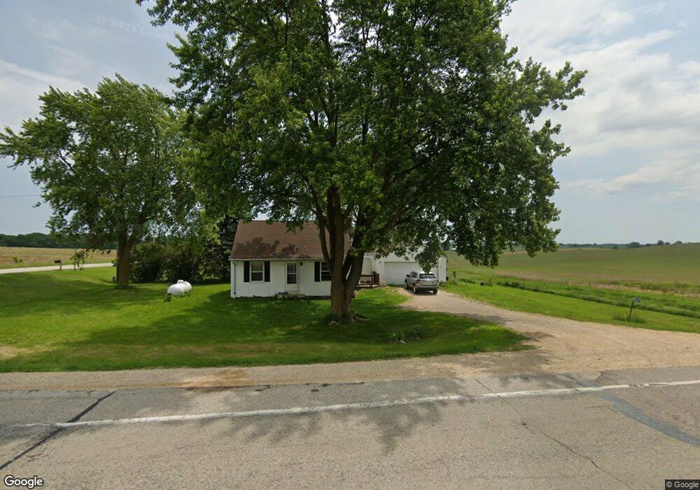
N5692 County Road P Mayville, WI 53050
Estimated Value: $282,159 - $318,000
3
Beds
1
Bath
1,231
Sq Ft
$244/Sq Ft
Est. Value
About This Home
This home is located at N5692 County Road P, Mayville, WI 53050 and is currently estimated at $300,790, approximately $244 per square foot. N5692 County Road P is a home located in Dodge County with nearby schools including Hartford High School.
Ownership History
Date
Name
Owned For
Owner Type
Purchase Details
Closed on
Oct 20, 2017
Sold by
8867 Llc
Bought by
Wagner Sara M
Current Estimated Value
Home Financials for this Owner
Home Financials are based on the most recent Mortgage that was taken out on this home.
Original Mortgage
$141,391
Outstanding Balance
$117,879
Interest Rate
3.75%
Mortgage Type
FHA
Estimated Equity
$182,911
Purchase Details
Closed on
Apr 23, 2014
Sold by
Berndt Doreen M
Bought by
8867 Llc
Purchase Details
Closed on
Aug 27, 2009
Sold by
Boeder Shawn and Boeder Sarah
Bought by
Berndt Doreen
Purchase Details
Closed on
May 1, 2006
Sold by
Sternberg Doris and Sternberg Walter
Bought by
Boeder Shawn
Home Financials for this Owner
Home Financials are based on the most recent Mortgage that was taken out on this home.
Original Mortgage
$86,700
Interest Rate
6.37%
Mortgage Type
New Conventional
Create a Home Valuation Report for This Property
The Home Valuation Report is an in-depth analysis detailing your home's value as well as a comparison with similar homes in the area
Home Values in the Area
Average Home Value in this Area
Purchase History
| Date | Buyer | Sale Price | Title Company |
|---|---|---|---|
| Wagner Sara M | $144,000 | None Available | |
| 8867 Llc | -- | None Available | |
| Berndt Doreen M | -- | None Available | |
| Berndt Doreen | $115,000 | None Available | |
| Boeder Shawn | $102,000 | -- |
Source: Public Records
Mortgage History
| Date | Status | Borrower | Loan Amount |
|---|---|---|---|
| Open | Wagner Sara M | $141,391 | |
| Previous Owner | Boeder Shawn | $86,700 |
Source: Public Records
Tax History Compared to Growth
Tax History
| Year | Tax Paid | Tax Assessment Tax Assessment Total Assessment is a certain percentage of the fair market value that is determined by local assessors to be the total taxable value of land and additions on the property. | Land | Improvement |
|---|---|---|---|---|
| 2024 | $2,020 | $140,200 | $30,500 | $109,700 |
| 2023 | $1,783 | $140,200 | $30,500 | $109,700 |
| 2022 | $1,842 | $140,200 | $30,500 | $109,700 |
| 2021 | $1,915 | $140,200 | $30,500 | $109,700 |
| 2020 | $1,984 | $140,200 | $30,500 | $109,700 |
| 2019 | $2,014 | $140,200 | $30,500 | $109,700 |
| 2018 | $1,977 | $140,200 | $30,500 | $109,700 |
| 2017 | $1,793 | $114,600 | $27,300 | $87,300 |
| 2016 | $1,737 | $114,600 | $27,300 | $87,300 |
| 2015 | $1,859 | $114,600 | $27,300 | $87,300 |
| 2014 | $2,001 | $114,600 | $27,300 | $87,300 |
Source: Public Records
Map
Nearby Homes
- 234 Watertower Cir
- 202 East Ave
- N5413 County Rd S
- Lt0 E Neda Rd
- 0 Burkwald Ave
- 6372 Yellowstone Trail N
- Lt1 Lilly Rd
- Lt0 Lilly Rd
- Lt2 Lilly Rd
- W990 Kelly Dr
- N7575 Doyle Rd
- Lt2 Rolling Hills Dr
- 7087 Nenno Rd
- 1762 Conestoga Ct
- 1783 Saddle Dr
- 757 Bridlewood Dr
- 1596 Oriole Dr
- 754 Bridlewood Dr
- 836 Tower Dr
- 947 Broadmoore Dr Unit 1702
- 5692 County Road P
- W1333 Illinois Rd
- N5731 County Road P
- N5665 County Road P
- W1501 Illinois Rd
- W1535 Illinois Rd
- W1671 Illinois Rd
- W2183 State Road 33
- W2107 State Road 33
- N5911 County Road P
- N5782 Buchanan Rd
- N5806 Buchanan Rd
- N5826 Buchanan Rd
- N5844 Buchanan Rd
- N5566 Buchanan Rd
- N5953 County Road P
- W1016 Illinois Rd
- N5968 County Road P
- N5861 Buchanan Rd
- N5887 Buchanan Rd