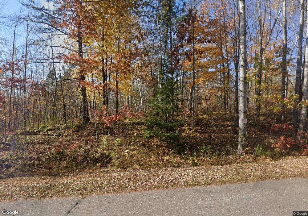
N5717 Cemetary Rd Ladysmith, WI 54848
Estimated Value: $191,457 - $279,000
--
Bed
--
Bath
--
Sq Ft
2.5
Acres
About This Home
This home is located at N5717 Cemetary Rd, Ladysmith, WI 54848 and is currently estimated at $235,364. N5717 Cemetary Rd is a home located in Rusk County with nearby schools including Ladysmith Elementary School, Ladysmith Middle School, and Ladysmith High School.
Ownership History
Date
Name
Owned For
Owner Type
Purchase Details
Closed on
Jan 26, 2021
Sold by
Soltis Michael and Soltis Christine
Bought by
Carroll Timothy P
Current Estimated Value
Purchase Details
Closed on
Nov 1, 2018
Sold by
Jones Peter A and Jones Brenda S
Bought by
Soltis Michael and Soltis Christine
Home Financials for this Owner
Home Financials are based on the most recent Mortgage that was taken out on this home.
Original Mortgage
$88,000
Interest Rate
2.63%
Mortgage Type
New Conventional
Purchase Details
Closed on
Apr 2, 2008
Sold by
Hutnik Thomas J
Bought by
Jones Peter A
Purchase Details
Closed on
Feb 12, 2007
Sold by
City Of Ladysmith
Bought by
Jones Peter A and Jones Brenda S
Create a Home Valuation Report for This Property
The Home Valuation Report is an in-depth analysis detailing your home's value as well as a comparison with similar homes in the area
Home Values in the Area
Average Home Value in this Area
Purchase History
| Date | Buyer | Sale Price | Title Company |
|---|---|---|---|
| Carroll Timothy P | $147,500 | None Available | |
| Soltis Michael | $110,000 | None Available | |
| Jones Peter A | -- | -- | |
| Jones Peter A | $109,000 | -- |
Source: Public Records
Mortgage History
| Date | Status | Borrower | Loan Amount |
|---|---|---|---|
| Previous Owner | Soltis Michael | $88,000 | |
| Closed | Jones Peter A | $0 |
Source: Public Records
Tax History Compared to Growth
Tax History
| Year | Tax Paid | Tax Assessment Tax Assessment Total Assessment is a certain percentage of the fair market value that is determined by local assessors to be the total taxable value of land and additions on the property. | Land | Improvement |
|---|---|---|---|---|
| 2024 | $1,716 | $91,000 | $10,800 | $80,200 |
| 2023 | $1,721 | $91,000 | $10,800 | $80,200 |
| 2022 | $1,698 | $91,000 | $10,800 | $80,200 |
| 2021 | $1,632 | $91,000 | $10,800 | $80,200 |
| 2020 | $1,671 | $91,000 | $10,800 | $80,200 |
| 2019 | $1,657 | $91,000 | $10,800 | $80,200 |
| 2018 | $1,482 | $75,100 | $9,100 | $66,000 |
| 2017 | $1,520 | $75,100 | $9,100 | $66,000 |
| 2016 | $1,502 | $75,100 | $9,100 | $66,000 |
| 2015 | $1,920 | $75,100 | $9,100 | $66,000 |
| 2014 | $1,274 | $75,100 | $9,100 | $66,000 |
| 2013 | $1,151 | $75,100 | $9,100 | $66,000 |
Source: Public Records
Map
Nearby Homes
- 1403 Aspen Ct
- 1005 E Bruno
- Lot 4 Bruno Ave
- N5381 State Highway 27
- 720 Summit Ave
- 1229 Eagle Ct
- 814 E 4th St N
- 000 E 10th St N
- 600 Park Ave E
- 719 E 11th St N
- 0 W 5th St N
- 500 Menasha Ave E
- 1108 and 1108.5 Menasha Ave E Unit 2
- 304 River Ave E
- 301 E 15th St N
- 805 Lake Ave E
- 711 Cleveland Ave W
- 411 Lake Ave E
- 9636 W Port Arthur Rd
- 516 Lake Ave E
- N5717 Cemetery Rd
- n 5717 Cemetery Rd
- 5717 Cemetery Rd
- N5731 Cemetary Rd
- N5731 Cemetery Rd
- W8215 Birch Ridge Rd
- W8203 Birch Ridge Rd
- W8193 Birch Ridge Rd
- W8212 Birch Ridge Rd
- W8204 Birch Ridge Rd
- W8192 Birch Ridge Rd
- W8150 Birch Ridge Rd
- N5605 Cemetary Rd
- N5800 Cemetary Rd
- N5853 Cemetary Rd
- N5517 Cemetary Rd
- N5501 Cemetary Rd
- 814 E 4th Street St
- N1897 E River Run Road Rd
- 0 Knapp Road Rd Unit 1565207
