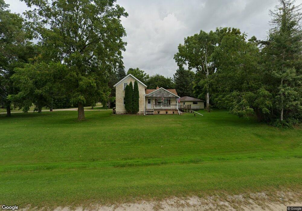
N5810 State Road 67 Iron Ridge, WI 53035
Estimated Value: $225,362 - $345,000
--
Bed
--
Bath
--
Sq Ft
0.98
Acres
About This Home
This home is located at N5810 State Road 67, Iron Ridge, WI 53035 and is currently estimated at $298,341. N5810 State Road 67 is a home located in Dodge County with nearby schools including Horicon Elementary School, Horicon High School, and St. Matthew Lutheran School.
Ownership History
Date
Name
Owned For
Owner Type
Purchase Details
Closed on
Jan 13, 2005
Sold by
Schickert Delores A and Schickert James H
Bought by
Schickert Delores A and Schickert Phyllis A
Current Estimated Value
Home Financials for this Owner
Home Financials are based on the most recent Mortgage that was taken out on this home.
Original Mortgage
$126,900
Interest Rate
9.35%
Mortgage Type
Adjustable Rate Mortgage/ARM
Create a Home Valuation Report for This Property
The Home Valuation Report is an in-depth analysis detailing your home's value as well as a comparison with similar homes in the area
Home Values in the Area
Average Home Value in this Area
Purchase History
| Date | Buyer | Sale Price | Title Company |
|---|---|---|---|
| Schickert Delores A | -- | -- |
Source: Public Records
Mortgage History
| Date | Status | Borrower | Loan Amount |
|---|---|---|---|
| Closed | Schickert Delores A | $126,900 |
Source: Public Records
Tax History Compared to Growth
Tax History
| Year | Tax Paid | Tax Assessment Tax Assessment Total Assessment is a certain percentage of the fair market value that is determined by local assessors to be the total taxable value of land and additions on the property. | Land | Improvement |
|---|---|---|---|---|
| 2024 | $2,133 | $130,600 | $32,600 | $98,000 |
| 2023 | $1,902 | $130,600 | $32,600 | $98,000 |
| 2022 | $1,945 | $130,600 | $32,600 | $98,000 |
| 2021 | $1,941 | $130,600 | $32,600 | $98,000 |
| 2020 | $2,065 | $130,600 | $32,600 | $98,000 |
| 2019 | $1,906 | $130,600 | $32,600 | $98,000 |
| 2018 | $1,954 | $130,600 | $32,600 | $98,000 |
| 2017 | $1,940 | $130,600 | $32,600 | $98,000 |
| 2016 | $1,935 | $130,600 | $32,600 | $98,000 |
| 2015 | $1,930 | $130,600 | $32,600 | $98,000 |
| 2014 | $2,087 | $130,600 | $32,600 | $98,000 |
Source: Public Records
Map
Nearby Homes
- 0 Burkwald Ave
- 202 East Ave
- 234 Watertower Cir
- Lt0 E Neda Rd
- N5413 County Rd S
- N6436 County Road Tw
- N4973 Lake Dr
- N4569 Hazelwood Rd
- N4510 Anthony Island -
- N4510 & N4504 Anthony Island
- Lt38 Sinissippi Point Rd
- W4069 Raasch Hill Rd
- .68 Acre Parcel Anthony Island
- Lt1 W Horseshoe Rd
- 727 E Lakeview Rd Unit 8
- 244 S Ridge St
- W4436 E Lakeview Rd
- 300 Birchcrest Rd
- 827 E Lakeview Rd
- 252 S Hustis St
- 120 State Road 67 Unit N
- N5812 N Hwy 67
- N5812 State Road 67
- 234 Kuehl Dr
- 236 Kuehl Dr
- 114 State Road 67
- 110 State Road 67
- N5827 State Road 67
- 230 Kuehl Dr
- 237 Kuehl Dr
- 228 Kuehl Dr
- 239 Kuehl Dr
- 100 State Road 67
- 226 Michael Dr
- 121 Westgate Dr
- 224 Michael Dr Unit A
- 224 Michael Dr
- 119 Westgate Dr
- 241 Kuehl Dr
- 118 Westgate Dr