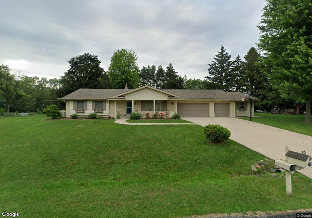
N59W18044 Spruce Ln Menomonee Falls, WI 53051
Estimated Value: $506,000 - $558,000
4
Beds
3
Baths
2,363
Sq Ft
$228/Sq Ft
Est. Value
About This Home
This home is located at N59W18044 Spruce Ln, Menomonee Falls, WI 53051 and is currently estimated at $539,433, approximately $228 per square foot. N59W18044 Spruce Ln is a home located in Waukesha County with nearby schools including Lannon Elementary School, Templeton Middle School, and Hamilton High School.
Ownership History
Date
Name
Owned For
Owner Type
Purchase Details
Closed on
May 27, 2016
Sold by
Tannel Michael A and Tannel Susan M
Bought by
Faust Lucas J and Faust Angela G
Current Estimated Value
Home Financials for this Owner
Home Financials are based on the most recent Mortgage that was taken out on this home.
Original Mortgage
$249,000
Outstanding Balance
$198,305
Interest Rate
3.59%
Mortgage Type
New Conventional
Estimated Equity
$341,128
Purchase Details
Closed on
Oct 8, 2013
Sold by
Hickey Jerry C and Hickey Janaan M
Bought by
Tannel Michael A and Tannel Susan M
Home Financials for this Owner
Home Financials are based on the most recent Mortgage that was taken out on this home.
Original Mortgage
$132,500
Interest Rate
4.58%
Mortgage Type
New Conventional
Create a Home Valuation Report for This Property
The Home Valuation Report is an in-depth analysis detailing your home's value as well as a comparison with similar homes in the area
Home Values in the Area
Average Home Value in this Area
Purchase History
| Date | Buyer | Sale Price | Title Company |
|---|---|---|---|
| Faust Lucas J | $339,000 | None Available | |
| Tannel Michael A | $322,500 | None Available |
Source: Public Records
Mortgage History
| Date | Status | Borrower | Loan Amount |
|---|---|---|---|
| Open | Faust Lucas J | $249,000 | |
| Previous Owner | Tannel Michael A | $132,500 |
Source: Public Records
Tax History Compared to Growth
Tax History
| Year | Tax Paid | Tax Assessment Tax Assessment Total Assessment is a certain percentage of the fair market value that is determined by local assessors to be the total taxable value of land and additions on the property. | Land | Improvement |
|---|---|---|---|---|
| 2024 | $5,181 | $460,200 | $126,900 | $333,300 |
| 2023 | $4,987 | $460,200 | $126,900 | $333,300 |
| 2022 | $4,685 | $292,000 | $87,600 | $204,400 |
| 2021 | $4,412 | $292,000 | $87,600 | $204,400 |
| 2020 | $4,420 | $292,000 | $87,600 | $204,400 |
| 2019 | $4,448 | $292,000 | $87,600 | $204,400 |
| 2018 | $4,281 | $292,000 | $87,600 | $204,400 |
| 2017 | $4,165 | $292,000 | $87,600 | $204,400 |
| 2016 | $4,259 | $292,000 | $87,600 | $204,400 |
| 2015 | $4,470 | $292,000 | $87,600 | $204,400 |
| 2014 | $4,956 | $292,000 | $87,600 | $204,400 |
| 2013 | $4,956 | $292,000 | $87,600 | $204,400 |
Source: Public Records
Map
Nearby Homes
- N59W17728 Meadow Ct Unit 15
- W183N6023 Lost Pond Ct
- W208N6659 Sweet Clover Dr
- N51W18938 Quietwood Dr
- N58W19314 Fox River Way
- N51W18970 Quietwood Dr
- W170N5582 Ridgewood Dr Unit 5582
- W195N5814 Deer Park Ct
- N54W19340 Kearney Ln
- Lt40 Edgewater Ct
- N54W19469 Broadwing Place
- N57W19673 Holly Ct
- W194N5457 Broadwing Cir
- N51W18979 Quietwood Dr
- N51W19033 Quietwood Dr
- Lt2 Quietwood Dr
- N54W16349 Westwind Dr
- N61W16085 Hawthorne Dr
- N69W17762 Morning Star Ct
- W188N5040 Red Crown Trail
- N59W18083 Spruce Ln
- Lt1 Marcy Rd
- W180N5948 Marcy Rd
- N59W18117 Spruce Ln
- W178N5990 Timms Prairie Walk Unit 1
- W178N5982 Timms Prairie Walk Unit 2
- N59W18144 Spruce Ln
- N58W18034 Birch Ln
- N59W18155 Spruce Ln
- W180N6029 Marcy Rd
- N58W18080 Birch Ln
- W181N5986 Jackson Dr
- W181N6004 Jackson Dr
- N59W17838 Prairie Sky Ct Unit 3
- N59W17814 Prairie Sky Ct Unit 4
- N58W18031 Birch Ln
- W178N6011 Prairie Sky Ct Unit 8
- W178N6006 Prairie Sky Ct Unit 10
- W178N6009 Prairie Sky Ct Unit 7
- N58W18116 Birch Ln