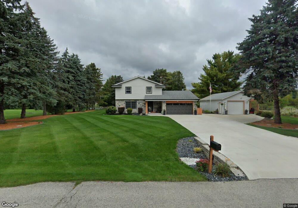
N59W21422 Mclaughlin Dr Menomonee Falls, WI 53051
Estimated Value: $430,000 - $479,000
4
Beds
2
Baths
1,670
Sq Ft
$271/Sq Ft
Est. Value
About This Home
This home is located at N59W21422 Mclaughlin Dr, Menomonee Falls, WI 53051 and is currently estimated at $452,043, approximately $270 per square foot. N59W21422 Mclaughlin Dr is a home located in Waukesha County with nearby schools including Lannon Elementary School, Templeton Middle School, and Hamilton High School.
Ownership History
Date
Name
Owned For
Owner Type
Purchase Details
Closed on
Jul 17, 2015
Sold by
Nienas Albert A
Bought by
Curro Andrew S and Curro Michelle J
Current Estimated Value
Home Financials for this Owner
Home Financials are based on the most recent Mortgage that was taken out on this home.
Original Mortgage
$216,600
Outstanding Balance
$170,005
Interest Rate
4.05%
Mortgage Type
New Conventional
Estimated Equity
$282,038
Purchase Details
Closed on
Aug 4, 2006
Sold by
Nienas Albert A
Bought by
The Albert A Nienas Living Trust
Create a Home Valuation Report for This Property
The Home Valuation Report is an in-depth analysis detailing your home's value as well as a comparison with similar homes in the area
Home Values in the Area
Average Home Value in this Area
Purchase History
| Date | Buyer | Sale Price | Title Company |
|---|---|---|---|
| Curro Andrew S | $228,000 | None Available | |
| The Albert A Nienas Living Trust | -- | None Available |
Source: Public Records
Mortgage History
| Date | Status | Borrower | Loan Amount |
|---|---|---|---|
| Open | Curro Andrew S | $216,600 |
Source: Public Records
Tax History Compared to Growth
Tax History
| Year | Tax Paid | Tax Assessment Tax Assessment Total Assessment is a certain percentage of the fair market value that is determined by local assessors to be the total taxable value of land and additions on the property. | Land | Improvement |
|---|---|---|---|---|
| 2024 | $3,817 | $341,300 | $101,100 | $240,200 |
| 2023 | $3,666 | $341,300 | $101,100 | $240,200 |
| 2022 | $3,399 | $213,800 | $69,600 | $144,200 |
| 2021 | $3,200 | $213,800 | $69,600 | $144,200 |
| 2020 | $3,222 | $213,800 | $69,600 | $144,200 |
| 2019 | $3,232 | $213,800 | $69,600 | $144,200 |
| 2018 | $3,104 | $213,800 | $69,600 | $144,200 |
| 2017 | $2,831 | $199,800 | $69,600 | $130,200 |
| 2016 | $2,892 | $199,800 | $69,600 | $130,200 |
| 2015 | $3,039 | $199,800 | $69,600 | $130,200 |
| 2014 | $3,370 | $199,800 | $69,600 | $130,200 |
| 2013 | $3,370 | $199,800 | $69,600 | $130,200 |
Source: Public Records
Map
Nearby Homes
- W212N6064 Legacy Trail
- W217N6084 Cypress Point
- N57W20859 Lomond Rd
- N57W20904 Lomond Rd
- N56W21025 Carnoustie Way
- N56W21027 Carnoustie Way
- The Wicklow Plan at Fox River Falls
- The Walnut Plan at Fox River Falls
- The Sycamore Plan at Fox River Falls
- The Sweetbriar Plan at Fox River Falls
- The Savannah Plan at Fox River Falls
- The Mulberry Plan at Fox River Falls
- The Monterey Plan at Fox River Falls
- The Marigold Plan at Fox River Falls
- The Maple Plan at Fox River Falls
- The Lily Plan at Fox River Falls
- The Lavender Plan at Fox River Falls
- The Kendall Plan at Fox River Falls
- The Juneberry Plan at Fox River Falls
- The Holly Plan at Fox River Falls
- N58W21425 Mclaughlin Dr
- N59W21482 Mclaughlin Dr
- W214N5868 Silver Meadows Dr
- N58W21498 Mclaughlin Dr
- W214N5846 Silver Meadows Dr
- N59W21465 MacLynn Dr
- N59W21511 MacLynn Dr
- N59W21421 MacLynn Dr
- N59W21535 MacLynn Dr
- N59W21422 MacLynn Dr
- N59W21520 MacLynn Dr
- W215N5871 Silver Meadows Dr
- W215N5891 Silver Meadows Dr
- W214N5818 Silver Meadows Dr
- N59W21613 MacLynn Dr
- W215N5986 Arbor Ln
- N59W21566 MacLynn Dr
- W215N5993 Arbor Ln
- N60W21445 Legacy Trail
- N59W21621 Silver Meadows Dr