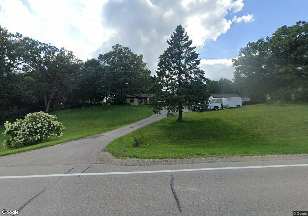
N6099 State Road 59 Albany, WI 53502
Estimated Value: $480,378 - $498,000
--
Bed
--
Bath
--
Sq Ft
1.5
Acres
About This Home
This home is located at N6099 State Road 59, Albany, WI 53502 and is currently estimated at $490,095. N6099 State Road 59 is a home located in Green County with nearby schools including Albany Elementary School, Albany Community Middle School, and Albany High School.
Ownership History
Date
Name
Owned For
Owner Type
Purchase Details
Closed on
Sep 24, 2019
Sold by
Gander David J and Gander Michelle M
Bought by
Klinger Dylan T
Current Estimated Value
Home Financials for this Owner
Home Financials are based on the most recent Mortgage that was taken out on this home.
Original Mortgage
$272,650
Outstanding Balance
$238,327
Interest Rate
3.5%
Mortgage Type
New Conventional
Estimated Equity
$251,768
Purchase Details
Closed on
May 18, 2018
Sold by
Sherwin William J and Sherwin Lois J
Bought by
Gander David J and Gander Michelle M
Home Financials for this Owner
Home Financials are based on the most recent Mortgage that was taken out on this home.
Original Mortgage
$274,928
Interest Rate
5.12%
Mortgage Type
FHA
Create a Home Valuation Report for This Property
The Home Valuation Report is an in-depth analysis detailing your home's value as well as a comparison with similar homes in the area
Home Values in the Area
Average Home Value in this Area
Purchase History
| Date | Buyer | Sale Price | Title Company |
|---|---|---|---|
| Klinger Dylan T | $287,000 | None Available | |
| Gander David J | $280,000 | None Available |
Source: Public Records
Mortgage History
| Date | Status | Borrower | Loan Amount |
|---|---|---|---|
| Open | Klinger Dylan T | $272,650 | |
| Previous Owner | Gander David J | $274,928 |
Source: Public Records
Tax History Compared to Growth
Tax History
| Year | Tax Paid | Tax Assessment Tax Assessment Total Assessment is a certain percentage of the fair market value that is determined by local assessors to be the total taxable value of land and additions on the property. | Land | Improvement |
|---|---|---|---|---|
| 2024 | $4,932 | $329,200 | $63,000 | $266,200 |
| 2023 | $3,855 | $329,200 | $63,000 | $266,200 |
| 2022 | $4,046 | $191,000 | $37,500 | $153,500 |
| 2021 | $3,995 | $191,000 | $37,500 | $153,500 |
| 2020 | $3,764 | $191,000 | $37,500 | $153,500 |
| 2019 | $3,757 | $191,000 | $37,500 | $153,500 |
| 2018 | $3,909 | $191,000 | $37,500 | $153,500 |
| 2017 | $3,827 | $191,000 | $37,500 | $153,500 |
| 2016 | $3,727 | $191,000 | $37,500 | $153,500 |
| 2014 | $3,570 | $191,000 | $37,500 | $153,500 |
Source: Public Records
Map
Nearby Homes
- N6220 Blarney Stone Dr Unit 53
- Lot 85 Blarney Stone Dr
- Lot 57 Blarney Stone Dr
- Lot 47 Blarney Stone Dr
- Lot 61 Blarney Stone Dr
- Lot 68 Blarney Stone Dr
- N6285 Blarney Stone Dr
- Lot 79 Blarney Stone Dr
- Lot 63 Blarney Stone Dr
- Lot 76 Blarney Stone Dr
- Lot 56 Blarney Stone Dr
- Lot 58 Blarney Stone Dr
- Lot 59 Blarney Stone Dr
- Lot 48 Blarney Stone Dr Unit 48
- Lot 22 Bud Ln
- N5585 Shea Ln
- Lt4 N Cincinnati St
- Lt3 N Cincinnati St
- 303 N Summit St
- 302 N 5th Ave
- n 6099 State Road 59
- N6099 Wisconsin 59
- N6113 State Road 59
- n 6113 State Road 59
- N6098 Hammer Rd
- N6056 Hammer Rd
- L6 Hammer Rd
- N6122 Hammer Rd
- N6142 Hammer Rd
- N6060 Hammer Rd
- N6804 Hammer Rd
- N6154 Hammer Rd
- W168 High Roller Cir
- W155 Boots Dr
- N6075 Hammer Rd
- 6804 Hammer Rd
- N6147 Hammer Rd
- N6069 Hammer Rd
- W176 High Roller Cir
- W177 Boots Dr