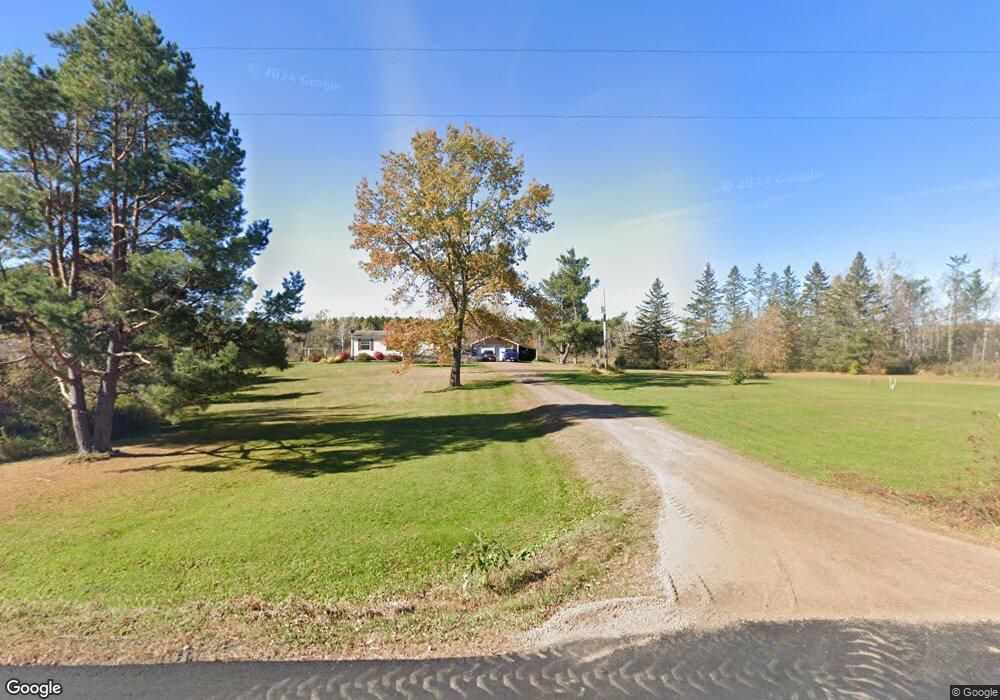
N6193 Cemetary Rd Ladysmith, WI 54848
Estimated Value: $215,392 - $291,000
--
Bed
--
Bath
--
Sq Ft
10
Acres
About This Home
This home is located at N6193 Cemetary Rd, Ladysmith, WI 54848 and is currently estimated at $249,797. N6193 Cemetary Rd is a home located in Rusk County with nearby schools including Ladysmith Elementary School, Ladysmith Middle School, and Ladysmith High School.
Ownership History
Date
Name
Owned For
Owner Type
Purchase Details
Closed on
Jun 30, 2016
Sold by
Luebke Christa D
Bought by
Armstrong John D
Current Estimated Value
Purchase Details
Closed on
May 27, 2010
Sold by
Nelson Sally A
Bought by
Verdegan Christa D
Home Financials for this Owner
Home Financials are based on the most recent Mortgage that was taken out on this home.
Original Mortgage
$22,000
Interest Rate
5.13%
Purchase Details
Closed on
Oct 5, 2009
Sold by
Miller Robin M
Bought by
Nelson Sally A
Create a Home Valuation Report for This Property
The Home Valuation Report is an in-depth analysis detailing your home's value as well as a comparison with similar homes in the area
Home Values in the Area
Average Home Value in this Area
Purchase History
| Date | Buyer | Sale Price | Title Company |
|---|---|---|---|
| Armstrong John D | $99,000 | -- | |
| Verdegan Christa D | -- | -- | |
| Nelson Sally A | $27,000 | -- |
Source: Public Records
Mortgage History
| Date | Status | Borrower | Loan Amount |
|---|---|---|---|
| Previous Owner | Verdegan Christa D | $22,000 | |
| Closed | Nelson Sally A | $0 |
Source: Public Records
Tax History Compared to Growth
Tax History
| Year | Tax Paid | Tax Assessment Tax Assessment Total Assessment is a certain percentage of the fair market value that is determined by local assessors to be the total taxable value of land and additions on the property. | Land | Improvement |
|---|---|---|---|---|
| 2024 | $1,719 | $103,900 | $10,600 | $93,300 |
| 2023 | $1,675 | $103,900 | $10,600 | $93,300 |
| 2022 | $1,677 | $104,000 | $10,700 | $93,300 |
| 2021 | $1,577 | $104,000 | $10,700 | $93,300 |
| 2020 | $1,720 | $104,000 | $10,700 | $93,300 |
| 2019 | $1,672 | $103,900 | $10,600 | $93,300 |
| 2018 | $1,704 | $84,300 | $9,100 | $75,200 |
| 2017 | $1,886 | $83,500 | $9,100 | $74,400 |
| 2016 | $1,878 | $83,500 | $9,100 | $74,400 |
| 2015 | $2,134 | $83,500 | $9,100 | $74,400 |
| 2014 | $1,588 | $83,500 | $9,100 | $74,400 |
| 2013 | $1,443 | $83,500 | $9,100 | $74,400 |
Source: Public Records
Map
Nearby Homes
- 1 State Highway 27
- 9636 W Port Arthur Rd
- 8+ Acres On Thornapple River
- N6527 Timber Trail
- 1403 Aspen Ct
- N5381 State Highway 27
- 1005 E Bruno
- Lot 4 Bruno Ave
- 720 Summit Ave
- N6909 W Elm Rd
- 1229 Eagle Ct
- 0 W 5th St N
- 814 E 4th St N
- 600 Park Ave E
- 000 E 10th St N
- 719 E 11th St N
- 500 Menasha Ave E
- 1108 and 1108.5 Menasha Ave E Unit 2
- 304 River Ave E
- 711 Cleveland Ave W
- N6234 Cemetary Rd
- W8250 E Parkview Rd
- W8211 E Parkview Rd
- W8231 E Parkview Rd
- W8273 E Parkview Rd
- W8312 E Parkview Rd
- 8273 E Park View Rd
- 8312 E Park View Rd
- W8295 E Parkview Rd
- W8255 E Parkview Rd
- 6316 Cemetery Rd
- N6316 Cemetary Rd
- N6562 Timber Trail E
- W8335 E Parkview Rd
- W8392 E Parkview Rd
- W8392 E Parkview Rd
- N6364 Cemetery Rd
- N6364 Cemetary Rd
- N6364 Cemetary Rd
- W8395 E Parkview Rd