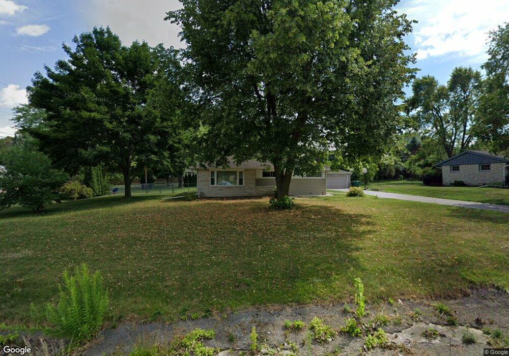
N61W15213 How Ave Menomonee Falls, WI 53051
Estimated Value: $355,000 - $422,000
3
Beds
2
Baths
1,234
Sq Ft
$308/Sq Ft
Est. Value
About This Home
This home is located at N61W15213 How Ave, Menomonee Falls, WI 53051 and is currently estimated at $379,871, approximately $307 per square foot. N61W15213 How Ave is a home located in Waukesha County with nearby schools including North Middle School, Menomonee Falls High School, and Pilgrim Lutheran School.
Ownership History
Date
Name
Owned For
Owner Type
Purchase Details
Closed on
Jun 14, 2019
Sold by
Miller Michael P and Miller Nancy C
Bought by
Lasowski Matthew J and Lasowski Jordyn A
Current Estimated Value
Home Financials for this Owner
Home Financials are based on the most recent Mortgage that was taken out on this home.
Original Mortgage
$232,750
Outstanding Balance
$203,472
Interest Rate
3.82%
Mortgage Type
New Conventional
Estimated Equity
$176,399
Create a Home Valuation Report for This Property
The Home Valuation Report is an in-depth analysis detailing your home's value as well as a comparison with similar homes in the area
Home Values in the Area
Average Home Value in this Area
Purchase History
| Date | Buyer | Sale Price | Title Company |
|---|---|---|---|
| Lasowski Matthew J | $245,000 | None Available |
Source: Public Records
Mortgage History
| Date | Status | Borrower | Loan Amount |
|---|---|---|---|
| Open | Lasowski Matthew J | $232,750 |
Source: Public Records
Tax History Compared to Growth
Tax History
| Year | Tax Paid | Tax Assessment Tax Assessment Total Assessment is a certain percentage of the fair market value that is determined by local assessors to be the total taxable value of land and additions on the property. | Land | Improvement |
|---|---|---|---|---|
| 2024 | $3,227 | $288,600 | $116,100 | $172,500 |
| 2023 | $3,097 | $288,600 | $116,100 | $172,500 |
| 2022 | $3,265 | $204,800 | $79,800 | $125,000 |
| 2021 | $3,123 | $204,800 | $79,800 | $125,000 |
| 2020 | $3,295 | $204,800 | $79,800 | $125,000 |
| 2019 | $3,147 | $204,800 | $79,800 | $125,000 |
| 2018 | $3,296 | $204,800 | $79,800 | $125,000 |
| 2017 | $3,929 | $204,800 | $79,800 | $125,000 |
| 2016 | $3,478 | $204,800 | $79,800 | $125,000 |
| 2015 | $3,491 | $204,800 | $79,800 | $125,000 |
| 2014 | $3,723 | $204,800 | $79,800 | $125,000 |
| 2013 | $3,723 | $204,800 | $79,800 | $125,000 |
Source: Public Records
Map
Nearby Homes
- N65W14542 Redwood Dr
- N64W14282 Mill Rd
- N64W14182 Mill Rd
- N66W14402 Ash Dr
- N67W15832 Tamarack Trail
- W140N6628 Florence Ave
- W136N6291 Hummingbird Way
- W162N5492 Westwind Dr Unit 2
- W155N6995 Amberleigh Cir
- W148N6937 Terriwood Dr
- W156N5364 Bette Dr
- N60W13464 Tall Oak Ct
- N69W15889 Eileen Ave
- W155N7081 Amberleigh Cir
- N68W14031 Oakwood Dr
- N63W13412 Hummingbird Way
- W157N7069 Mayflower Ct Unit A
- N52W14491 Aryshire Ct
- W144N7085 Terrace Dr
- W130N6462 Crestwood Dr
- N61W15167 How Ave
- N61W15249 How Ave
- N61W15222 How Ave
- W151N6179 Mineola Dr
- N61W15131 How Ave
- N61W15285 How Ave
- N61W15288 Pontiac Dr
- N61W15093 How Ave
- N61W15188 Wigwam Dr
- W152N6208 Pontiac Dr
- N61W15230 Wigwam Dr
- N61W15150 Wigwam Dr
- N61W15082 How Ave
- W151N6199 Mineola Dr
- W153N6156 Wigwam Dr
- N61W15266 Wigwam Dr
- N61W15110 Wigwam Dr
- W152N6219 Pontiac Dr
- W151N6196 Mineola Dr
- N61W15061 How Ave