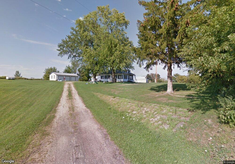
N620 Schroeder Rd Coon Valley, WI 54623
Estimated Value: $276,639 - $506,000
--
Bed
--
Bath
--
Sq Ft
2.68
Acres
About This Home
This home is located at N620 Schroeder Rd, Coon Valley, WI 54623 and is currently estimated at $343,660. N620 Schroeder Rd is a home located in La Crosse County with nearby schools including Southern Bluffs Elementary School, Longfellow Middle School, and Central High School.
Ownership History
Date
Name
Owned For
Owner Type
Purchase Details
Closed on
Jun 19, 2012
Sold by
Schroeder Dale W and Willer Joanne M
Bought by
Schroeder James L and Schroeder Elizabeth M
Current Estimated Value
Home Financials for this Owner
Home Financials are based on the most recent Mortgage that was taken out on this home.
Original Mortgage
$132,554
Outstanding Balance
$91,519
Interest Rate
3.75%
Mortgage Type
FHA
Estimated Equity
$252,141
Purchase Details
Closed on
Mar 22, 2011
Sold by
Ericson Paul W
Bought by
Schroeder Donald E and Schroeder Dale W
Create a Home Valuation Report for This Property
The Home Valuation Report is an in-depth analysis detailing your home's value as well as a comparison with similar homes in the area
Home Values in the Area
Average Home Value in this Area
Purchase History
| Date | Buyer | Sale Price | Title Company |
|---|---|---|---|
| Schroeder James L | $135,000 | None Available | |
| Schroeder Donald E | -- | None Available |
Source: Public Records
Mortgage History
| Date | Status | Borrower | Loan Amount |
|---|---|---|---|
| Open | Schroeder James L | $132,554 |
Source: Public Records
Tax History Compared to Growth
Tax History
| Year | Tax Paid | Tax Assessment Tax Assessment Total Assessment is a certain percentage of the fair market value that is determined by local assessors to be the total taxable value of land and additions on the property. | Land | Improvement |
|---|---|---|---|---|
| 2023 | $2,475 | $131,700 | $35,900 | $95,800 |
| 2022 | $2,431 | $131,700 | $35,900 | $95,800 |
| 2021 | $2,454 | $131,700 | $35,900 | $95,800 |
| 2020 | $2,470 | $131,700 | $35,900 | $95,800 |
| 2019 | $2,429 | $131,700 | $35,900 | $95,800 |
| 2018 | $2,383 | $131,700 | $35,900 | $95,800 |
| 2017 | $2,390 | $131,700 | $35,900 | $95,800 |
| 2016 | $2,219 | $114,300 | $35,900 | $78,400 |
| 2015 | $2,118 | $114,300 | $35,900 | $78,400 |
| 2014 | $2,160 | $114,300 | $35,900 | $78,400 |
| 2013 | $1,901 | $93,600 | $35,000 | $58,600 |
Source: Public Records
Map
Nearby Homes
- N1110 Bloomer Mill Rd
- W4934 Mill St
- W4945 Harvest Ln
- 000 Us Highway 14 61 -
- N1394 Red Oaks Dr
- W842 County Road K
- 5615 Meir Ct
- TBD Vanity Dr
- 5917 River Run Rd
- 5521 Mormon Coulee Rd
- 5221 33rd St S
- 0000 Korthals Ln
- W1080 Mohawk Valley Rd
- 3532 Levy Ln
- N1583 Meadow Ridge Rd
- N1947 Forest Ridge Dr
- W4946 Battlestone Station Rd Unit 23
- W4952 Battlestone Station Rd Unit 25
- 3010 N Marion Rd
- 0000 Mormon Coulee Rd
- Lot 1 County Road Mm
- W5008 County Road Mm
- W5022 County Road Mm
- W5038 County Road Mm
- W5056 County Road Mm
- N511 Gronemus Rd
- N425 Gronemus Rd
- N612 Dengel Rd
- N751 Bloomer Mill Rd
- N614 Dengel Rd
- W4651 County Road Mm
- N430 Gronemus Rd
- N771 Lauterbach Rd
- N710 Bloomer Mill Rd
- N788 Lauterbach Rd
- N775 Bloomer Mill Rd
- W4586 County Road Mm
- W4567 County Road Mm
- W5291 Sky Line Dr
- N906 Lauterbach Rd