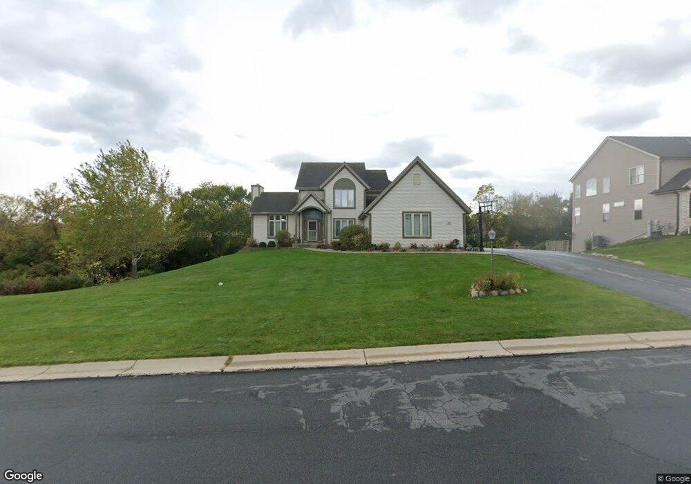
N63W12935 Grove St Menomonee Falls, WI 53051
Estimated Value: $701,198 - $736,000
4
Beds
4
Baths
3,340
Sq Ft
$216/Sq Ft
Est. Value
About This Home
This home is located at N63W12935 Grove St, Menomonee Falls, WI 53051 and is currently estimated at $721,800, approximately $216 per square foot. N63W12935 Grove St is a home located in Waukesha County with nearby schools including North Middle School, Menomonee Falls High School, and Milwaukee Seventh-Day Adventist School.
Ownership History
Date
Name
Owned For
Owner Type
Purchase Details
Closed on
Dec 16, 2003
Sold by
Saniter Llc
Bought by
Khambatta Sunita
Current Estimated Value
Home Financials for this Owner
Home Financials are based on the most recent Mortgage that was taken out on this home.
Original Mortgage
$280,000
Outstanding Balance
$131,195
Interest Rate
6.04%
Mortgage Type
Purchase Money Mortgage
Estimated Equity
$590,605
Create a Home Valuation Report for This Property
The Home Valuation Report is an in-depth analysis detailing your home's value as well as a comparison with similar homes in the area
Home Values in the Area
Average Home Value in this Area
Purchase History
| Date | Buyer | Sale Price | Title Company |
|---|---|---|---|
| Khambatta Sunita | $350,000 | -- |
Source: Public Records
Mortgage History
| Date | Status | Borrower | Loan Amount |
|---|---|---|---|
| Open | Khambatta Sunita | $280,000 |
Source: Public Records
Tax History Compared to Growth
Tax History
| Year | Tax Paid | Tax Assessment Tax Assessment Total Assessment is a certain percentage of the fair market value that is determined by local assessors to be the total taxable value of land and additions on the property. | Land | Improvement |
|---|---|---|---|---|
| 2024 | $6,699 | $589,900 | $156,400 | $433,500 |
| 2023 | $6,003 | $549,000 | $156,400 | $392,600 |
| 2022 | $6,220 | $383,700 | $107,900 | $275,800 |
| 2021 | $5,957 | $383,700 | $107,900 | $275,800 |
| 2020 | $6,240 | $383,700 | $107,900 | $275,800 |
| 2019 | $5,982 | $383,700 | $107,900 | $275,800 |
| 2018 | $6,310 | $383,700 | $107,900 | $275,800 |
| 2017 | $6,505 | $383,700 | $107,900 | $275,800 |
| 2016 | $6,626 | $383,700 | $107,900 | $275,800 |
| 2015 | $6,626 | $383,700 | $107,900 | $275,800 |
| 2014 | $7,043 | $383,700 | $107,900 | $275,800 |
| 2013 | $7,043 | $383,700 | $107,900 | $275,800 |
Source: Public Records
Map
Nearby Homes
- N63W13412 Hummingbird Way
- N66W12812 Corryton Ct
- 11958 W Mill Rd Unit 24
- 11910 W Mill Rd Unit 6
- W137N6161 Weyer Farm Ct
- 5861 N 121st St
- 11957 W Appleton Ave Unit 4
- 11937 W Appleton Ave Unit 14
- 11937 W Appleton Ave Unit 20
- 6241 N 118th St
- 6183 N 118th St
- 11927 W Appleton Ave Unit 6
- 11917 W Appleton Ave Unit 6
- W134N6759 Wild Rose Ct
- 6172 N 116th St
- 5935 N 117th St
- N64W14282 Mill Rd
- 11335 W Carmen Ave
- N65W14542 Redwood Dr
- 11250 W Heritage Dr
- N63W12969 Grove St
- N62W12936 River Heights Dr
- N63W12922 Grove St
- N63W12896 Grove St
- N62W12900 River Heights Dr
- N63W12966 Grove St
- N62W12972 River Heights Dr
- N63W12864 Grove St
- N62W12852 River Heights Dr
- N63W12824 Grove St
- N63W12825 Grove St
- N62W12921 River Heights Dr
- W130N6289 River Dr
- W130N6303 River Dr
- W130N6259 River Dr
- W130N6275 River Dr
- N62W12957 River Heights Dr
- W128N6240 River Heights Dr
- W127N6277 Sumac St
- W128N6239 River Heights Dr