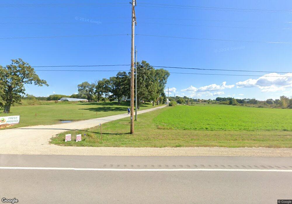
N640 Us Highway 12 Fort Atkinson, WI 53538
Estimated Value: $386,000 - $816,000
3
Beds
1
Bath
1,500
Sq Ft
$380/Sq Ft
Est. Value
About This Home
This home is located at N640 Us Highway 12, Fort Atkinson, WI 53538 and is currently estimated at $570,462, approximately $380 per square foot. N640 Us Highway 12 is a home located in Jefferson County with nearby schools including Purdy Elementary School, Fort Atkinson Middle School, and Fort Atkinson High School.
Ownership History
Date
Name
Owned For
Owner Type
Purchase Details
Closed on
Jul 8, 2022
Sold by
Stade Auction Center Inc
Bought by
Chupp Larry E and Chupp Betty D
Current Estimated Value
Purchase Details
Closed on
Sep 10, 2020
Sold by
Stade Auction Center Inc
Bought by
Wisconsin Department Of Transportation
Purchase Details
Closed on
Jan 30, 2018
Sold by
Stade William P and Stade Karen M
Bought by
Stade Auction Center Inc
Purchase Details
Closed on
Mar 24, 2013
Sold by
Young Charlotte M
Bought by
Stade William P and Stade Karen M
Home Financials for this Owner
Home Financials are based on the most recent Mortgage that was taken out on this home.
Original Mortgage
$325,000
Interest Rate
3.5%
Mortgage Type
Future Advance Clause Open End Mortgage
Create a Home Valuation Report for This Property
The Home Valuation Report is an in-depth analysis detailing your home's value as well as a comparison with similar homes in the area
Home Values in the Area
Average Home Value in this Area
Purchase History
| Date | Buyer | Sale Price | Title Company |
|---|---|---|---|
| Chupp Larry E | $650,000 | Fidelity Land Title Ltd | |
| Wisconsin Department Of Transportation | $3,500 | None Available | |
| Stade Auction Center Inc | $440,000 | -- | |
| Stade William P | -- | None Available |
Source: Public Records
Mortgage History
| Date | Status | Borrower | Loan Amount |
|---|---|---|---|
| Previous Owner | Stade Willam P | $300,000 | |
| Previous Owner | Stade William P | $325,000 | |
| Previous Owner | Young Richard W | $273,000 |
Source: Public Records
Tax History Compared to Growth
Tax History
| Year | Tax Paid | Tax Assessment Tax Assessment Total Assessment is a certain percentage of the fair market value that is determined by local assessors to be the total taxable value of land and additions on the property. | Land | Improvement |
|---|---|---|---|---|
| 2024 | $5,003 | $274,200 | $62,900 | $211,300 |
| 2023 | $5,065 | $274,200 | $62,900 | $211,300 |
| 2022 | $5,240 | $274,600 | $63,300 | $211,300 |
| 2021 | $4,886 | $274,900 | $63,600 | $211,300 |
| 2020 | $4,245 | $274,500 | $63,200 | $211,300 |
| 2019 | $4,237 | $218,100 | $51,100 | $167,000 |
| 2018 | $3,916 | $218,100 | $51,100 | $167,000 |
| 2017 | $3,802 | $218,100 | $51,100 | $167,000 |
| 2016 | $3,952 | $218,100 | $51,100 | $167,000 |
| 2015 | $3,851 | $218,100 | $51,100 | $167,000 |
| 2014 | $3,756 | $218,700 | $51,700 | $167,000 |
| 2013 | $3,889 | $219,100 | $52,100 | $167,000 |
Source: Public Records
Map
Nearby Homes
- Lt0 County Rd N
- 1391 Tower Hill Pass
- 680 Stonefield Ln
- 695 Stonefield Ln
- 1270 Black River Ct
- 1229 W Bloomingfield Dr
- 11337 E County Rd N
- Lt1 Warner Rd
- Lt10 Pearson Ct
- The Basswood Duplex Plan at The Residences at Meadowview
- The Magnolia Duplex Plan at The Residences at Meadowview
- The Spruce Ranch Duplex Plan at The Residences at Meadowview
- 1584 Meadowview Ct
- 1589 Meadowview Ct
- 1591 Meadowview Ct
- 1581 Meadowview Ct
- 255 Indian Mound Pkwy
- 1575 Meadowview Ct
- 1639 Turtle Mound Ln
- 215 S Pine Cir
- N640 Us Hwy 12
- W5305 Cheesebrough Rd
- N5382 Cheesebrough Rd
- W5382 Cheesebrough Rd
- W5322 Cheesebrough Rd
- W5392 Cheesebrough Rd
- W5272 Cheesebrough Rd
- N632 Buckingham Rd
- W5214 Meske Rd
- N546 Buckingham Rd
- N491 Us Highway 12
- N544 Buckingham Rd
- W5190 Meske Rd
- N664 Buckingham Rd
- N686 Buckingham Rd
- N510 Buckingham Rd
- W5172 Meske Rd
- W5523 Creamery Rd
- Lot 2 Buckingham Rd
- W5511 Hoge Rd
