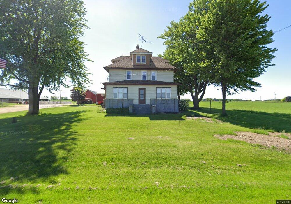
N6489 Freedom Rd Hartford, WI 53027
Estimated Value: $352,359 - $473,000
--
Bed
--
Bath
--
Sq Ft
1.1
Acres
About This Home
This home is located at N6489 Freedom Rd, Hartford, WI 53027 and is currently estimated at $404,840. N6489 Freedom Rd is a home located in Dodge County with nearby schools including Hartford High School.
Ownership History
Date
Name
Owned For
Owner Type
Purchase Details
Closed on
Aug 29, 2023
Sold by
Pamperin Cathy A
Bought by
Pamperin Michael C
Current Estimated Value
Home Financials for this Owner
Home Financials are based on the most recent Mortgage that was taken out on this home.
Original Mortgage
$1,450,000
Outstanding Balance
$1,418,195
Interest Rate
6.78%
Mortgage Type
New Conventional
Estimated Equity
-$1,013,355
Create a Home Valuation Report for This Property
The Home Valuation Report is an in-depth analysis detailing your home's value as well as a comparison with similar homes in the area
Home Values in the Area
Average Home Value in this Area
Purchase History
| Date | Buyer | Sale Price | Title Company |
|---|---|---|---|
| Pamperin Michael C | -- | None Listed On Document |
Source: Public Records
Mortgage History
| Date | Status | Borrower | Loan Amount |
|---|---|---|---|
| Open | Pamperin Michael C | $1,450,000 |
Source: Public Records
Tax History Compared to Growth
Tax History
| Year | Tax Paid | Tax Assessment Tax Assessment Total Assessment is a certain percentage of the fair market value that is determined by local assessors to be the total taxable value of land and additions on the property. | Land | Improvement |
|---|---|---|---|---|
| 2024 | $3,023 | $203,100 | $42,400 | $160,700 |
| 2023 | $2,694 | $203,100 | $42,400 | $160,700 |
| 2022 | $2,781 | $203,100 | $42,400 | $160,700 |
| 2021 | $2,893 | $203,100 | $42,400 | $160,700 |
| 2020 | $2,968 | $203,100 | $42,400 | $160,700 |
| 2019 | $3,027 | $203,100 | $42,400 | $160,700 |
| 2018 | $2,972 | $203,100 | $42,400 | $160,700 |
| 2017 | $3,174 | $207,100 | $42,400 | $164,700 |
| 2016 | $3,070 | $207,100 | $42,400 | $164,700 |
| 2015 | $3,303 | $207,100 | $42,400 | $164,700 |
| 2014 | $3,617 | $207,100 | $42,400 | $164,700 |
Source: Public Records
Map
Nearby Homes
- N7575 Doyle Rd
- 7087 Nenno Rd
- 6372 Yellowstone Trail N
- Lt13 Eagle View Dr
- Lt1 Eagle View Dr
- Lt4 Eagle View Dr
- Montrose Manor Plan at Grandview Heights
- Isabelle II Plan at Grandview Heights
- Simen Plan at Grandview Heights
- Sarah III Plan at Grandview Heights
- Balmore II Plan at Grandview Heights
- Edinburgh Plan at Grandview Heights
- 234 Watertower Cir
- Lt0 E Neda Rd
- 202 East Ave
- 0 Burkwald Ave
- N5413 County Rd S
- 337 S Menomonee St
- 6372 Wildlife Rd
- 306 S Milwaukee St
- 62.8 Acres Hwy 33 and Freedom Rd
- W946 State Road 33
- N6347 Freedom Rd
- N6659 Freedom Rd
- N6659 Freedom Rd
- N6480 County Road P
- W745 State Road 33
- W1118 State Road 33
- N6719 Freedom Rd
- W648 Church Rd
- N6218 Freedom Rd
- W638 Church Rd
- N6752 County Road P
- W633 Church Rd
- W630 Church Rd
- N6174 County Road P
- N6783 Alaska Rd
- W1195 State Road 33
- N6852 Freedom Rd
- W1196 State Road 33