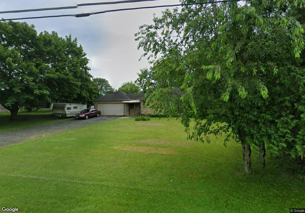
N64W18443 Mill Rd Menomonee Falls, WI 53051
Estimated Value: $282,536 - $348,000
2
Beds
1
Bath
948
Sq Ft
$347/Sq Ft
Est. Value
About This Home
This home is located at N64W18443 Mill Rd, Menomonee Falls, WI 53051 and is currently estimated at $329,384, approximately $347 per square foot. N64W18443 Mill Rd is a home located in Waukesha County with nearby schools including Lannon Elementary School, Templeton Middle School, and Hamilton High School.
Ownership History
Date
Name
Owned For
Owner Type
Purchase Details
Closed on
Oct 30, 2002
Sold by
Kaulfuerst Joseph A and Kaulfuerst Tonya H
Bought by
Bettin Peter J
Current Estimated Value
Home Financials for this Owner
Home Financials are based on the most recent Mortgage that was taken out on this home.
Original Mortgage
$108,720
Outstanding Balance
$45,806
Interest Rate
6.1%
Mortgage Type
Stand Alone First
Estimated Equity
$283,578
Purchase Details
Closed on
Jul 30, 1999
Sold by
Bieser John P and Weiss Laurie S
Bought by
Kaulfuerst Joseph A and Kaulfuerst Tonya H
Home Financials for this Owner
Home Financials are based on the most recent Mortgage that was taken out on this home.
Original Mortgage
$105,074
Interest Rate
7.69%
Create a Home Valuation Report for This Property
The Home Valuation Report is an in-depth analysis detailing your home's value as well as a comparison with similar homes in the area
Home Values in the Area
Average Home Value in this Area
Purchase History
| Date | Buyer | Sale Price | Title Company |
|---|---|---|---|
| Bettin Peter J | $135,900 | -- | |
| Kaulfuerst Joseph A | $126,100 | -- |
Source: Public Records
Mortgage History
| Date | Status | Borrower | Loan Amount |
|---|---|---|---|
| Open | Bettin Peter J | $108,720 | |
| Previous Owner | Kaulfuerst Joseph A | $105,074 |
Source: Public Records
Tax History Compared to Growth
Tax History
| Year | Tax Paid | Tax Assessment Tax Assessment Total Assessment is a certain percentage of the fair market value that is determined by local assessors to be the total taxable value of land and additions on the property. | Land | Improvement |
|---|---|---|---|---|
| 2024 | $2,737 | $247,100 | $94,300 | $152,800 |
| 2023 | $2,620 | $247,100 | $94,300 | $152,800 |
| 2022 | $2,789 | $176,700 | $65,000 | $111,700 |
| 2021 | $2,626 | $176,700 | $65,000 | $111,700 |
| 2020 | $2,654 | $176,700 | $65,000 | $111,700 |
| 2019 | $2,656 | $176,700 | $65,000 | $111,700 |
| 2018 | $2,546 | $176,700 | $65,000 | $111,700 |
| 2017 | $2,497 | $176,700 | $65,000 | $111,700 |
| 2016 | $2,549 | $176,700 | $65,000 | $111,700 |
| 2015 | $2,680 | $176,700 | $65,000 | $111,700 |
| 2014 | $2,972 | $176,700 | $65,000 | $111,700 |
| 2013 | $2,972 | $176,700 | $65,000 | $111,700 |
Source: Public Records
Map
Nearby Homes
- W183N6023 Lost Pond Ct
- N59W17764 Meadow Ct Unit 12
- N59W17728 Meadow Ct Unit 15
- W208N6659 Sweet Clover Dr
- W178N7112 Haven Dr
- The Neenah Plan at Sommersfield
- The Ashland Plan at Sommersfield
- The Madison Plan at Sommersfield
- The Laurel Plan at Sommersfield
- The Prescott Plan at Sommersfield
- The Geneva Plan at Sommersfield
- The Hudson Plan at Sommersfield
- The Rosebud Plan at Sommersfield
- W182N5742 Balsam Ct
- N69W17762 Morning Star Ct
- W195N5814 Deer Park Ct
- N56W19246 Spencers Ct
- N51W18938 Quietwood Dr
- N57W19673 Holly Ct
- N51W18970 Quietwood Dr
- N64W18407 Mill Rd
- N64W18591 Mill Rd
- N64W18768 Mill Rd
- W180N6388 Marcy Rd
- W180N6368 Marcy Rd
- W180N6173 Marcy Rd
- W183N6053 Lost Pond Ct
- W183N6050 Lost Pond Ct
- W180N6170 Marcy Rd
- W181N6055 Jackson Dr
- N60W18406 Lost Pond Dr
- W183N6041 Lost Pond Ct
- W183N6044 Lost Pond Ct
- W181N6052 Jackson Dr
- W181N6045 Jackson Dr
- W183N6026 Lost Pond Ct
- W181N6040 Jackson Dr
- N60W18266 Lost Pond Dr
- W181N6027 Jackson Dr
- W181N6022 Jackson Dr