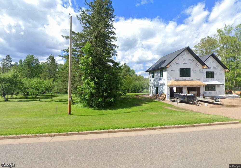
N6926 Cty B Deerbrook, WI 54424
Estimated Value: $159,697 - $342,000
--
Bed
--
Bath
--
Sq Ft
4
Acres
About This Home
This home is located at N6926 Cty B, Deerbrook, WI 54424 and is currently estimated at $229,232. N6926 Cty B is a home.
Ownership History
Date
Name
Owned For
Owner Type
Purchase Details
Closed on
Oct 31, 2006
Sold by
Crandall Wiley G
Bought by
Donohue Debra J
Current Estimated Value
Purchase Details
Closed on
Oct 24, 2006
Sold by
Cramer Allan N and Cramer Barbara D
Bought by
Crandall Wiley G
Purchase Details
Closed on
Jun 4, 2005
Sold by
Cramer Allan N and Cramer Barbara D
Bought by
Crandall Wiley
Purchase Details
Closed on
Jun 3, 2005
Sold by
Ronald A Ronald A and Green Audrey K
Bought by
Cramer Allan N and Cramer Barbara D
Create a Home Valuation Report for This Property
The Home Valuation Report is an in-depth analysis detailing your home's value as well as a comparison with similar homes in the area
Home Values in the Area
Average Home Value in this Area
Purchase History
| Date | Buyer | Sale Price | Title Company |
|---|---|---|---|
| Donohue Debra J | -- | Langlade Abstract & Title, C | |
| Crandall Wiley G | -- | Langlade Abstract & Title, C | |
| Crandall Wiley | $25,000 | -- | |
| Cramer Allan N | -- | -- |
Source: Public Records
Mortgage History
| Date | Status | Borrower | Loan Amount |
|---|---|---|---|
| Closed | Crandall Wiley | $0 |
Source: Public Records
Tax History Compared to Growth
Tax History
| Year | Tax Paid | Tax Assessment Tax Assessment Total Assessment is a certain percentage of the fair market value that is determined by local assessors to be the total taxable value of land and additions on the property. | Land | Improvement |
|---|---|---|---|---|
| 2024 | $959 | $110,600 | $29,500 | $81,100 |
| 2023 | $1,040 | $86,600 | $18,600 | $68,000 |
| 2022 | $1,138 | $86,600 | $18,600 | $68,000 |
| 2021 | $1,057 | $86,600 | $18,600 | $68,000 |
| 2020 | $1,138 | $86,600 | $18,600 | $68,000 |
| 2019 | $1,107 | $86,600 | $18,600 | $68,000 |
| 2018 | $1,066 | $86,600 | $18,600 | $68,000 |
| 2017 | $1,152 | $86,300 | $18,300 | $68,000 |
| 2016 | $1,003 | $86,300 | $18,300 | $68,000 |
| 2015 | $1,055 | $86,300 | $18,300 | $68,000 |
| 2014 | $1,035 | $86,300 | $18,300 | $68,000 |
| 2013 | $1,125 | $86,300 | $18,300 | $68,000 |
Source: Public Records
Map
Nearby Homes
- ON Byers Rd
- ON Cth B
- 0 Highway 45
- N7791 Pence Lake Rd
- N7530 Black Oak Rd
- W9196 Birchwood Ln
- N5450 Cth E
- N7680 Cth E
- W12289 County Road J
- W10350 Deer Trail Ln
- W11230 Horseshoe Bend Rd
- N7873 Forest Rd
- N5134 Star Neva Rd
- N6569 Town Forest Rd
- n4704 U S 45
- W10212 Cth T
- N6606 Rangeline Rd
- 0 Winter Rd Unit 201923
- 0 Winter Rd Unit 50276035
- 10774 Summit Lake Rd
- W10255 Blue Bell Rd
- W10358 Byers Rd
- w 10358 Byers Rd
- W10326 Borth Lake Rd
- N7006 Cty B
- N6864 Cty B
- W10286 Borth Lake Rd
- W10293 Borth Lake Rd
- W10318 Borth Lake Rd
- W10294 Koepenick Rd
- W10325 Borth Lake Rd
- W10328 Borth Lake Rd
- W10318 Byers Rd
- W10348 Borth Lake Rd
- N6825 Cty B
- W10354 Borth Lake Rd
- W10398 Borth Lake Rd
- W10378 Borth Lake Rd
- W10422 Borth Lake Rd
- W10406 Borth Lake Rd