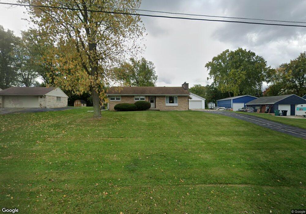
N69W13441 Harding Dr Menomonee Falls, WI 53051
Estimated Value: $332,000 - $368,000
3
Beds
1
Bath
1,184
Sq Ft
$294/Sq Ft
Est. Value
About This Home
This home is located at N69W13441 Harding Dr, Menomonee Falls, WI 53051 and is currently estimated at $347,597, approximately $293 per square foot. N69W13441 Harding Dr is a home located in Waukesha County with nearby schools including Riverside Elementary School, North Middle School, and Menomonee Falls High School.
Ownership History
Date
Name
Owned For
Owner Type
Purchase Details
Closed on
Jun 7, 2024
Sold by
Henry J And Lou Ann Arnold Family Trust and Ionnitiu Lori M
Bought by
Henry J And Lou Ann Arnold Family Trust and Arnold
Current Estimated Value
Purchase Details
Closed on
Jul 6, 2000
Sold by
Arnold Henry J and Arnold Lou Ann
Bought by
The Henry J & Lou Ann Arnold Family Tr
Create a Home Valuation Report for This Property
The Home Valuation Report is an in-depth analysis detailing your home's value as well as a comparison with similar homes in the area
Home Values in the Area
Average Home Value in this Area
Purchase History
| Date | Buyer | Sale Price | Title Company |
|---|---|---|---|
| Henry J And Lou Ann Arnold Family Trust | -- | None Listed On Document | |
| The Henry J & Lou Ann Arnold Family Tr | -- | -- |
Source: Public Records
Tax History Compared to Growth
Tax History
| Year | Tax Paid | Tax Assessment Tax Assessment Total Assessment is a certain percentage of the fair market value that is determined by local assessors to be the total taxable value of land and additions on the property. | Land | Improvement |
|---|---|---|---|---|
| 2024 | $3,319 | $278,500 | $105,000 | $173,500 |
| 2023 | $2,984 | $278,500 | $105,000 | $173,500 |
| 2022 | $3,060 | $192,400 | $72,000 | $120,400 |
| 2021 | $2,927 | $192,400 | $72,000 | $120,400 |
| 2020 | $3,091 | $192,400 | $72,000 | $120,400 |
| 2019 | $2,951 | $192,400 | $72,000 | $120,400 |
| 2018 | $3,087 | $192,400 | $72,000 | $120,400 |
| 2017 | $3,691 | $192,400 | $72,000 | $120,400 |
| 2016 | $3,260 | $192,400 | $72,000 | $120,400 |
| 2015 | $3,274 | $192,400 | $72,000 | $120,400 |
| 2014 | $3,493 | $192,400 | $72,000 | $120,400 |
| 2013 | $3,493 | $192,400 | $72,000 | $120,400 |
Source: Public Records
Map
Nearby Homes
- N72W13429 Good Hope Rd
- W134N6759 Wild Rose Ct
- W139N6995 Bay Ridge Ln
- W142N6966 Oakwood Dr
- N66W12812 Corryton Ct
- N74W13737 Appleton Ave Unit 107
- N63W13412 Hummingbird Way
- 7118 N 124th St
- N65W14542 Redwood Dr
- N64W14282 Mill Rd
- W148N7311 Woodland Dr
- 11917 W Appleton Ave Unit 6
- 11927 W Appleton Ave Unit 6
- 11958 W Mill Rd Unit 24
- 11957 W Appleton Ave Unit 4
- W137N6161 Weyer Farm Ct
- 11937 W Appleton Ave Unit 14
- 11937 W Appleton Ave Unit 20
- W148N7497 Woodland Dr
- 11910 W Mill Rd Unit 6
- N69W13409 Harding Dr
- N69W13473 Harding Dr
- N69W13426 Harding Dr
- N69W13400 Harding Dr
- N69W13450 Harding Dr
- N69W13509 Harding Dr
- N69W13359 Harding Dr
- N69W13490 Harding Dr
- N68W13458 Ranch Rd
- N68W13390 Ranch Rd
- N69W13333 Harding Dr
- N69W13539 Harding Dr
- N68W13494 Ranch Rd
- N69W13360 Harding Dr
- N68W13350 Ranch Rd
- N70W13443 Brentwood Dr
- N68W13435 Ranch Rd
- N68W13469 Ranch Rd
- N68W13528 Ranch Rd
- N70W13375 Brentwood Dr