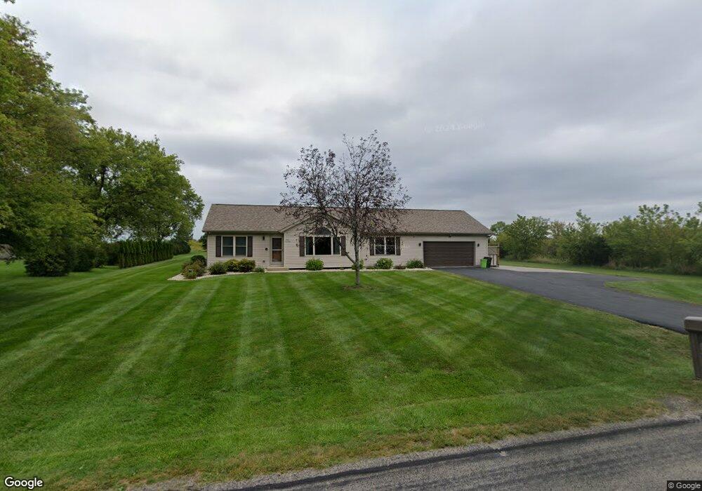
N72W39482 Lang Rd Oconomowoc, WI 53066
Estimated Value: $393,000 - $639,000
--
Bed
--
Bath
--
Sq Ft
0.85
Acres
About This Home
This home is located at N72W39482 Lang Rd, Oconomowoc, WI 53066 and is currently estimated at $464,523. N72W39482 Lang Rd is a home with nearby schools including Ixonia Elementary School, Nature Hill Intermediate School, and Oconomowoc High School.
Ownership History
Date
Name
Owned For
Owner Type
Purchase Details
Closed on
Nov 20, 2012
Sold by
Bmo Harris Bank Na
Bought by
Stemo Todd W and Stemo Amy E
Current Estimated Value
Home Financials for this Owner
Home Financials are based on the most recent Mortgage that was taken out on this home.
Original Mortgage
$151,500
Outstanding Balance
$104,640
Interest Rate
3.38%
Mortgage Type
New Conventional
Estimated Equity
$359,883
Purchase Details
Closed on
Jun 25, 2012
Sold by
Nosek William and Rios Nosek Marta
Bought by
Bmo Harris Bank Na
Create a Home Valuation Report for This Property
The Home Valuation Report is an in-depth analysis detailing your home's value as well as a comparison with similar homes in the area
Home Values in the Area
Average Home Value in this Area
Purchase History
| Date | Buyer | Sale Price | Title Company |
|---|---|---|---|
| Stemo Todd W | $150,000 | None Available | |
| Bmo Harris Bank Na | $138,586 | None Available |
Source: Public Records
Mortgage History
| Date | Status | Borrower | Loan Amount |
|---|---|---|---|
| Open | Stemo Todd W | $151,500 |
Source: Public Records
Tax History Compared to Growth
Tax History
| Year | Tax Paid | Tax Assessment Tax Assessment Total Assessment is a certain percentage of the fair market value that is determined by local assessors to be the total taxable value of land and additions on the property. | Land | Improvement |
|---|---|---|---|---|
| 2024 | $3,184 | $276,900 | $51,500 | $225,400 |
| 2023 | $2,929 | $276,900 | $51,500 | $225,400 |
| 2022 | $3,049 | $264,900 | $51,500 | $213,400 |
| 2021 | $2,877 | $229,700 | $42,600 | $187,100 |
| 2020 | $2,962 | $229,700 | $42,600 | $187,100 |
| 2019 | $2,871 | $229,700 | $42,600 | $187,100 |
| 2018 | $2,799 | $210,300 | $38,800 | $171,500 |
| 2017 | $2,831 | $210,300 | $38,800 | $171,500 |
| 2016 | $2,673 | $188,800 | $36,200 | $152,600 |
| 2015 | $2,782 | $188,800 | $36,200 | $152,600 |
| 2014 | $2,793 | $188,800 | $36,200 | $152,600 |
| 2013 | $2,793 | $180,900 | $36,200 | $144,700 |
Source: Public Records
Map
Nearby Homes
- N65W38281 Woodlake Dr
- N65W38200 Woodlake Dr
- N65W38259 Woodlake Dr
- N65W38184 Woodlake Dr
- N65W38241 Woodlake Dr
- N65W38164 Woodlake Dr
- N65W38183 Woodlake Dr
- N65W38144 Woodlake Dr
- N65W38151 Woodlake Dr
- N65W38124 Woodlake Dr
- N65W38131 Woodlake Dr
- N65W38102 Woodlake Dr
- N65W38111 Woodlake Dr
- N65W38089 Woodlake Dr
- W179 Madison Ave
- N65W38069 Woodlake Dr
- W277 Madison Ave
- N65W38024 Woodlake Dr
- N65W38047 Woodlake Dr
- N65W38025 Woodlake Dr
- N72W39484 Lang Rd
- N72W39488 Lang Rd
- N71W39491 Lang Rd
- N72W39494 Lang Rd
- N72W39500 Lang Rd
- N71W39527 Lang Rd
- N72W39550 Lang Rd
- N72W39600 Lang Rd
- W395N7085 Saeger Ave
- N71W39633 Lang Rd
- N72W39650 Lang Rd
- W395N7079 Saeger Ave
- N72W39700 Lang Rd
- W395N7095 Saeger Ave
- N71W39757 Lang Rd
- N72W39724 Lang Rd
- W395N6953 Saeger Ave
- W395N7089 Saeger Ave
- N71W39777 Lang Rd
- N72W39748 Lang Rd