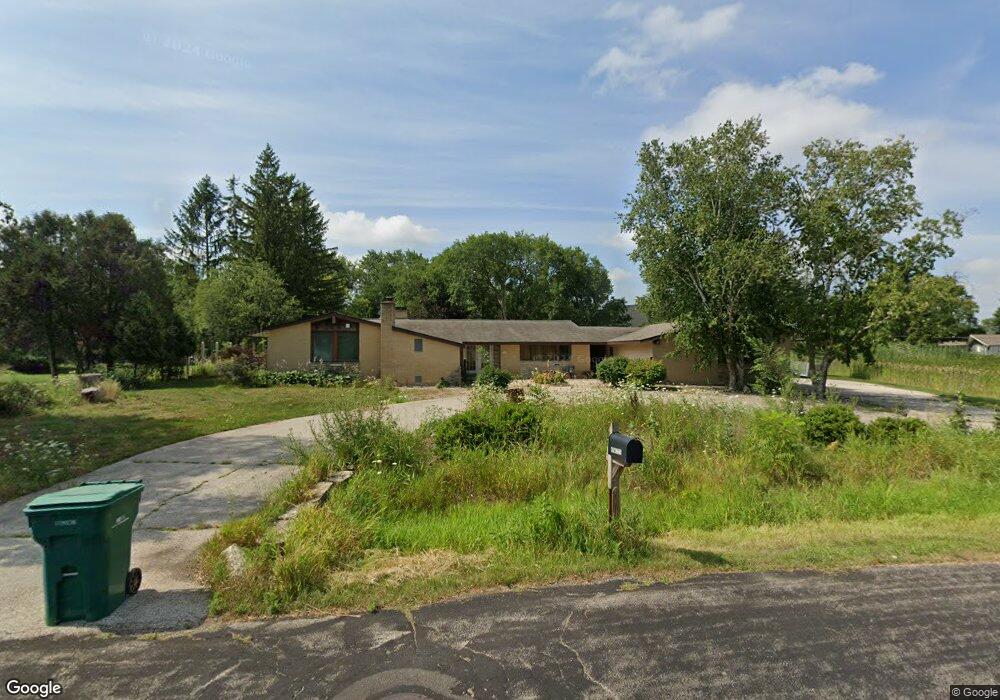
N75W17279 Wilson Dr Menomonee Falls, WI 53051
Estimated Value: $479,000 - $560,752
4
Beds
2
Baths
2,218
Sq Ft
$233/Sq Ft
Est. Value
About This Home
This home is located at N75W17279 Wilson Dr, Menomonee Falls, WI 53051 and is currently estimated at $516,438, approximately $232 per square foot. N75W17279 Wilson Dr is a home located in Waukesha County with nearby schools including Lannon Elementary School, Templeton Middle School, and Hamilton High School.
Ownership History
Date
Name
Owned For
Owner Type
Purchase Details
Closed on
Sep 23, 2005
Sold by
Peters Michael
Bought by
Peters Cheryl A
Current Estimated Value
Home Financials for this Owner
Home Financials are based on the most recent Mortgage that was taken out on this home.
Original Mortgage
$237,600
Outstanding Balance
$143,696
Interest Rate
8%
Mortgage Type
Fannie Mae Freddie Mac
Estimated Equity
$372,742
Purchase Details
Closed on
Aug 1, 2001
Sold by
Krueger Evelyn A
Bought by
Peters Michael and Peters Cheryl A
Home Financials for this Owner
Home Financials are based on the most recent Mortgage that was taken out on this home.
Original Mortgage
$168,000
Interest Rate
6.99%
Create a Home Valuation Report for This Property
The Home Valuation Report is an in-depth analysis detailing your home's value as well as a comparison with similar homes in the area
Home Values in the Area
Average Home Value in this Area
Purchase History
| Date | Buyer | Sale Price | Title Company |
|---|---|---|---|
| Peters Cheryl A | -- | -- | |
| Peters Michael | $210,000 | -- |
Source: Public Records
Mortgage History
| Date | Status | Borrower | Loan Amount |
|---|---|---|---|
| Open | Peters Cheryl A | $237,600 | |
| Previous Owner | Peters Michael | $168,000 |
Source: Public Records
Tax History Compared to Growth
Tax History
| Year | Tax Paid | Tax Assessment Tax Assessment Total Assessment is a certain percentage of the fair market value that is determined by local assessors to be the total taxable value of land and additions on the property. | Land | Improvement |
|---|---|---|---|---|
| 2024 | $5,115 | $432,100 | $135,700 | $296,400 |
| 2023 | $5,170 | $432,100 | $135,700 | $296,400 |
| 2022 | $5,136 | $290,400 | $100,600 | $189,800 |
| 2021 | $4,860 | $290,400 | $100,600 | $189,800 |
| 2020 | $4,816 | $290,400 | $100,600 | $189,800 |
| 2019 | $4,963 | $290,400 | $100,600 | $189,800 |
| 2018 | $4,837 | $290,400 | $100,600 | $189,800 |
| 2017 | $4,712 | $290,400 | $100,600 | $189,800 |
| 2016 | $4,780 | $290,400 | $100,600 | $189,800 |
| 2015 | $5,001 | $290,400 | $100,600 | $189,800 |
| 2014 | $4,928 | $290,400 | $100,600 | $189,800 |
| 2013 | $4,928 | $290,400 | $100,600 | $189,800 |
Source: Public Records
Map
Nearby Homes
- N75W17767 Woody Ln
- The Berkshire Plan at Edgewood Preserve
- The Isabella Plan at Edgewood Preserve
- The Clara Plan at Edgewood Preserve
- The Riley Plan at Edgewood Preserve
- The Celina Plan at Edgewood Preserve
- The Celeste Plan at Edgewood Preserve
- The Julia Plan at Edgewood Preserve
- The Charlotte Plan at Edgewood Preserve
- The Eliza Plan at Edgewood Preserve
- The Aubrey Plan at Edgewood Preserve
- The Elsa Plan at Edgewood Preserve
- Lt2 Good Hope Rd
- N75W17841 Woody Ln
- N80W17533 Robin Cir Unit 1
- N69W17762 Morning Star Ct
- N53W19764 Kingair Dr
- W178N7112 Haven Dr
- N75W15758 Colony Rd
- N77W15736 Crossway Dr
- N75W17231 Wilson Dr
- W172N7455 Shady Ln
- N75W17242 Wilson Dr
- W173N7458 Joanne Dr
- N75W17299 Wilson Dr
- W173N7436 Joanne Dr
- N75W17298 Wilson Dr
- W173N7488 Joanne Dr
- W172N7445 Shady Ln
- N75W17329 Wilson Dr
- W174N7510 Joanne Dr
- Lt0 Joanne Dr
- W172N7480 Shady Ln
- W172N7547 Shady Ln
- W173N7422 Joanne Dr
- N75W17318 Wilson Dr
- W173N7451 Joanne Dr
- N75W17355 Wilson Dr
- W174N7483 Joanne Dr
- N75W17332 Wilson Dr