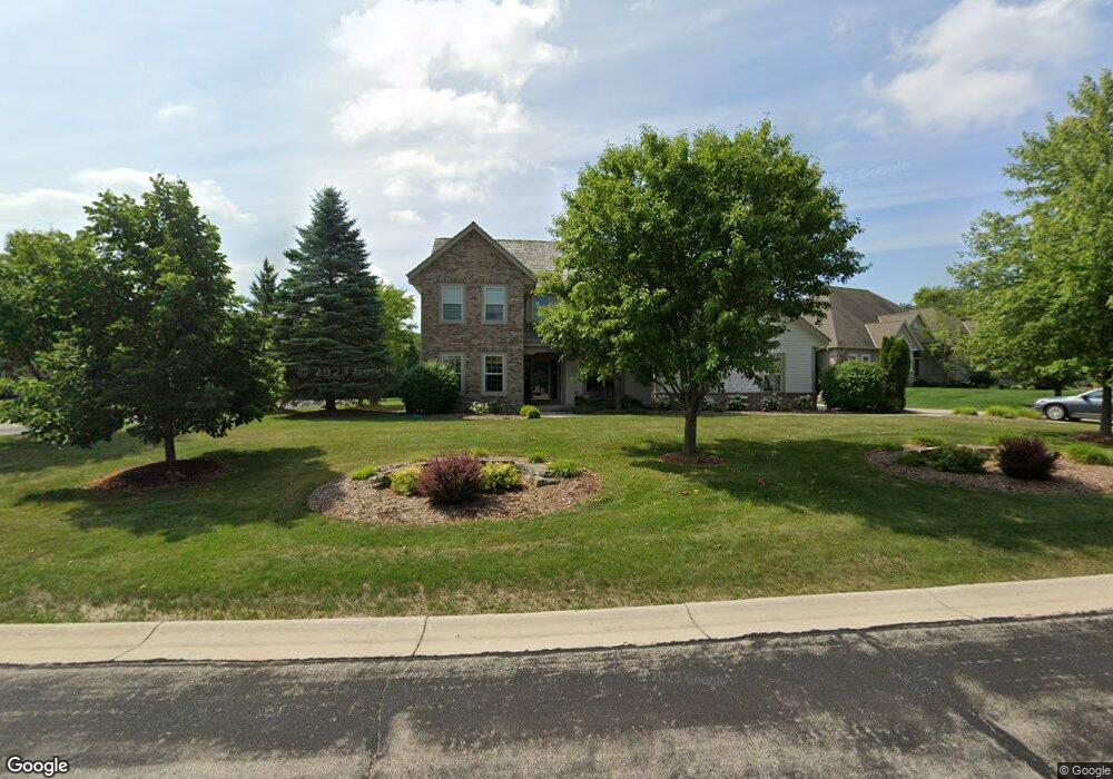
N76W17071 Kolbrook Ct Menomonee Falls, WI 53051
Estimated Value: $760,995 - $879,000
5
Beds
4
Baths
3,848
Sq Ft
$211/Sq Ft
Est. Value
About This Home
This home is located at N76W17071 Kolbrook Ct, Menomonee Falls, WI 53051 and is currently estimated at $811,499, approximately $210 per square foot. N76W17071 Kolbrook Ct is a home located in Waukesha County with nearby schools including Valley View Elementary School, North Middle School, and Menomonee Falls High School.
Ownership History
Date
Name
Owned For
Owner Type
Purchase Details
Closed on
May 6, 2011
Sold by
Prudential Relocation Inc
Bought by
Currey Adam and Currey Laura
Current Estimated Value
Home Financials for this Owner
Home Financials are based on the most recent Mortgage that was taken out on this home.
Original Mortgage
$379,905
Outstanding Balance
$264,987
Interest Rate
4.96%
Mortgage Type
New Conventional
Estimated Equity
$546,512
Purchase Details
Closed on
Nov 9, 2010
Sold by
Henderson Peter S and Henderson Tamika L
Bought by
Prudential Relocation Inc
Purchase Details
Closed on
Mar 21, 2007
Sold by
Perthel Brothers Co Inc
Bought by
Henderson Peter S and Henderson Tamika L
Home Financials for this Owner
Home Financials are based on the most recent Mortgage that was taken out on this home.
Original Mortgage
$75,000
Interest Rate
6.31%
Mortgage Type
Credit Line Revolving
Purchase Details
Closed on
Feb 13, 2006
Sold by
Shady Lane Development Inc
Bought by
Perthel Brothers Inc
Create a Home Valuation Report for This Property
The Home Valuation Report is an in-depth analysis detailing your home's value as well as a comparison with similar homes in the area
Home Values in the Area
Average Home Value in this Area
Purchase History
| Date | Buyer | Sale Price | Title Company |
|---|---|---|---|
| Currey Adam | $399,900 | None Available | |
| Prudential Relocation Inc | $399,900 | None Available | |
| Henderson Peter S | $500,000 | None Available | |
| Perthel Brothers Inc | $122,500 | None Available |
Source: Public Records
Mortgage History
| Date | Status | Borrower | Loan Amount |
|---|---|---|---|
| Open | Currey Adam | $379,905 | |
| Previous Owner | Henderson Peter S | $75,000 | |
| Previous Owner | Henderson Peter S | $399,950 |
Source: Public Records
Tax History Compared to Growth
Tax History
| Year | Tax Paid | Tax Assessment Tax Assessment Total Assessment is a certain percentage of the fair market value that is determined by local assessors to be the total taxable value of land and additions on the property. | Land | Improvement |
|---|---|---|---|---|
| 2024 | $7,465 | $656,400 | $145,400 | $511,000 |
| 2023 | $7,202 | $656,400 | $145,400 | $511,000 |
| 2022 | $7,710 | $473,900 | $100,100 | $373,800 |
| 2021 | $7,385 | $473,900 | $100,100 | $373,800 |
| 2020 | $7,725 | $473,900 | $100,100 | $373,800 |
| 2019 | $7,411 | $473,900 | $100,100 | $373,800 |
| 2018 | $7,830 | $473,900 | $100,100 | $373,800 |
| 2017 | $8,060 | $473,900 | $100,100 | $373,800 |
| 2016 | $8,214 | $473,900 | $100,100 | $373,800 |
| 2015 | $8,206 | $473,900 | $100,100 | $373,800 |
| 2014 | $8,718 | $473,900 | $100,100 | $373,800 |
| 2013 | $8,718 | $473,900 | $100,100 | $373,800 |
Source: Public Records
Map
Nearby Homes
- N75W17767 Woody Ln
- N75W17841 Woody Ln
- Lt2 Good Hope Rd
- The Berkshire Plan at Edgewood Preserve
- The Isabella Plan at Edgewood Preserve
- The Clara Plan at Edgewood Preserve
- The Riley Plan at Edgewood Preserve
- The Celina Plan at Edgewood Preserve
- The Celeste Plan at Edgewood Preserve
- The Julia Plan at Edgewood Preserve
- The Charlotte Plan at Edgewood Preserve
- The Eliza Plan at Edgewood Preserve
- The Aubrey Plan at Edgewood Preserve
- The Elsa Plan at Edgewood Preserve
- N80W17533 Robin Cir Unit 1
- N53W19764 Kingair Dr
- N75W15758 Colony Rd
- N77W15736 Crossway Dr
- W162N8224 Tamarack Ct
- W155N7481 Pebble Ct
- N76W17085 Kolbrook Ct
- W170N7615 Patrician Pkwy
- W170N7646 Patrician Pkwy
- N76W17060 Kolbrook Ct
- N76W17103 Kolbrook Ct
- W170N7655 Patrician Pkwy
- W170N7632 Patrician Pkwy
- N76W17088 Kolbrook Ct
- N76W17106 Kolbrook Ct
- W170N7652 Patrician Pkwy
- W169N7683 Overlook Trail
- W169N7639 Overlook Trail
- W170N7712 Trails End Ct
- W172N7658 Shady Ln
- W170N7715 Trails End Ct
- W169N7625 Overlook Trail
- W172N7614 Shady Ln
- W169N7701 Overlook Trail
- W172N7680 Shady Ln
- W169N7609 Overlook Trail