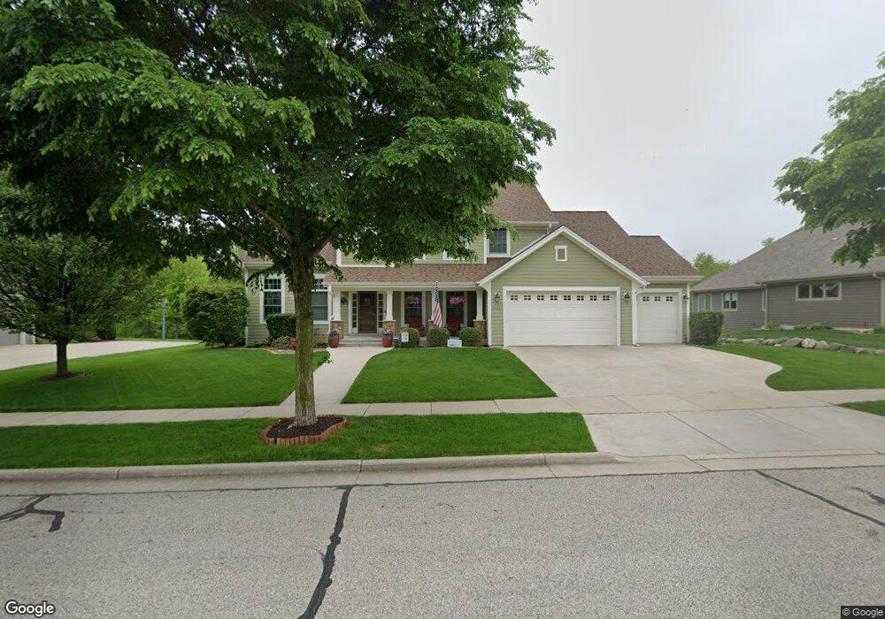
N76W8075 Topview Trail Cedarburg, WI 53012
Estimated Value: $864,000 - $1,104,000
--
Bed
--
Bath
--
Sq Ft
0.4
Acres
About This Home
This home is located at N76W8075 Topview Trail, Cedarburg, WI 53012 and is currently estimated at $973,267. N76W8075 Topview Trail is a home located in Ozaukee County with nearby schools including Cedarburg High School, First Immanuel Lutheran School, and Morningstar Montessori Inc.
Ownership History
Date
Name
Owned For
Owner Type
Purchase Details
Closed on
Jun 11, 2012
Sold by
Kelly John G and Kelly Maura W
Bought by
Dirks John C and Dirks Megan M
Current Estimated Value
Home Financials for this Owner
Home Financials are based on the most recent Mortgage that was taken out on this home.
Original Mortgage
$398,500
Outstanding Balance
$276,175
Interest Rate
3.83%
Mortgage Type
New Conventional
Estimated Equity
$697,092
Purchase Details
Closed on
Dec 4, 2008
Sold by
Topview Trails Llc
Bought by
Kelly John G and Kelly Maura W
Home Financials for this Owner
Home Financials are based on the most recent Mortgage that was taken out on this home.
Original Mortgage
$163,800
Interest Rate
6.3%
Mortgage Type
Credit Line Revolving
Create a Home Valuation Report for This Property
The Home Valuation Report is an in-depth analysis detailing your home's value as well as a comparison with similar homes in the area
Home Values in the Area
Average Home Value in this Area
Purchase History
| Date | Buyer | Sale Price | Title Company |
|---|---|---|---|
| Dirks John C | $525,000 | None Available | |
| Kelly John G | $611,400 | None Available |
Source: Public Records
Mortgage History
| Date | Status | Borrower | Loan Amount |
|---|---|---|---|
| Open | Dirks John C | $398,500 | |
| Previous Owner | Kelly John G | $163,800 | |
| Previous Owner | Kelly John G | $417,000 |
Source: Public Records
Tax History Compared to Growth
Tax History
| Year | Tax Paid | Tax Assessment Tax Assessment Total Assessment is a certain percentage of the fair market value that is determined by local assessors to be the total taxable value of land and additions on the property. | Land | Improvement |
|---|---|---|---|---|
| 2024 | $11,712 | $778,700 | $155,600 | $623,100 |
| 2023 | $10,867 | $778,700 | $155,600 | $623,100 |
| 2022 | $10,599 | $778,700 | $155,600 | $623,100 |
| 2021 | $10,271 | $571,200 | $141,600 | $429,600 |
| 2020 | $10,846 | $571,200 | $141,600 | $429,600 |
| 2019 | $10,684 | $571,200 | $141,600 | $429,600 |
| 2018 | $10,504 | $571,200 | $141,600 | $429,600 |
| 2017 | $10,325 | $571,200 | $141,600 | $429,600 |
| 2016 | $10,585 | $571,200 | $141,600 | $429,600 |
| 2015 | $9,715 | $540,000 | $141,600 | $398,400 |
| 2014 | $9,873 | $540,000 | $141,600 | $398,400 |
| 2013 | $10,342 | $540,000 | $141,600 | $398,400 |
Source: Public Records
Map
Nearby Homes
- N77W7565 Chestnut St
- 889 Horns Corners Rd
- W73N1025 Poplar Ave
- W67N786 Evergreen Blvd
- N50W7228 Western Rd
- Lt1 Bridge Rd
- W68N921 Washington Ave
- 1111 Wauwatosa Rd
- W72N1047 Hampton Ave
- N69W6507 Bridge Rd
- N114W7191 Oakmont Dr
- 320 Douglas Ln
- N50W6592 Western Rd
- N105W6695 Stone Lake Cir Unit 5
- N106W6600 Stone Lake Cir Unit 9
- N106W6590 Stone Lake Cir Unit 10
- N56W6339 Center St
- N105W6431 Stone Lake Cir Unit 32
- N91W6149 Arbor Dr
- N104W6262 Susan Ln
- N76W8115 Topview Trail
- N76W8045 Topview Trail
- N78W8080 Topview Trail
- N76W8025 Topview Trail
- N78W8120 Topview Trail
- N76W8135 Topview Trail
- N78W8060 Topview Trail
- N74W8068 Harvest Ln
- N78W8040 Topview Trail
- N78 W8140 Topview Trail
- N74W8048 Harvest Ln
- N76W7975 Topview Trail
- N78W8020 Topview Trail
- N74W8028 Harvest Ln
- N78W8160 Topview Trail
- N76W7945 Topview Trail
- W81 N756 Topview Trail
- N78W7960 Topview Trail
- N76W8155 Topview Trail
- W81N744 Topview Trail