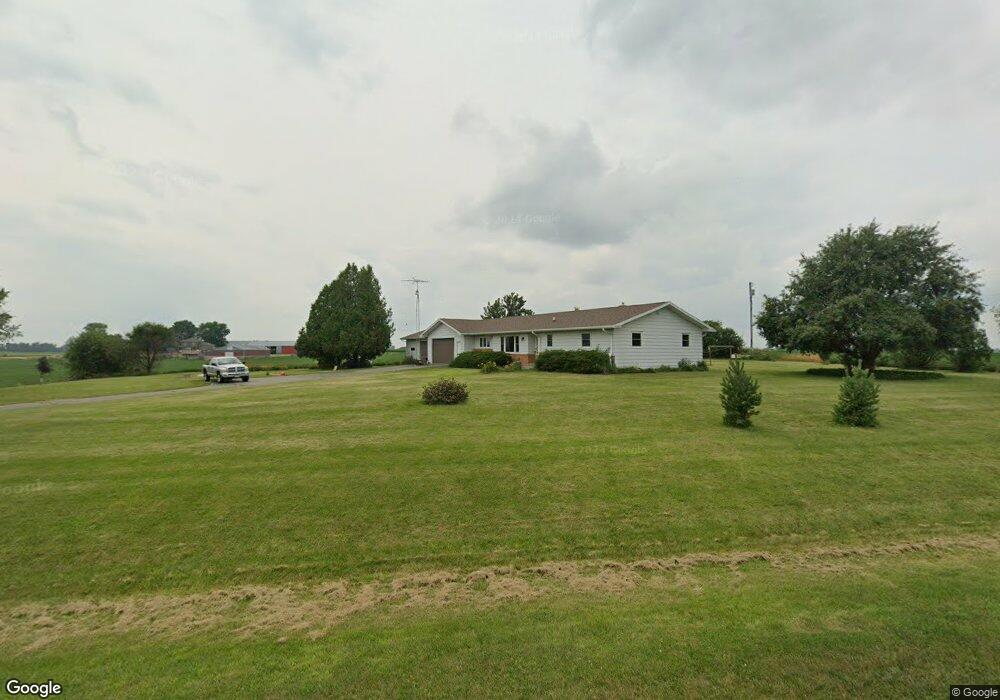
N7743 Butternut Rd Burnett, WI 53922
Estimated Value: $289,068 - $464,000
--
Bed
--
Bath
--
Sq Ft
1.15
Acres
About This Home
This home is located at N7743 Butternut Rd, Burnett, WI 53922 and is currently estimated at $357,767. N7743 Butternut Rd is a home located in Dodge County with nearby schools including Beaver Dam High School.
Ownership History
Date
Name
Owned For
Owner Type
Purchase Details
Closed on
Dec 7, 2018
Sold by
Woodward Julie A and Joan F Goodrich Revocable Trus
Bought by
Broitzman Justin L and Broitzman Brianna N
Current Estimated Value
Home Financials for this Owner
Home Financials are based on the most recent Mortgage that was taken out on this home.
Original Mortgage
$164,000
Outstanding Balance
$144,487
Interest Rate
4.8%
Mortgage Type
New Conventional
Estimated Equity
$213,280
Create a Home Valuation Report for This Property
The Home Valuation Report is an in-depth analysis detailing your home's value as well as a comparison with similar homes in the area
Home Values in the Area
Average Home Value in this Area
Purchase History
| Date | Buyer | Sale Price | Title Company |
|---|---|---|---|
| Broitzman Justin L | $205,000 | Guaranty Title Services Inc |
Source: Public Records
Mortgage History
| Date | Status | Borrower | Loan Amount |
|---|---|---|---|
| Open | Broitzman Justin L | $164,000 |
Source: Public Records
Tax History Compared to Growth
Tax History
| Year | Tax Paid | Tax Assessment Tax Assessment Total Assessment is a certain percentage of the fair market value that is determined by local assessors to be the total taxable value of land and additions on the property. | Land | Improvement |
|---|---|---|---|---|
| 2024 | $2,581 | $191,200 | $32,300 | $158,900 |
| 2023 | $2,573 | $191,200 | $32,300 | $158,900 |
| 2022 | $2,687 | $191,200 | $32,300 | $158,900 |
| 2021 | $2,613 | $191,200 | $32,300 | $158,900 |
| 2020 | $2,760 | $191,200 | $32,300 | $158,900 |
| 2019 | $2,719 | $191,200 | $32,300 | $158,900 |
| 2018 | $2,730 | $179,600 | $32,300 | $147,300 |
| 2017 | $2,828 | $179,600 | $32,300 | $147,300 |
| 2016 | $2,493 | $179,600 | $32,300 | $147,300 |
| 2015 | $2,484 | $179,600 | $32,300 | $147,300 |
| 2014 | $2,717 | $179,600 | $32,300 | $147,300 |
Source: Public Records
Map
Nearby Homes
- W7170 E Fir Rd
- N7245 County Road I
- N7427 Hillendale Pkwy
- W6181 Maple St
- N6710 High Point Rd
- W6180 Main St
- Lot 2 Hidden Valley Dr
- 8246 N Crystal Lake Rd
- 106 Reuben Ct
- The Harrington Plan at Stoney Ridge
- The Dover Plan at Stoney Ridge
- The Bridgeport Plan at Stoney Ridge
- The Caspian Plan at Stoney Ridge
- The Conway Plan at Stoney Ridge
- The Saybrook Plan at Stoney Ridge
- The Charleston Plan at Stoney Ridge
- The Wingra Plan at Stoney Ridge
- The Catalina Plan at Stoney Ridge
- 102 Mary Belle Ln
- 107 Reuben Ct
- N7790 Butternut Rd
- W6937 County Road E
- N7848 Butternut Rd
- W6724 County Road E
- N7791 County Road I
- N7722 County Road I
- W6682 County Road E
- N7684 County Road I
- W6630 County Road E
- N7676 Fir Rd
- w 6612 County Rd E
- W6612 County Road E
- N7950 County Road I
- N7707 Fir Rd
- 0 Fir Rd
- W6586 County Road E
- N7508 County Road I
- W7201 County Road E
- N8073 County Road I
- W6547 County Road E