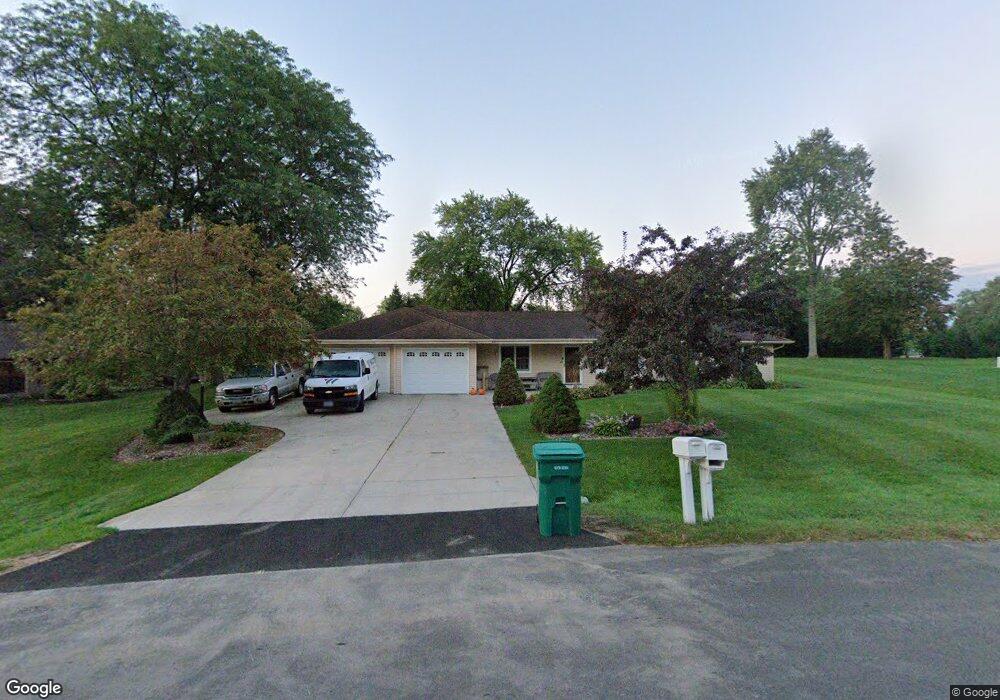
N78W15743 Longwood St Menomonee Falls, WI 53051
Estimated Value: $434,000 - $452,517
3
Beds
1
Bath
1,248
Sq Ft
$355/Sq Ft
Est. Value
About This Home
This home is located at N78W15743 Longwood St, Menomonee Falls, WI 53051 and is currently estimated at $442,879, approximately $354 per square foot. N78W15743 Longwood St is a home located in Waukesha County with nearby schools including Valley View Elementary School, North Middle School, and Menomonee Falls High School.
Ownership History
Date
Name
Owned For
Owner Type
Purchase Details
Closed on
Apr 28, 2016
Sold by
Kosanke Keith A and Kosanke Sharon K
Bought by
Fredericks Shawn R and Fredericks Kristina M
Current Estimated Value
Home Financials for this Owner
Home Financials are based on the most recent Mortgage that was taken out on this home.
Original Mortgage
$277,337
Outstanding Balance
$221,138
Interest Rate
3.71%
Mortgage Type
VA
Estimated Equity
$221,741
Purchase Details
Closed on
Jun 19, 1997
Sold by
Severson Ronald W and Severson Doris P
Bought by
Kosanke Keith A and Kosanke Sharon K
Home Financials for this Owner
Home Financials are based on the most recent Mortgage that was taken out on this home.
Original Mortgage
$125,800
Interest Rate
8.01%
Mortgage Type
FHA
Create a Home Valuation Report for This Property
The Home Valuation Report is an in-depth analysis detailing your home's value as well as a comparison with similar homes in the area
Home Values in the Area
Average Home Value in this Area
Purchase History
| Date | Buyer | Sale Price | Title Company |
|---|---|---|---|
| Fredericks Shawn R | $271,500 | None Available | |
| Kosanke Keith A | $127,500 | -- |
Source: Public Records
Mortgage History
| Date | Status | Borrower | Loan Amount |
|---|---|---|---|
| Open | Fredericks Shawn R | $277,337 | |
| Previous Owner | Kosanke Keith A | $125,800 |
Source: Public Records
Tax History Compared to Growth
Tax History
| Year | Tax Paid | Tax Assessment Tax Assessment Total Assessment is a certain percentage of the fair market value that is determined by local assessors to be the total taxable value of land and additions on the property. | Land | Improvement |
|---|---|---|---|---|
| 2024 | $4,633 | $410,600 | $117,500 | $293,100 |
| 2023 | $4,458 | $410,600 | $117,500 | $293,100 |
| 2022 | $4,340 | $269,900 | $80,800 | $189,100 |
| 2021 | $4,154 | $269,900 | $80,800 | $189,100 |
| 2020 | $4,367 | $269,900 | $80,800 | $189,100 |
| 2019 | $4,179 | $269,900 | $80,800 | $189,100 |
| 2018 | $4,393 | $269,900 | $80,800 | $189,100 |
| 2017 | $4,543 | $269,900 | $80,800 | $189,100 |
| 2016 | $4,624 | $269,900 | $80,800 | $189,100 |
| 2015 | $3,757 | $225,700 | $80,800 | $144,900 |
| 2014 | $4,044 | $225,700 | $80,800 | $144,900 |
| 2013 | $4,044 | $225,700 | $80,800 | $144,900 |
Source: Public Records
Map
Nearby Homes
- N53W19764 Kingair Dr
- N53W19776 Kingair Dr
- W155N7481 Pebble Ct
- W147N7725 Northpoint Dr
- N84W15750 Ridge Rd Unit 204
- W148N7497 Woodland Dr
- N76W14595 N Point Ct
- W163N8459 Arthur Ave
- N84W15170 Knoll Terrace
- W148N7311 Woodland Dr
- N84W16544 Ann Ave
- N86W16193 Arthur Ave
- N79W17331 Bluejay Ct Unit 1
- N86W16387 Appleton Ave
- N81W14117 Titan Ct
- W174N8125 Shady Ln Unit 1
- N86W16564 Jacobson Dr
- N85W14520 Manchester Dr
- W175N8080 Robin Cir Unit 1
- N69W15889 Eileen Ave
- N79W15775 Longwood St
- W156N7875 Cherry Ln
- N79W15740 Longwood St
- N78W15706 Longwood St
- N78W15740 Bradley Cir
- N79W15764 Longwood St
- N79W15803 Longwood St
- N78W15836 Bradley Cir
- W156N7850 Cherry Ln
- N78W15786 Bradley Cir
- N78W15641 Longwood St
- N78W15692 Longwood St
- W158N7872 Bradley Cir
- N78W15638 Longwood St
- N79W15801 Charles Ct
- N78W15781 Bradley Cir
- W156N7828 Cherry Ln
- W159N7900 Bradley Cir
- W158N7927 Longwood St
- N79W15709 Charles Ct