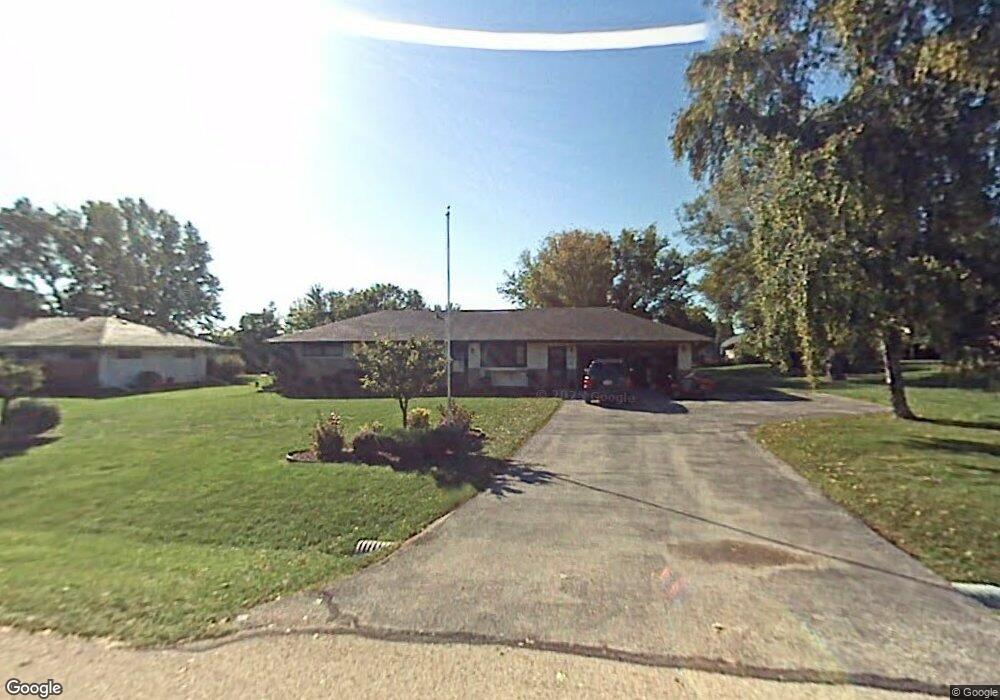
N78W16009 Carl Ross Dr Menomonee Falls, WI 53051
Estimated Value: $402,000 - $441,000
4
Beds
2
Baths
1,815
Sq Ft
$230/Sq Ft
Est. Value
About This Home
This home is located at N78W16009 Carl Ross Dr, Menomonee Falls, WI 53051 and is currently estimated at $417,093, approximately $229 per square foot. N78W16009 Carl Ross Dr is a home located in Waukesha County with nearby schools including Valley View Elementary School, North Middle School, and Menomonee Falls High School.
Ownership History
Date
Name
Owned For
Owner Type
Purchase Details
Closed on
Jul 1, 2010
Sold by
Gasper Richard M
Bought by
Brings Michael W and Lyles Brings Alma M
Current Estimated Value
Home Financials for this Owner
Home Financials are based on the most recent Mortgage that was taken out on this home.
Original Mortgage
$190,435
Outstanding Balance
$127,492
Interest Rate
4.87%
Mortgage Type
FHA
Estimated Equity
$289,601
Purchase Details
Closed on
Dec 8, 2004
Sold by
Mcmahon John K and Mcmahon Judith L
Bought by
Gasper Richard M
Home Financials for this Owner
Home Financials are based on the most recent Mortgage that was taken out on this home.
Original Mortgage
$121,000
Interest Rate
5.84%
Mortgage Type
Purchase Money Mortgage
Purchase Details
Closed on
Mar 29, 1996
Sold by
Frost Allen R and Frost Margaret E
Bought by
Mcmahon John K and Mcmahon Judith L
Create a Home Valuation Report for This Property
The Home Valuation Report is an in-depth analysis detailing your home's value as well as a comparison with similar homes in the area
Home Values in the Area
Average Home Value in this Area
Purchase History
| Date | Buyer | Sale Price | Title Company |
|---|---|---|---|
| Brings Michael W | $193,000 | Priority Title Corporation | |
| Gasper Richard M | $176,000 | -- | |
| Mcmahon John K | $127,000 | -- |
Source: Public Records
Mortgage History
| Date | Status | Borrower | Loan Amount |
|---|---|---|---|
| Open | Brings Michael W | $190,435 | |
| Previous Owner | Gasper Richard M | $121,000 |
Source: Public Records
Tax History Compared to Growth
Tax History
| Year | Tax Paid | Tax Assessment Tax Assessment Total Assessment is a certain percentage of the fair market value that is determined by local assessors to be the total taxable value of land and additions on the property. | Land | Improvement |
|---|---|---|---|---|
| 2024 | $3,549 | $316,500 | $111,200 | $205,300 |
| 2023 | $3,408 | $316,500 | $111,200 | $205,300 |
| 2022 | $3,358 | $210,400 | $76,500 | $133,900 |
| 2021 | $3,193 | $209,200 | $76,500 | $132,700 |
| 2020 | $3,367 | $209,200 | $76,500 | $132,700 |
| 2019 | $3,368 | $209,200 | $76,500 | $132,700 |
| 2018 | $3,845 | $209,200 | $76,500 | $132,700 |
| 2017 | $3,497 | $209,200 | $76,500 | $132,700 |
| 2016 | $3,556 | $209,200 | $76,500 | $132,700 |
| 2015 | $3,568 | $209,200 | $76,500 | $132,700 |
| 2014 | $3,805 | $209,200 | $76,500 | $132,700 |
| 2013 | $3,805 | $209,200 | $76,500 | $132,700 |
Source: Public Records
Map
Nearby Homes
- N53W19764 Kingair Dr
- N53W19776 Kingair Dr
- W155N7481 Pebble Ct
- W147N7725 Northpoint Dr
- N84W15750 Ridge Rd Unit 204
- W148N7497 Woodland Dr
- W163N8459 Arthur Ave
- N79W17331 Bluejay Ct Unit 1
- N76W14595 N Point Ct
- N84W16544 Ann Ave
- W148N7311 Woodland Dr
- W174N8125 Shady Ln Unit 1
- N84W15170 Knoll Terrace
- W175N8080 Robin Cir Unit 1
- N86W16193 Arthur Ave
- N72W17011 Good Hope Rd
- Lt2 Good Hope Rd
- N69W15889 Eileen Ave
- The Charlotte Plan at Edgewood Preserve
- The Elsa Plan at Edgewood Preserve
- N78W15971 Carl Ross Dr
- N78W16045 Carl Ross Dr
- N78W16024 Carl Ross Dr
- N78W15984 Carl Ross Dr
- N77W16018 Hunters Ridge Cir
- N77W15988 Hunters Ridge Cir
- N78W16081 Carl Ross Dr
- N77W16048 Hunters Ridge Cir
- N78W15935 Carl Ross Dr
- N77W15960 Hunters Ridge Cir
- N78W16060 Carl Ross Dr
- N78W15940 Carl Ross Dr
- N77W16072 Hunters Ridge Cir
- N77W15930 Hunters Ridge Cir
- N77W16021 Hunters Ridge Cir
- N77W15981 Hunters Ridge Cir
- N77W16051 Hunters Ridge Cir
- N77W15955 Hunters Ridge Cir
- N78W16094 Carl Ross Dr
- N78W15901 Carl Ross Dr