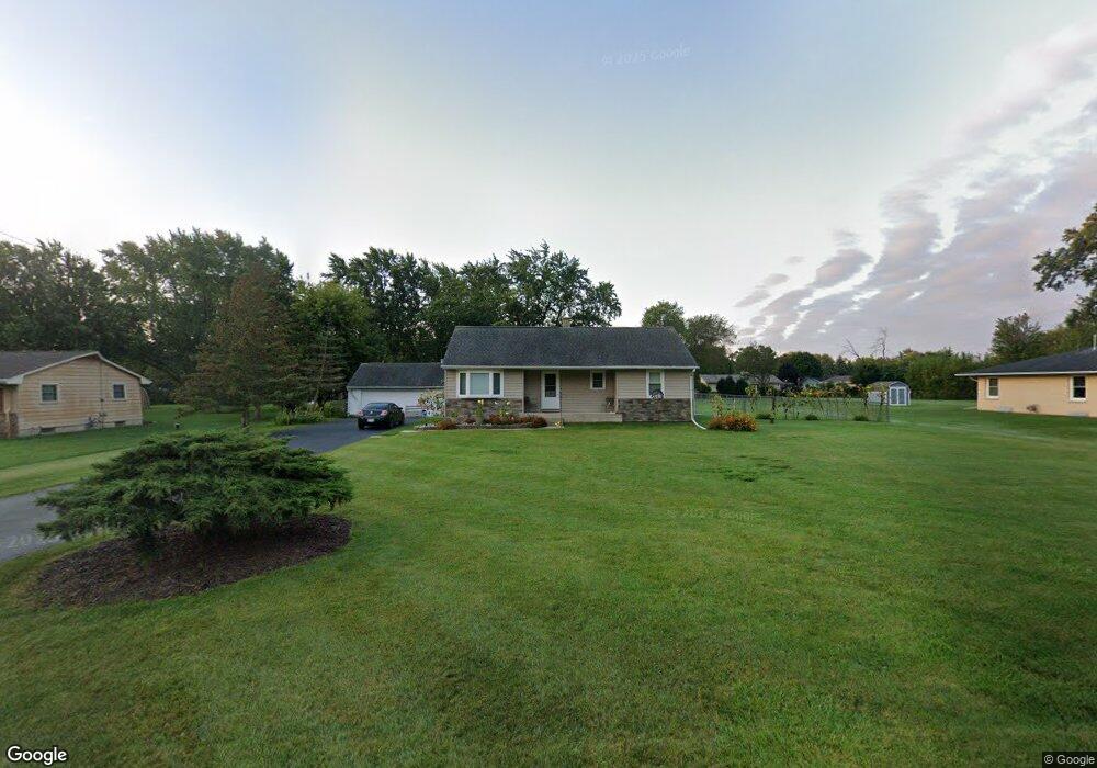
N80W16101 Rainbow Dr Menomonee Falls, WI 53051
Estimated Value: $328,000 - $364,711
2
Beds
2
Baths
1,112
Sq Ft
$311/Sq Ft
Est. Value
About This Home
This home is located at N80W16101 Rainbow Dr, Menomonee Falls, WI 53051 and is currently estimated at $345,428, approximately $310 per square foot. N80W16101 Rainbow Dr is a home located in Waukesha County with nearby schools including Valley View Elementary School, North Middle School, and Menomonee Falls High School.
Ownership History
Date
Name
Owned For
Owner Type
Purchase Details
Closed on
Jun 28, 2002
Sold by
Schrubbe Royal Gregory and Schrubbe Bernadette L
Bought by
Kuemper Theodore F and Kuemper Tanya M
Current Estimated Value
Home Financials for this Owner
Home Financials are based on the most recent Mortgage that was taken out on this home.
Original Mortgage
$150,960
Outstanding Balance
$64,403
Interest Rate
6.8%
Mortgage Type
VA
Estimated Equity
$281,025
Purchase Details
Closed on
May 19, 2000
Sold by
Schrubbe Royal G and Schrubbe Imogene L
Bought by
Schrubbe Royal Gregory and Schrubbe Bernadette L
Create a Home Valuation Report for This Property
The Home Valuation Report is an in-depth analysis detailing your home's value as well as a comparison with similar homes in the area
Home Values in the Area
Average Home Value in this Area
Purchase History
| Date | Buyer | Sale Price | Title Company |
|---|---|---|---|
| Kuemper Theodore F | $148,000 | -- | |
| Schrubbe Royal Gregory | -- | -- |
Source: Public Records
Mortgage History
| Date | Status | Borrower | Loan Amount |
|---|---|---|---|
| Open | Kuemper Theodore F | $150,960 |
Source: Public Records
Tax History Compared to Growth
Tax History
| Year | Tax Paid | Tax Assessment Tax Assessment Total Assessment is a certain percentage of the fair market value that is determined by local assessors to be the total taxable value of land and additions on the property. | Land | Improvement |
|---|---|---|---|---|
| 2024 | $3,367 | $300,700 | $123,800 | $176,900 |
| 2023 | $3,232 | $300,700 | $123,800 | $176,900 |
| 2022 | $3,194 | $200,500 | $85,100 | $115,400 |
| 2021 | $3,055 | $200,500 | $85,100 | $115,400 |
| 2020 | $3,224 | $200,500 | $85,100 | $115,400 |
| 2019 | $3,079 | $200,500 | $85,100 | $115,400 |
| 2018 | $3,223 | $200,500 | $85,100 | $115,400 |
| 2017 | $3,347 | $200,500 | $85,100 | $115,400 |
| 2016 | $3,403 | $200,500 | $85,100 | $115,400 |
| 2015 | $3,416 | $200,500 | $85,100 | $115,400 |
| 2014 | $3,643 | $200,500 | $85,100 | $115,400 |
| 2013 | $3,643 | $200,500 | $85,100 | $115,400 |
Source: Public Records
Map
Nearby Homes
- N53W19764 Kingair Dr
- N53W19776 Kingair Dr
- W163N8459 Arthur Ave
- N84W15750 Ridge Rd Unit 204
- N84W16544 Ann Ave
- N86W16193 Arthur Ave
- W155N7481 Pebble Ct
- N79W17331 Bluejay Ct Unit 1
- N86W16387 Appleton Ave
- W174N8125 Shady Ln Unit 1
- N86W16564 Jacobson Dr
- W175N8080 Robin Cir Unit 1
- W147N7725 Northpoint Dr
- W148N7497 Woodland Dr
- N76W14595 N Point Ct
- Lt101 Main St
- Lt54 Main St
- Lt8 Main St
- Lt53 Main St
- Lt57 Main St
- N80W16141 Rainbow Dr
- N80W16079 Rainbow Dr
- N80W16102 Rainbow Dr
- N80W16181 Rainbow Dr
- N80W16021 Rainbow Dr
- N80W16138 Rainbow Dr
- N80W16078 Rainbow Dr
- N79W16118 Longwood St
- N80W16180 Rainbow Dr
- N79W16080 Longwood St
- N80W16020 Rainbow Dr
- N79W16152 Longwood St
- N80W16221 Rainbow Dr
- N79W16042 Longwood St
- N80W15979 Rainbow Dr
- N79W16180 Longwood St
- N80W16220 Rainbow Dr
- N80W15990 Rainbow Dr
- N79W16012 Longwood St
- N79W16218 Longwood St