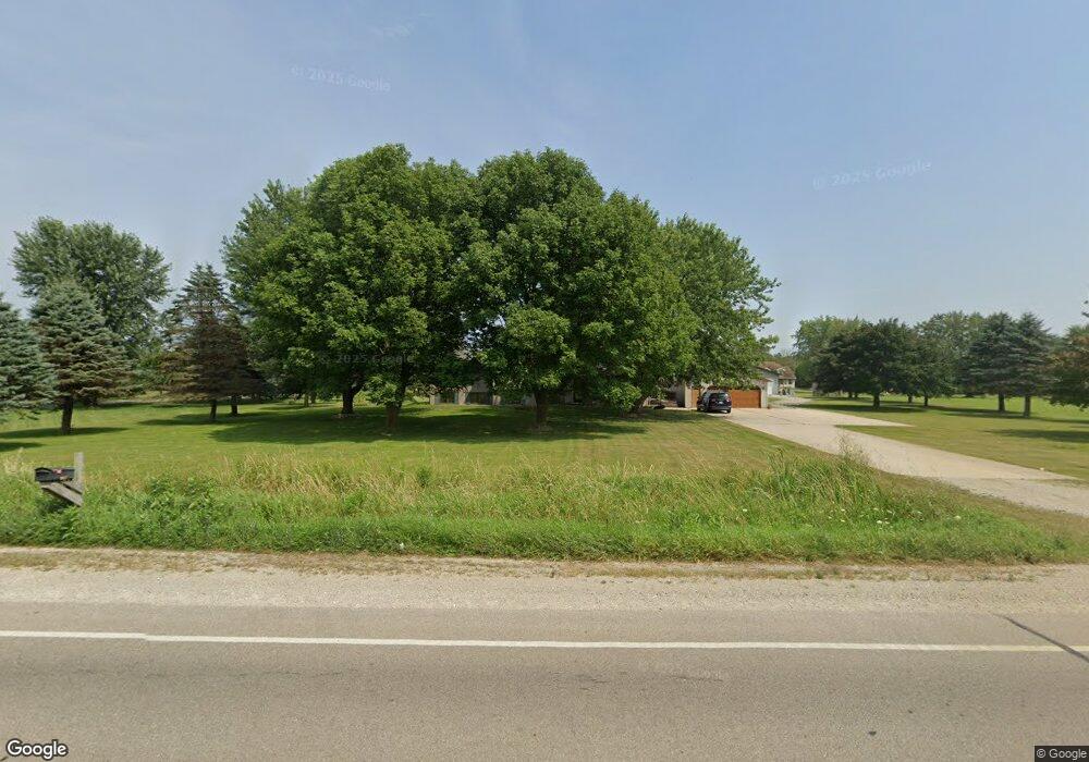
N8140 State Highway 55 Seymour, WI 54165
Estimated Value: $550,561 - $587,000
--
Bed
--
Bath
--
Sq Ft
2.01
Acres
About This Home
This home is located at N8140 State Highway 55, Seymour, WI 54165 and is currently estimated at $566,390. N8140 State Highway 55 is a home located in Outagamie County with nearby schools including Seymour High School and St. John the Baptist School.
Ownership History
Date
Name
Owned For
Owner Type
Purchase Details
Closed on
Dec 19, 2022
Sold by
Lavesser Nicole M
Bought by
Mattson Matthew and Mattson Kellina
Current Estimated Value
Home Financials for this Owner
Home Financials are based on the most recent Mortgage that was taken out on this home.
Original Mortgage
$446,500
Outstanding Balance
$431,452
Interest Rate
6.31%
Estimated Equity
$134,938
Purchase Details
Closed on
Jun 15, 2016
Sold by
Buck Brian H and Buck Melinda S
Bought by
Banks Chad M and Banks Nicole M
Create a Home Valuation Report for This Property
The Home Valuation Report is an in-depth analysis detailing your home's value as well as a comparison with similar homes in the area
Home Values in the Area
Average Home Value in this Area
Purchase History
| Date | Buyer | Sale Price | Title Company |
|---|---|---|---|
| Mattson Matthew | $470,000 | First American Title Insurance | |
| Banks Chad M | $215,000 | -- |
Source: Public Records
Mortgage History
| Date | Status | Borrower | Loan Amount |
|---|---|---|---|
| Open | Mattson Matthew | $446,500 |
Source: Public Records
Tax History Compared to Growth
Tax History
| Year | Tax Paid | Tax Assessment Tax Assessment Total Assessment is a certain percentage of the fair market value that is determined by local assessors to be the total taxable value of land and additions on the property. | Land | Improvement |
|---|---|---|---|---|
| 2023 | $4,004 | $244,600 | $19,400 | $225,200 |
| 2022 | $3,143 | $205,700 | $19,400 | $186,300 |
| 2021 | $2,774 | $205,700 | $19,400 | $186,300 |
| 2020 | $2,866 | $205,700 | $19,400 | $186,300 |
| 2019 | $2,967 | $205,700 | $19,400 | $186,300 |
| 2018 | $3,277 | $205,700 | $19,400 | $186,300 |
| 2017 | $3,173 | $205,700 | $19,400 | $186,300 |
| 2016 | $3,213 | $205,700 | $19,400 | $186,300 |
| 2015 | $3,222 | $205,700 | $19,400 | $186,300 |
| 2014 | $3,385 | $205,700 | $19,400 | $186,300 |
| 2013 | $3,603 | $205,700 | $19,400 | $186,300 |
Source: Public Records
Map
Nearby Homes
- W2441 County Road G
- 226 N Main St
- 673 W Factory St
- 364 Lincoln St
- 433 Doersch Trail
- 0 Maple Vista Ct
- 1212 Northwood Dr
- W3142 High St
- 619 S Main St
- W3116 Kortney Ln
- W2638 Autumn Blaze Trail
- W4526 Jeske Rd
- W2028 State Highway 156
- W1535 Ranch Rd
- 0 Ballard Rd
- W783 County Road Vv
- W1513 Town Rd
- W2872 Cindy Ct
- 0 Ashman Rd
- W5632 Schnabl Rd
- N8140 State Highway 55
- N8140 State Highway 55
- N8134 Norris Ln
- N8158 State Highway 55
- N8101 Norris Ln
- N8158 Wisconsin 55
- N8152 Norris Ln
- N8186 State Highway 55
- N8143 State Highway 55
- W2956 Cemetery Rd
- 0 Wisconsin 55
- W2984 Cemetery Rd
- 1216 N Main St
- W2992 Cemetery Rd
- N8247 State Highway 55
- N8249 State Highway 55
- N8249 State Highway 55
- W4139 County Road Vv
- N8272 State Highway 55
- N8281 Wisconsin 55