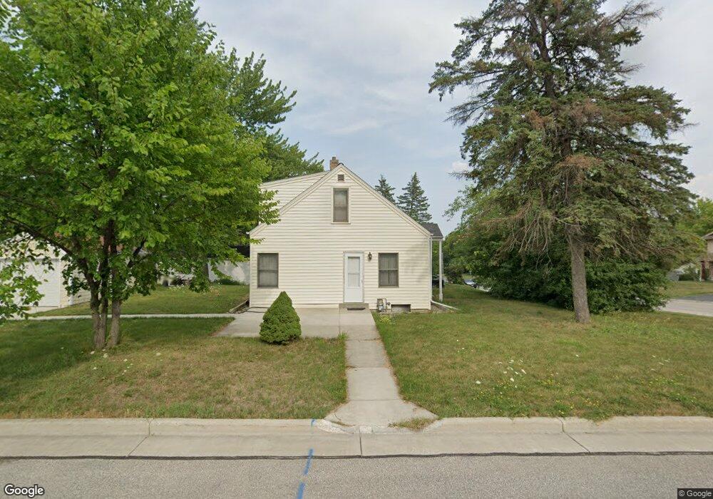
N84W16334 Menomonee Ave Menomonee Falls, WI 53051
Estimated Value: $293,000 - $341,000
3
Beds
2
Baths
1,176
Sq Ft
$271/Sq Ft
Est. Value
About This Home
This home is located at N84W16334 Menomonee Ave, Menomonee Falls, WI 53051 and is currently estimated at $318,255, approximately $270 per square foot. N84W16334 Menomonee Ave is a home located in Waukesha County with nearby schools including Shady Lane Elementary School, North Middle School, and Menomonee Falls High School.
Ownership History
Date
Name
Owned For
Owner Type
Purchase Details
Closed on
Jan 22, 2008
Sold by
Becker Jonathan C and Becker Lisa R
Bought by
Becker Joel F and Becker Diane M
Current Estimated Value
Home Financials for this Owner
Home Financials are based on the most recent Mortgage that was taken out on this home.
Original Mortgage
$80,000
Outstanding Balance
$50,655
Interest Rate
6.22%
Mortgage Type
Purchase Money Mortgage
Estimated Equity
$267,600
Purchase Details
Closed on
Jul 12, 2004
Sold by
Becker Kenneth J and Becker Marilyn D
Bought by
Becker Jonathan C and Becker Lisa R
Home Financials for this Owner
Home Financials are based on the most recent Mortgage that was taken out on this home.
Original Mortgage
$100,000
Interest Rate
5.75%
Mortgage Type
Purchase Money Mortgage
Create a Home Valuation Report for This Property
The Home Valuation Report is an in-depth analysis detailing your home's value as well as a comparison with similar homes in the area
Home Values in the Area
Average Home Value in this Area
Purchase History
| Date | Buyer | Sale Price | Title Company |
|---|---|---|---|
| Becker Joel F | $130,000 | Land Title Services Inc | |
| Becker Jonathan C | $130,000 | -- |
Source: Public Records
Mortgage History
| Date | Status | Borrower | Loan Amount |
|---|---|---|---|
| Open | Becker Joel F | $80,000 | |
| Previous Owner | Becker Jonathan C | $100,000 |
Source: Public Records
Tax History Compared to Growth
Tax History
| Year | Tax Paid | Tax Assessment Tax Assessment Total Assessment is a certain percentage of the fair market value that is determined by local assessors to be the total taxable value of land and additions on the property. | Land | Improvement |
|---|---|---|---|---|
| 2024 | $2,725 | $245,000 | $91,400 | $153,600 |
| 2023 | $2,610 | $245,000 | $91,400 | $153,600 |
| 2022 | $2,520 | $159,700 | $63,200 | $96,500 |
| 2021 | $2,409 | $159,700 | $63,200 | $96,500 |
| 2020 | $2,552 | $159,700 | $63,200 | $96,500 |
| 2019 | $2,433 | $159,700 | $63,200 | $96,500 |
| 2018 | $2,536 | $159,700 | $63,200 | $96,500 |
| 2017 | $2,643 | $159,700 | $63,200 | $96,500 |
| 2016 | $2,685 | $159,700 | $63,200 | $96,500 |
| 2015 | $2,701 | $159,700 | $63,200 | $96,500 |
| 2014 | $2,886 | $159,700 | $63,200 | $96,500 |
| 2013 | $2,886 | $159,700 | $63,200 | $96,500 |
Source: Public Records
Map
Nearby Homes
- W163N8459 Arthur Ave
- N84W16544 Ann Ave
- N86W16193 Arthur Ave
- N86W16387 Appleton Ave
- N84W15750 Ridge Rd Unit 204
- N86W16564 Jacobson Dr
- W160N8969 Madison Ave
- N84W15170 Knoll Terrace
- Lt101 Main St
- Lt54 Main St
- Lt8 Main St
- Lt53 Main St
- Lt57 Main St
- Lt13 Main St
- Lt87 Main St
- Lt45 Main St
- Lt38 Main St
- Lt42 Main St
- Lt61 Main St
- Lt80 Main St
- N84W16316 Menomonee Ave
- N84W16298 Menomonee Ave
- N84W16335 Donald Ave
- N84W16317 Donald Ave
- W163N8419 Arthur Ave
- W163N8409 Arthur Ave
- N84W16299 Donald Ave
- W163N8429 Arthur Ave
- N84W16278 Menomonee Ave
- N84W16341 Menomonee Ave
- N84W16315 Menomonee Ave
- W163N8439 Arthur Ave
- N84W16279 Donald Ave
- N84W16381 Menomonee Ave
- N84W16279 Menomonee Ave
- N84W16260 Menomonee Ave
- W163N8449 Arthur Ave
- N84W16263 Donald Ave
- W164N8418 Hiawatha Ave
- W164N8410 Hiawatha Ave