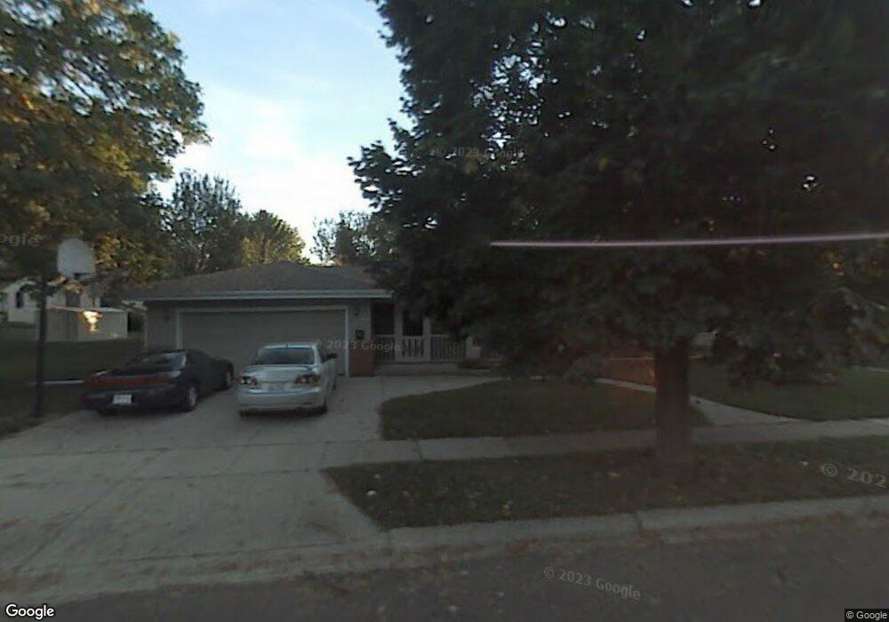
N85W16859 Ann Ave Menomonee Falls, WI 53051
Estimated Value: $347,000 - $476,000
4
Beds
3
Baths
1,912
Sq Ft
$214/Sq Ft
Est. Value
About This Home
This home is located at N85W16859 Ann Ave, Menomonee Falls, WI 53051 and is currently estimated at $409,035, approximately $213 per square foot. N85W16859 Ann Ave is a home located in Waukesha County with nearby schools including Shady Lane Elementary School, North Middle School, and Menomonee Falls High School.
Ownership History
Date
Name
Owned For
Owner Type
Purchase Details
Closed on
Apr 19, 2023
Sold by
Romans Ronald R
Bought by
Block Jacob
Current Estimated Value
Home Financials for this Owner
Home Financials are based on the most recent Mortgage that was taken out on this home.
Original Mortgage
$154,000
Outstanding Balance
$152,025
Interest Rate
6.73%
Mortgage Type
New Conventional
Estimated Equity
$257,010
Purchase Details
Closed on
Jul 14, 2014
Sold by
Kohls Keith A and Kohls Sarah
Bought by
Romans Ronald
Home Financials for this Owner
Home Financials are based on the most recent Mortgage that was taken out on this home.
Original Mortgage
$181,600
Interest Rate
4.2%
Mortgage Type
New Conventional
Purchase Details
Closed on
Jan 5, 2000
Sold by
Schoepke Glenn C and Schoepke Susan A
Bought by
Kohls Keith A and Dillenburg Sarah M
Home Financials for this Owner
Home Financials are based on the most recent Mortgage that was taken out on this home.
Original Mortgage
$170,000
Interest Rate
7.81%
Create a Home Valuation Report for This Property
The Home Valuation Report is an in-depth analysis detailing your home's value as well as a comparison with similar homes in the area
Home Values in the Area
Average Home Value in this Area
Purchase History
| Date | Buyer | Sale Price | Title Company |
|---|---|---|---|
| Block Jacob | $300,000 | Frontier Title | |
| Romans Ronald | $227,000 | Priority Title Corp | |
| Kohls Keith A | $194,000 | -- |
Source: Public Records
Mortgage History
| Date | Status | Borrower | Loan Amount |
|---|---|---|---|
| Open | Block Jacob | $154,000 | |
| Previous Owner | Romans Ronald | $181,600 | |
| Previous Owner | Kohls Keith A | $170,000 |
Source: Public Records
Tax History Compared to Growth
Tax History
| Year | Tax Paid | Tax Assessment Tax Assessment Total Assessment is a certain percentage of the fair market value that is determined by local assessors to be the total taxable value of land and additions on the property. | Land | Improvement |
|---|---|---|---|---|
| 2024 | $3,640 | $324,400 | $90,400 | $234,000 |
| 2023 | $3,496 | $324,400 | $90,400 | $234,000 |
| 2022 | $3,334 | $209,000 | $62,400 | $146,600 |
| 2021 | $3,189 | $209,000 | $62,400 | $146,600 |
| 2020 | $3,364 | $209,000 | $62,400 | $146,600 |
| 2019 | $3,214 | $209,000 | $62,400 | $146,600 |
| 2018 | $3,367 | $209,000 | $62,400 | $146,600 |
| 2017 | $4,010 | $209,000 | $62,400 | $146,600 |
| 2016 | $3,552 | $209,000 | $62,400 | $146,600 |
| 2015 | $3,687 | $209,000 | $62,400 | $146,600 |
| 2014 | $3,801 | $209,000 | $62,400 | $146,600 |
| 2013 | $3,801 | $209,000 | $62,400 | $146,600 |
Source: Public Records
Map
Nearby Homes
- N84W16544 Ann Ave
- N86W16564 Jacobson Dr
- W163N8459 Arthur Ave
- N86W16387 Appleton Ave
- N86W16193 Arthur Ave
- W177N8635 Lynwood Dr
- W174N8125 Shady Ln Unit 1
- N90W16995 Appleton Ave
- N89W16328 Cleveland Ave
- N84W15750 Ridge Rd Unit 204
- W175N8080 Robin Cir Unit 1
- N88W17868 Christman Rd
- W178N8846 Queensway St
- N84W18113 Imperial Ct
- Lt101 Main St
- Lt54 Main St
- Lt8 Main St
- Lt53 Main St
- Lt57 Main St
- Lt13 Main St
- W168N8507 Jacobson Dr
- W169N8526 Sheridan Dr
- W168N8521 Jacobson Dr
- W169N8516 Sheridan Dr
- W168N8501 Jacobson Dr
- N85W16856 Ann Ave
- W169N8498 Sheridan Dr
- W169N8550 Sheridan Dr
- N85W16836 Ann Ave
- W168N8491 Jacobson Dr
- W169N8490 Sheridan Dr
- W167N8549 Jacobson Dr
- N85W16941 Ann Ave
- W168N8481 Jacobson Dr
- W168N8510 Jacobson Dr
- W168N8498 Jacobson Dr
- W168N8520 Jacobson Dr
- W168N8492 Jacobson Dr
- W169N8480 Sheridan Dr
- W169N8505 Sheridan Dr