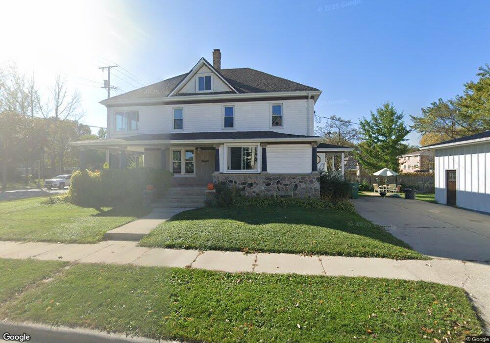
N90W16556 Roosevelt Dr Menomonee Falls, WI 53051
Estimated Value: $384,000 - $447,000
5
Beds
2
Baths
2,663
Sq Ft
$161/Sq Ft
Est. Value
About This Home
This home is located at N90W16556 Roosevelt Dr, Menomonee Falls, WI 53051 and is currently estimated at $428,705, approximately $160 per square foot. N90W16556 Roosevelt Dr is a home located in Waukesha County with nearby schools including Shady Lane Elementary School, North Middle School, and Menomonee Falls High School.
Ownership History
Date
Name
Owned For
Owner Type
Purchase Details
Closed on
May 14, 2020
Sold by
Kuhlenbeck Jeremy G and Kuhlenbeck Erin M
Bought by
Brandt Austin M
Current Estimated Value
Home Financials for this Owner
Home Financials are based on the most recent Mortgage that was taken out on this home.
Original Mortgage
$264,127
Outstanding Balance
$234,053
Interest Rate
3.3%
Mortgage Type
FHA
Estimated Equity
$194,652
Purchase Details
Closed on
Feb 18, 2005
Sold by
Mueller Gail M
Bought by
Kuhlenbeck Jeremy G and Kuhlenbeck Erin M
Home Financials for this Owner
Home Financials are based on the most recent Mortgage that was taken out on this home.
Original Mortgage
$175,920
Interest Rate
5.6%
Mortgage Type
Purchase Money Mortgage
Create a Home Valuation Report for This Property
The Home Valuation Report is an in-depth analysis detailing your home's value as well as a comparison with similar homes in the area
Home Values in the Area
Average Home Value in this Area
Purchase History
| Date | Buyer | Sale Price | Title Company |
|---|---|---|---|
| Brandt Austin M | $269,167 | Prism Title | |
| Kuhlenbeck Jeremy G | $219,400 | -- |
Source: Public Records
Mortgage History
| Date | Status | Borrower | Loan Amount |
|---|---|---|---|
| Open | Brandt Austin M | $264,127 | |
| Previous Owner | Kuhlenbeck Jeremy G | $175,920 | |
| Closed | Kuhlenbeck Jeremy G | $43,980 |
Source: Public Records
Tax History Compared to Growth
Tax History
| Year | Tax Paid | Tax Assessment Tax Assessment Total Assessment is a certain percentage of the fair market value that is determined by local assessors to be the total taxable value of land and additions on the property. | Land | Improvement |
|---|---|---|---|---|
| 2024 | $4,255 | $344,700 | $96,700 | $248,000 |
| 2023 | $4,124 | $344,700 | $96,700 | $248,000 |
| 2022 | $3,818 | $200,700 | $66,800 | $133,900 |
| 2021 | $3,486 | $200,700 | $66,800 | $133,900 |
| 2020 | $3,450 | $194,800 | $66,800 | $128,000 |
| 2019 | $3,462 | $194,800 | $66,800 | $128,000 |
| 2018 | $3,495 | $194,800 | $66,800 | $128,000 |
| 2017 | $3,737 | $194,800 | $66,800 | $128,000 |
| 2016 | $3,529 | $194,800 | $66,800 | $128,000 |
| 2015 | $4,750 | $194,800 | $66,800 | $128,000 |
| 2014 | $3,538 | $194,800 | $66,800 | $128,000 |
| 2013 | $3,538 | $194,800 | $66,800 | $128,000 |
Source: Public Records
Map
Nearby Homes
- W166N9108 Grand Ave
- N89W16328 Cleveland Ave
- N90W16995 Appleton Ave
- W160N8969 Madison Ave
- N86W16387 Appleton Ave
- N92W17274 Forest Dr
- Lt101 Main St
- Lt54 Main St
- Lt8 Main St
- Lt53 Main St
- Lt57 Main St
- Lt13 Main St
- Lt87 Main St
- Lt45 Main St
- Lt38 Main St
- Lt42 Main St
- Lt61 Main St
- Lt80 Main St
- Lt86 Main St
- Lt56 Main St
- N90W16558 Roosevelt Dr
- N90W16572 Roosevelt Dr
- N90W16590 Roosevelt Dr
- N90W16555 Roosevelt Dr
- W165N9087 Hale Ave
- N90W16620 Roosevelt Dr
- N90W16555 W Roosevelt Dr Unit N90W16555
- W166N9074 Grand Ave Unit 2
- W166N9074 Grand Ave Unit 3
- W166N9074 Grand Ave
- W166N9018 Grand Ave
- W166N9008 Grand Ave
- N90W16660 Roosevelt Dr
- W166N9019 Grand Ave
- N91W16542 Pershing Ave
- N91W16528 Pershing Ave
- N90W16673 Roosevelt Dr
- N91W16644 Pershing Ave
- N90W16680 Roosevelt Dr
- W166N8998 Grand Ave