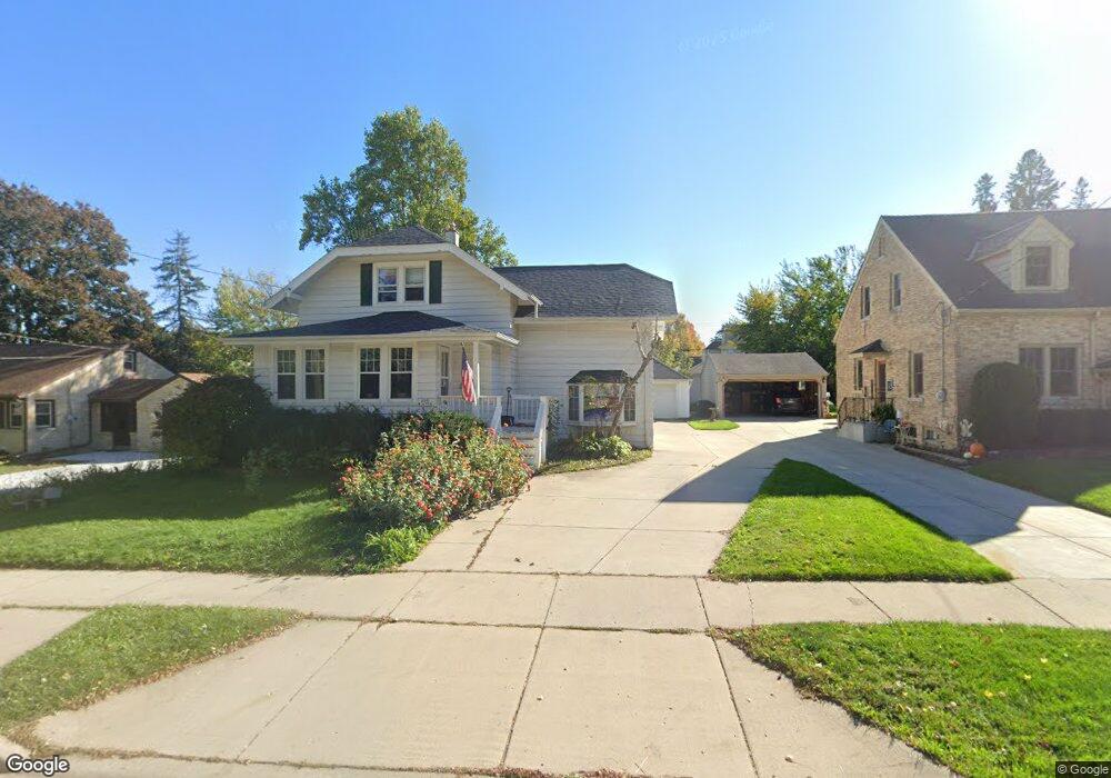
N90W16773 Pershing Ave Menomonee Falls, WI 53051
Estimated Value: $366,000 - $422,000
3
Beds
3
Baths
1,723
Sq Ft
$232/Sq Ft
Est. Value
About This Home
This home is located at N90W16773 Pershing Ave, Menomonee Falls, WI 53051 and is currently estimated at $400,062, approximately $232 per square foot. N90W16773 Pershing Ave is a home located in Waukesha County with nearby schools including Shady Lane Elementary School, North Middle School, and Menomonee Falls High School.
Ownership History
Date
Name
Owned For
Owner Type
Purchase Details
Closed on
Dec 9, 2020
Sold by
Zanders Trust
Bought by
Haskins Peter D and Haskins Emily C
Current Estimated Value
Home Financials for this Owner
Home Financials are based on the most recent Mortgage that was taken out on this home.
Original Mortgage
$261,000
Outstanding Balance
$232,782
Interest Rate
2.8%
Mortgage Type
New Conventional
Estimated Equity
$167,280
Purchase Details
Closed on
Aug 30, 2006
Sold by
Zanders Gordon H
Bought by
Zanders Gordon H and The Gordon H Zanders Living Trust
Home Financials for this Owner
Home Financials are based on the most recent Mortgage that was taken out on this home.
Original Mortgage
$199,200
Interest Rate
6.58%
Mortgage Type
New Conventional
Purchase Details
Closed on
Nov 21, 2005
Sold by
Zanders Gordon H
Bought by
Zanders Gordon H and Gordon H Zanders Revocable Living Trust
Purchase Details
Closed on
Aug 26, 2005
Sold by
Melter Paula and Melter Brian M
Bought by
Zanders Gordon H
Home Financials for this Owner
Home Financials are based on the most recent Mortgage that was taken out on this home.
Original Mortgage
$187,200
Interest Rate
1%
Mortgage Type
Fannie Mae Freddie Mac
Purchase Details
Closed on
Nov 8, 2002
Sold by
Watson Joseph L
Bought by
Fenn Paula
Home Financials for this Owner
Home Financials are based on the most recent Mortgage that was taken out on this home.
Original Mortgage
$152,000
Interest Rate
6.38%
Purchase Details
Closed on
Jun 14, 2002
Sold by
Musbach Dean M and Musbach Marjorie A
Bought by
Watson Joseph L and Fenn Paula
Home Financials for this Owner
Home Financials are based on the most recent Mortgage that was taken out on this home.
Original Mortgage
$152,000
Interest Rate
6.91%
Purchase Details
Closed on
Aug 13, 2001
Sold by
Farrell David C and Farrell Lisa M
Bought by
Musbach Dean M and Musbach Marjorie A
Create a Home Valuation Report for This Property
The Home Valuation Report is an in-depth analysis detailing your home's value as well as a comparison with similar homes in the area
Home Values in the Area
Average Home Value in this Area
Purchase History
| Date | Buyer | Sale Price | Title Company |
|---|---|---|---|
| Haskins Peter D | $145,000 | None Available | |
| Haskins Peter D | $145,000 | None Available | |
| Zanders Gordon H | -- | None Available | |
| Zanders Gordon H | -- | None Available | |
| Zanders Gordon H | -- | -- | |
| Zanders Gordon H | $234,000 | -- | |
| Fenn Paula | $88,100 | -- | |
| Watson Joseph L | $190,000 | -- | |
| Musbach Dean M | $184,900 | -- |
Source: Public Records
Mortgage History
| Date | Status | Borrower | Loan Amount |
|---|---|---|---|
| Open | Haskins Peter D | $261,000 | |
| Previous Owner | Zanders Gordon H | $199,200 | |
| Previous Owner | Zanders Gordon H | $187,200 | |
| Previous Owner | Fenn Paula | $152,000 | |
| Previous Owner | Watson Joseph L | $152,000 | |
| Closed | Fenn Paula | $19,000 |
Source: Public Records
Tax History Compared to Growth
Tax History
| Year | Tax Paid | Tax Assessment Tax Assessment Total Assessment is a certain percentage of the fair market value that is determined by local assessors to be the total taxable value of land and additions on the property. | Land | Improvement |
|---|---|---|---|---|
| 2024 | $3,761 | $334,900 | $96,700 | $238,200 |
| 2023 | $3,614 | $334,900 | $96,700 | $238,200 |
| 2022 | $3,523 | $220,400 | $66,800 | $153,600 |
| 2021 | $3,370 | $220,400 | $66,800 | $153,600 |
| 2020 | $3,552 | $220,400 | $66,800 | $153,600 |
| 2019 | $3,395 | $220,400 | $66,800 | $153,600 |
| 2018 | $3,559 | $220,400 | $66,800 | $153,600 |
| 2017 | $4,228 | $220,400 | $66,800 | $153,600 |
| 2016 | $3,753 | $220,400 | $66,800 | $153,600 |
| 2015 | $3,764 | $220,400 | $66,800 | $153,600 |
| 2014 | $4,013 | $220,400 | $66,800 | $153,600 |
| 2013 | $4,013 | $220,400 | $66,800 | $153,600 |
Source: Public Records
Map
Nearby Homes
- W166N9108 Grand Ave
- N90W16995 Appleton Ave
- N89W16328 Cleveland Ave
- N92W17274 Forest Dr
- W160N8969 Madison Ave
- W174N9287 Joper Rd
- N86W16564 Jacobson Dr
- N86W16387 Appleton Ave
- N86W16193 Arthur Ave
- N88W17690 Christman Rd
- Lt101 Main St
- Lt54 Main St
- Lt8 Main St
- Lt53 Main St
- Lt57 Main St
- Lt13 Main St
- Lt87 Main St
- Lt45 Main St
- Lt38 Main St
- Lt42 Main St
- N90W16791 Pershing Ave
- N90W16737 Pershing Ave
- N90W16807 Pershing Ave
- N90W16804 Pershing Ave
- N90W16721 Pershing Ave
- N90W16742 Pershing Ave
- N90W16734 Roosevelt Dr
- N90W16824 Pershing Ave
- N90W16752 Roosevelt Dr
- N90W16758 Pershing Ave
- N90W16835 Pershing Ave
- N90W16770 Roosevelt Dr
- N90W16701 Pershing Ave
- N90W16788 Roosevelt Dr
- N90W16716 Roosevelt Dr
- N90W16722 Pershing Ave
- W168N9104 Falls Ave
- N90W16848 Pershing Ave
- W168N9103 Falls Ave
- N90W16802 Roosevelt Dr