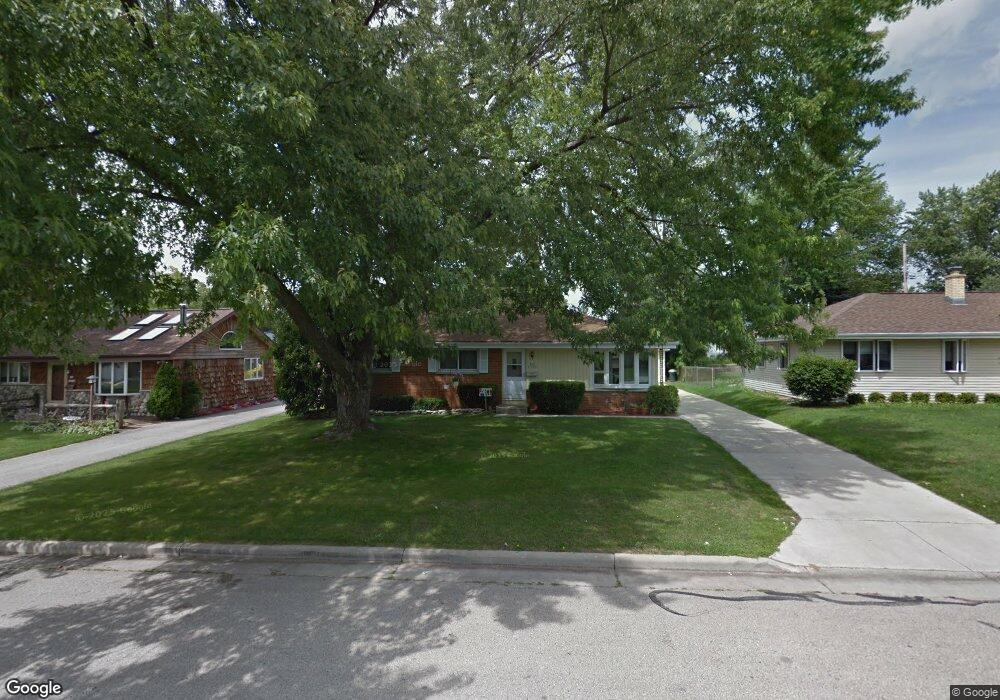
N92W17032 Roger Ave Menomonee Falls, WI 53051
Estimated Value: $338,000 - $363,000
3
Beds
2
Baths
1,196
Sq Ft
$295/Sq Ft
Est. Value
About This Home
This home is located at N92W17032 Roger Ave, Menomonee Falls, WI 53051 and is currently estimated at $352,724, approximately $294 per square foot. N92W17032 Roger Ave is a home located in Waukesha County with nearby schools including Shady Lane Elementary School, North Middle School, and Menomonee Falls High School.
Ownership History
Date
Name
Owned For
Owner Type
Purchase Details
Closed on
Jul 18, 2003
Sold by
Pfeil Loren M and Pfeil Theresa J
Bought by
Shriner Scott G and Shriner Marie R
Current Estimated Value
Home Financials for this Owner
Home Financials are based on the most recent Mortgage that was taken out on this home.
Original Mortgage
$141,000
Outstanding Balance
$60,127
Interest Rate
5.3%
Mortgage Type
Purchase Money Mortgage
Estimated Equity
$292,597
Purchase Details
Closed on
Apr 28, 1997
Sold by
Pfeil Loren M and Pfeil Theresa J
Bought by
Pfeil Loren M and Pfeil Theresa J
Home Financials for this Owner
Home Financials are based on the most recent Mortgage that was taken out on this home.
Original Mortgage
$107,900
Interest Rate
7.37%
Create a Home Valuation Report for This Property
The Home Valuation Report is an in-depth analysis detailing your home's value as well as a comparison with similar homes in the area
Home Values in the Area
Average Home Value in this Area
Purchase History
| Date | Buyer | Sale Price | Title Company |
|---|---|---|---|
| Shriner Scott G | $166,000 | -- | |
| Pfeil Loren M | -- | -- |
Source: Public Records
Mortgage History
| Date | Status | Borrower | Loan Amount |
|---|---|---|---|
| Open | Shriner Scott G | $141,000 | |
| Previous Owner | Pfeil Loren M | $107,900 |
Source: Public Records
Tax History Compared to Growth
Tax History
| Year | Tax Paid | Tax Assessment Tax Assessment Total Assessment is a certain percentage of the fair market value that is determined by local assessors to be the total taxable value of land and additions on the property. | Land | Improvement |
|---|---|---|---|---|
| 2024 | $3,261 | $291,500 | $90,900 | $200,600 |
| 2023 | $3,129 | $291,500 | $90,900 | $200,600 |
| 2022 | $3,044 | $191,400 | $62,700 | $128,700 |
| 2021 | $2,868 | $188,700 | $62,700 | $126,000 |
| 2020 | $3,030 | $188,700 | $62,700 | $126,000 |
| 2019 | $2,892 | $188,700 | $62,700 | $126,000 |
| 2018 | $3,025 | $188,700 | $62,700 | $126,000 |
| 2017 | $3,143 | $188,700 | $62,700 | $126,000 |
| 2016 | $3,195 | $188,700 | $62,700 | $126,000 |
| 2015 | $3,209 | $188,700 | $62,700 | $126,000 |
| 2014 | $3,424 | $188,700 | $62,700 | $126,000 |
| 2013 | $3,424 | $188,700 | $62,700 | $126,000 |
Source: Public Records
Map
Nearby Homes
- N92W17274 Forest Dr
- N90W16995 Appleton Ave
- W166N9108 Grand Ave
- W174N9287 Joper Rd
- N89W16328 Cleveland Ave
- N94W17842 Appleton Ave
- W160N8969 Madison Ave
- N88W17690 Christman Rd
- W178N8846 Queensway St
- N88W17868 Christman Rd
- N86W16387 Appleton Ave
- W162N9761 Mayflower Dr
- W179N9765 Riversbend Cir W
- N99W16701 Woodcock Rd
- W177N8635 Lynwood Dr
- N86W16193 Arthur Ave
- Lt101 Main St
- Lt54 Main St
- Lt8 Main St
- Lt53 Main St
- N92W17052 Roger Ave
- N92W17010 Roger Ave
- N92W17031 Roger Ave
- N92W17011 Roger Ave
- N92W17053 Roger Ave
- N92W17072 Roger Ave
- N92W16990 Roger Ave
- N92W16991 Roger Ave
- N92W17073 Roger Ave
- N92W17033 Forest Dr
- N92W17013 Forest Dr
- N92W17092 Roger Ave
- N92W16970 Roger Ave
- N92W17093 Roger Ave
- N92W16969 Roger Ave
- N92W17053 Forest Dr
- N92W17075 Forest Dr
- N92W16991 Forest Dr
- N92W16948 Roger Ave
- N92W16949 Roger Ave