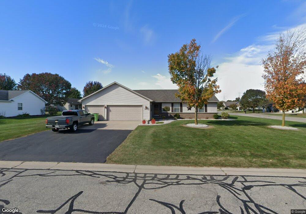
N9475 Dusty Dr Appleton, WI 54915
Estimated Value: $365,466 - $403,000
3
Beds
2
Baths
1,526
Sq Ft
$253/Sq Ft
Est. Value
About This Home
This home is located at N9475 Dusty Dr, Appleton, WI 54915 and is currently estimated at $386,617, approximately $253 per square foot. N9475 Dusty Dr is a home located in Calumet County with nearby schools including Sunrise Elementary School, J.R. Gerritts Middle School, and Mapleview Intermediate School.
Ownership History
Date
Name
Owned For
Owner Type
Purchase Details
Closed on
Dec 20, 2019
Sold by
Femal Michael J
Bought by
Femal Michelle L
Current Estimated Value
Purchase Details
Closed on
Apr 20, 2007
Sold by
Buckoski Aaron C and Buckoski Amanda J
Bought by
Femal Michael J and Femal Michelle C
Home Financials for this Owner
Home Financials are based on the most recent Mortgage that was taken out on this home.
Original Mortgage
$136,800
Interest Rate
6.19%
Mortgage Type
New Conventional
Create a Home Valuation Report for This Property
The Home Valuation Report is an in-depth analysis detailing your home's value as well as a comparison with similar homes in the area
Home Values in the Area
Average Home Value in this Area
Purchase History
| Date | Buyer | Sale Price | Title Company |
|---|---|---|---|
| Femal Michelle L | -- | None Listed On Document | |
| Femal Michael J | $171,000 | None Available |
Source: Public Records
Mortgage History
| Date | Status | Borrower | Loan Amount |
|---|---|---|---|
| Previous Owner | Femal Michael J | $136,800 |
Source: Public Records
Tax History
| Year | Tax Paid | Tax Assessment Tax Assessment Total Assessment is a certain percentage of the fair market value that is determined by local assessors to be the total taxable value of land and additions on the property. | Land | Improvement |
|---|---|---|---|---|
| 2024 | $3,735 | $220,300 | $44,100 | $176,200 |
| 2023 | $3,707 | $220,300 | $44,100 | $176,200 |
| 2022 | $3,497 | $220,300 | $44,100 | $176,200 |
| 2021 | $3,386 | $220,300 | $44,100 | $176,200 |
| 2020 | $3,632 | $220,300 | $44,100 | $176,200 |
| 2019 | $3,704 | $220,300 | $44,100 | $176,200 |
| 2018 | $3,604 | $181,800 | $44,100 | $137,700 |
| 2017 | $3,393 | $181,800 | $44,100 | $137,700 |
| 2016 | $3,558 | $181,800 | $44,100 | $137,700 |
| 2015 | $3,510 | $181,800 | $44,100 | $137,700 |
| 2013 | -- | $0 | $0 | $0 |
Source: Public Records
Map
Nearby Homes
- N9427 Dusty Dr
- W5479 Hidden Trail Ln
- N9551 Clover Ridge Trail
- W5598 Hoelzel Way
- N9265 Anton St
- N9581 Hartford Ln
- N9337 Rosella Dr
- W5609 Tonys Way
- N9678 Hopfensperger Rd
- W5658 Tonys Way
- N9598 Chadbury Ln
- N9262 Anton St
- N9243 Anton St
- N9246 Homestead Ln
- N9240 Homestead Ln
- N9232 Homestead Ln
- N9562 Otte Ct
- N9208 Homestead Ln
- 0 Otte Ct
- N9650 Darboy Dr
- W5529 Mile Long Dr
- N9467 Dusty Dr
- W5530 Mutzy Way
- W5505 Mile Long Dr
- W5520 Mile Long Dr
- N9468 Dusty Dr
- W5537 Mile Long Dr
- W5512 Mile Long Dr
- W5528 Mile Long Dr
- W5504 Mile Long Dr
- W5538 Mutzy Way
- N9460 Dusty Dr
- W5536 Mile Long Dr
- W5523 Mutzy Way
- W5495 Mile Long Dr
- W5545 Mile Long Dr
- N9454 Logan Ln
- W5546 Mutzy Way
- N9452 Dusty Dr
- W5496 Mile Long Dr
Your Personal Tour Guide
Ask me questions while you tour the home.