Estimated payment $621/month
About This Lot
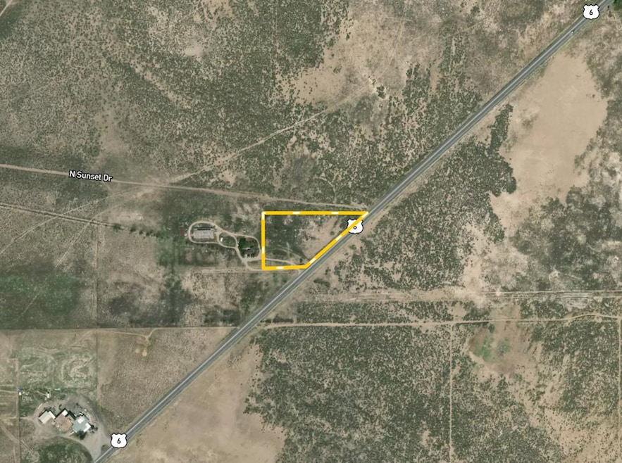
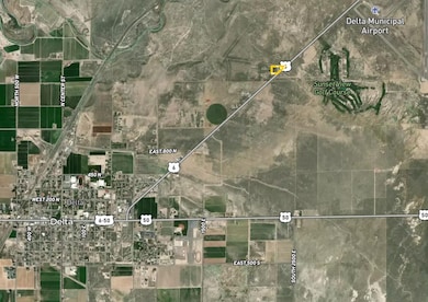
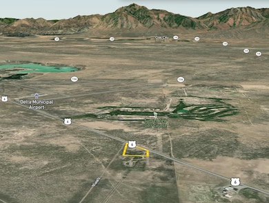
This 6.22 acre parcel is located in Millard County, Utah, within the Millard School District and near the community of Delta. The land is zoned Agricultural and is not part of any homeowners association. There are no covenants, conditions, or restrictions in place. This provides a simple ownership structure for buyers who want acreage that offers flexibility within the zoning and county regulations. The parcel is associated with Delta Elementary School and Delta High School, indicating that the land lies within the general Delta area. Delta is the largest nearby community and provides essential services including grocery, hardware, fuel, health care, and agricultural supply businesses. Hinckley is also nearby and is located approximately 5 to 8 miles west of Delta, depending on route. Oak City is approximately 12 to 15 miles to the northeast. These towns serve as the core population centers in the region and offer additional services that support agricultural, recreational, and rural land use needs. Because the exact address of the parcel is not provided, distances to towns are approximate and based on standard distances from the center of Delta to surrounding communities. The parcel has mixed access that includes concrete, gravel and dirt surface types. This variety of access conditions suggests that the immediate approach to the property may transition from improved roads to rural roadways as is typical in agricultural areas. There are no utilities available at the property. This includes no water, no power and no irrigation water. Buyers should plan for hauled water, well permitting research, or off-grid utility solutions if development is desired. The parcel includes flat sections, along with areas that have a gradual slope. This topography is suitable for various types of rural land use including general agricultural activity, livestock use, recreational use or long term land holding. Portions of the parcel are fenced. The presence of fencing provides initial boundary indication but buyers should still complete a survey or boundary verification if precise boundary placement is needed for future plans. The terrain allows for potential building sites, storage uses, agricultural structures or other uses that comply with county zoning.

Property Details
Property Type
- Land
Lot Details
- Current uses include row crop
- Potential uses include for development
Map
Home Values in the Area
Average Home Value in this Area
Property History
| Date | Event | Price | List to Sale | Price per Sq Ft |
|---|---|---|---|---|
| 12/02/2025 12/02/25 | For Sale | $99,000 | -- | -- |
- 700 N Highway 6
- 901 E 750 Rd N
- 628 Sunset St
- 629 E Millard St
- Locust Ave Unit LotWP001
- 7900 E 250 Rd N
- 461 Topaz Blvd Unit 6
- 445 Topaz Blvd Unit 10
- 2595 E 500 Rd S Unit 3
- 263 Silver Maple Dr
- 665 Bristlecone Ln
- 98 W 1000 N
- 44 E 300 S
- 0 E Highway 6 Unit LotWP001 16586023
- 321 E 200 S
- 625 E Birch Dr
- 325 N 100 W
- 38 E 300 S
- 32 E 300 S
- 331 W 200 N