Estimated payment $2,288/month
Highlights
- Horses Allowed On Property
- 83.56 Acre Lot
- Spring on Lot
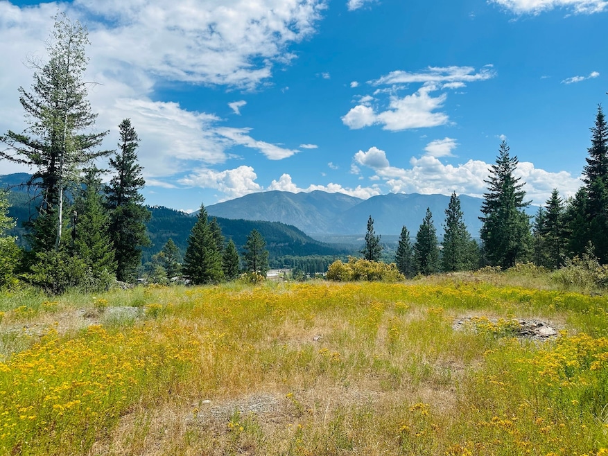
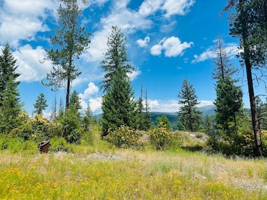
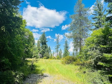
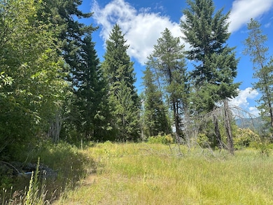
- Views of Trees
- Meadow
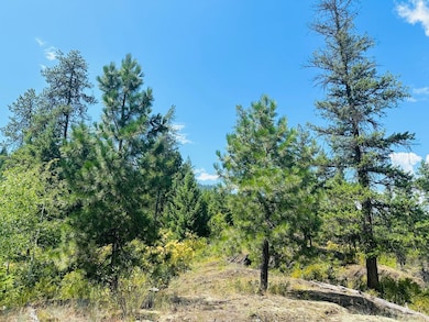
- Wooded Lot
About This Lot
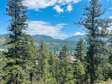
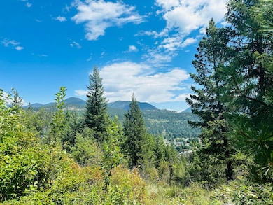
Almost 84 acres, with two separate parcels, with varied terrain & stunning views of the Cabinet Mountains and the Kootenai River Valley! There are gorgeous rock outcroppings & wildlife frequent the property. Property includes two separate legal descriptions, so already divided. Access the southern parcel via Campbell Drive. Behind a locked gate are 43.69 acres bordered by USFS land on one side and below, by the City of Troy. The adjacent parcel to the north is 39.87 acres, accessed via DeLeo Road. An easement provides access to the property, but a driveway would need to be built. Power could be brought to the property, but currently off grid. There is income potential from shale rock quarry sites. A ground water spring flows year-round at a current rate of about 5 gpm. No covenants or restrictions. Live in a remote setting with fabulous views, lots of elbow room, yet within walking distance of town!
Listing Agent
Clearwater Montana Properties - Noxon License #RRE-BRO-LIC-61371 Listed on: 04/03/2025
Property Details
Property Type
- Land
Est. Annual Taxes
- $206
Lot Details
- 83.56 Acre Lot
- Rock Outcropping
- Meadow
- Wooded Lot
Property Views
- Trees
- Mountain
- Meadow
- Valley
Horse Facilities and Amenities
- Horses Allowed On Property
Utilities
- No Utilities
- Spring water is a source of water for the property
Listing and Financial Details
- Assessor Parcel Number 56428012407110000
Community Details
Overview
- No Home Owners Association
Recreation
- Spring on Lot
Map
Home Values in the Area
Average Home Value in this Area
Tax History
| Year | Tax Paid | Tax Assessment Tax Assessment Total Assessment is a certain percentage of the fair market value that is determined by local assessors to be the total taxable value of land and additions on the property. | Land | Improvement |
|---|---|---|---|---|
| 2025 | $86 | $48,327 | $0 | $0 |
| 2024 | $76 | $59,260 | $0 | $0 |
| 2023 | $105 | $56,660 | $0 | $0 |
| 2022 | $102 | $54,061 | $0 | $0 |
| 2021 | $114 | $51,461 | $0 | $0 |
| 2020 | $143 | $48,862 | $0 | $0 |
| 2019 | $142 | $48,862 | $0 | $0 |
| 2018 | $141 | $48,862 | $0 | $0 |
| 2017 | $114 | $48,862 | $0 | $0 |
| 2016 | $133 | $48,862 | $0 | $0 |
| 2015 | $98 | $48,862 | $0 | $0 |
| 2014 | $111 | $76,774 | $0 | $0 |
Property History
| Date | Event | Price | Change | Sq Ft Price |
|---|---|---|---|---|
| 04/03/2025 04/03/25 | For Sale | $430,000 | -- | -- |
Source: Montana Regional MLS
MLS Number: 30043948
APN: 56-4280-12-4-07-11-0000
Disclaimer: Certain information contained herein is derived from information provided by parties other than Homes.com. All information provided is deemed reliable, but is not guaranteed to be accurate and should be independently verified.
![]() IDX information is provided exclusively for personal, non-commercial use, and may not be used for any purpose other than to identify prospective properties consumers may be interested in purchasing. Information is deemed reliable but not guaranteed.
IDX information is provided exclusively for personal, non-commercial use, and may not be used for any purpose other than to identify prospective properties consumers may be interested in purchasing. Information is deemed reliable but not guaranteed.
- 206 Mineral Ave
- 209 Mineral Ave
- TBD Dent Ave
- 514 Mineral Ave
- 106 N 6th St
- 707 E Grant Ave
- 1007 E Missoula Ave
- 296 Riverside Ave
- 708 N 3rd St
- Parcel A N Kootenai Dr
- Parcel B N Kootenai Dr
- 0000 Obrien Creek Rd
- 1278 Hunts Mill Rd
- 158 Twisted Branch Ln
- 12437 Us Highway 2
- NHN Little Bear Loop
- 1268 Hunts Mill Rd
- Lot 1 River Rd
- 153 Bighorn Way
- 16995 Us Highway 2
