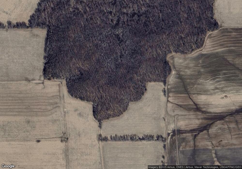
Estimated Value: $191,000 - $397,000
--
Bed
--
Bath
--
Sq Ft
5
Acres
About This Home
This home is located at S14714 N Bunting Rd, Osseo, WI 54758 and is currently estimated at $279,781. S14714 N Bunting Rd is a home located in Eau Claire County with nearby schools including Osseo-Fairchild Elementary School, Osseo-Fairchild Middle School, and Osseo-Fairchild High School.
Ownership History
Date
Name
Owned For
Owner Type
Purchase Details
Closed on
Sep 2, 2024
Sold by
Smith Ryan Anthony and Smith Daniel Aaron
Bought by
Smith Joelene M Sturz and Smith Y
Current Estimated Value
Purchase Details
Closed on
Mar 27, 2024
Sold by
Sturz Smith Joelene and Smith Y
Bought by
Smith Ryan A and Smith Ryan Anthony
Purchase Details
Closed on
Jul 16, 2015
Sold by
Dennis Eugene Smith Estate
Bought by
Smith Joelene M
Create a Home Valuation Report for This Property
The Home Valuation Report is an in-depth analysis detailing your home's value as well as a comparison with similar homes in the area
Home Values in the Area
Average Home Value in this Area
Purchase History
| Date | Buyer | Sale Price | Title Company |
|---|---|---|---|
| Smith Joelene M Sturz | -- | -- | |
| Smith Ryan A | $143,300 | Joelene M Sturz Smith | |
| Smith Joelene M | -- | -- |
Source: Public Records
Tax History Compared to Growth
Tax History
| Year | Tax Paid | Tax Assessment Tax Assessment Total Assessment is a certain percentage of the fair market value that is determined by local assessors to be the total taxable value of land and additions on the property. | Land | Improvement |
|---|---|---|---|---|
| 2024 | $1,554 | $124,300 | $16,800 | $107,500 |
| 2023 | $1,283 | $124,300 | $16,800 | $107,500 |
| 2022 | $1,396 | $124,300 | $16,800 | $107,500 |
| 2021 | $1,430 | $124,300 | $16,800 | $107,500 |
| 2020 | $1,480 | $92,200 | $0 | $0 |
| 2019 | $1,411 | $92,300 | $13,700 | $78,600 |
| 2018 | $1,386 | $92,300 | $13,700 | $78,600 |
| 2017 | $1,522 | $92,300 | $13,700 | $78,600 |
| 2016 | $1,510 | $92,300 | $13,700 | $78,600 |
| 2014 | -- | $92,300 | $13,700 | $78,600 |
| 2013 | -- | $92,300 | $13,700 | $78,600 |
Source: Public Records
Map
Nearby Homes
- S12500 US Highway 53
- 8120 County Road Hh
- E8111 Marshall Ave
- S10655 County Road D
- 0 Highway 10 NW
- W20834 County Road H
- 00000 County Road D
- 217 Birch St
- 435 1st Ave S
- 151 W Hawthorn St
- 222 W Hawthorn St
- 403 5th Ave S
- 610 E Pine St
- 219 E Fir St
- 15155 Ryder Rd
- 9290 Us Highway 53
- 14237 10th St
- 13813 10th St Unit 1
- 50831 Caroline St
- 13806 Park Ave
- S15002 N Bunting Rd
- 0 E Bunting Rd
- S15131 Thompson Rd
- E10290 E Bunting Rd
- 0 Robin Rd
- S15310 Thompson Rd
- E9470 W Robin Rd
- E9390 W Robin Rd
- E9995 W Robin Rd
- E10107 W Robin Rd
- E10522 E Bunting Rd
- S15297 Thompson Rd
- E9900 W Robin Rd
- E10590 E Bunting Rd
- E10590 E Bunting Rd
- 0 Bunting and Lark Roads
- 0 Bunting Rd
- E9065 W Robin Rd
- E10435 W Robin Rd
- E9090 W Robin Rd
