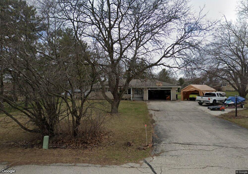
S63W13433 Windsor Rd Muskego, WI 53150
Estimated Value: $399,588 - $472,000
3
Beds
2
Baths
1,535
Sq Ft
$275/Sq Ft
Est. Value
About This Home
This home is located at S63W13433 Windsor Rd, Muskego, WI 53150 and is currently estimated at $421,897, approximately $274 per square foot. S63W13433 Windsor Rd is a home located in Waukesha County with nearby schools including Bay Lane Elementary School, Lake Denoon Middle School, and Creative and Performing Arts.
Ownership History
Date
Name
Owned For
Owner Type
Purchase Details
Closed on
Jul 8, 2002
Sold by
Schell Paul L and Schell Terri L
Bought by
Schell Paul L and Schell Terri L
Current Estimated Value
Home Financials for this Owner
Home Financials are based on the most recent Mortgage that was taken out on this home.
Original Mortgage
$122,500
Outstanding Balance
$51,599
Interest Rate
6.62%
Estimated Equity
$370,298
Purchase Details
Closed on
Dec 10, 1997
Sold by
Ward Shirley J
Bought by
Schell Paul L
Home Financials for this Owner
Home Financials are based on the most recent Mortgage that was taken out on this home.
Original Mortgage
$103,000
Interest Rate
7.36%
Create a Home Valuation Report for This Property
The Home Valuation Report is an in-depth analysis detailing your home's value as well as a comparison with similar homes in the area
Home Values in the Area
Average Home Value in this Area
Purchase History
| Date | Buyer | Sale Price | Title Company |
|---|---|---|---|
| Schell Paul L | -- | -- | |
| Schell Paul L | $131,500 | -- |
Source: Public Records
Mortgage History
| Date | Status | Borrower | Loan Amount |
|---|---|---|---|
| Open | Schell Paul L | $122,500 | |
| Closed | Schell Paul L | $103,000 |
Source: Public Records
Tax History Compared to Growth
Tax History
| Year | Tax Paid | Tax Assessment Tax Assessment Total Assessment is a certain percentage of the fair market value that is determined by local assessors to be the total taxable value of land and additions on the property. | Land | Improvement |
|---|---|---|---|---|
| 2024 | $3,096 | $275,500 | $74,700 | $200,800 |
| 2023 | $3,049 | $275,500 | $74,700 | $200,800 |
| 2022 | $2,983 | $275,500 | $74,700 | $200,800 |
| 2021 | $2,953 | $275,500 | $74,700 | $200,800 |
| 2020 | $3,209 | $233,900 | $65,400 | $168,500 |
| 2019 | $3,178 | $233,900 | $65,400 | $168,500 |
| 2018 | $3,218 | $233,900 | $65,400 | $168,500 |
| 2017 | $3,218 | $233,900 | $65,400 | $168,500 |
| 2016 | $3,129 | $202,800 | $62,600 | $140,200 |
| 2015 | $3,164 | $202,800 | $62,600 | $140,200 |
| 2014 | $3,444 | $202,800 | $62,600 | $140,200 |
| 2013 | $3,444 | $202,800 | $62,600 | $140,200 |
Source: Public Records
Map
Nearby Homes
- 6180 Preston Ln
- Lt17 W Old Farm Rd
- W137S6834 Dunstan Ct
- Lt8 Twin Silos Ct
- W140S6982 Twin Silos Ct
- Lt10 Norbert Ct
- 13615 W Deer Park Dr
- 5622 S Fox Tail Ct
- 11931 W Janesville Rd
- S70W14872 Dartmouth Cir
- 5701 S 121st St
- 5315 S Maryknoll Dr
- 12230 W Grange Ave
- 11310 Haleco Ln
- 5310 S Nicolet Dr
- W142S7571 Freedom Ave
- 11216 Bridget Ln
- S73W15032 Cherrywood Dr
- W145S7644 Durham Dr
- S70W15770 Sandalwood Dr
- W134S6418 Windsor Rd
- S63W13381 Windsor Rd
- S63W13426 Windsor Rd
- W133S6439 Saroyan Ct
- S63W13396 Windsor Rd
- W134S6436 Windsor Rd
- W133S6451 Saroyan Ct
- W134S6419 Windsor Rd
- W133S6440 Saroyan Ct
- S63W13347 Windsor Rd
- S63W13358 Windsor Rd
- S63W13326 Windsor Rd
- W134S6435 Windsor Rd
- W133S6465 Saroyan Ct
- W134S6362 Fennimore Ln
- S63W13279 Windsor Rd
- W134S6465 Windsor Rd
- S64W13319 Saroyan Ct
- W132S6433 Saroyan Rd
- S63W13292 Windsor Rd