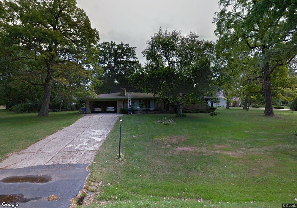
S64W12563 Tennyson Ln Muskego, WI 53150
Estimated Value: $449,000 - $537,000
3
Beds
3
Baths
2,097
Sq Ft
$227/Sq Ft
Est. Value
About This Home
This home is located at S64W12563 Tennyson Ln, Muskego, WI 53150 and is currently estimated at $475,890, approximately $226 per square foot. S64W12563 Tennyson Ln is a home located in Waukesha County with nearby schools including Bay Lane Elementary School, Lake Denoon Middle School, and Creative and Performing Arts.
Ownership History
Date
Name
Owned For
Owner Type
Purchase Details
Closed on
Nov 10, 2017
Sold by
Crow Dean W and Crow Ross
Bought by
Jelinek James P and Jelinek Erin L Singler
Current Estimated Value
Home Financials for this Owner
Home Financials are based on the most recent Mortgage that was taken out on this home.
Original Mortgage
$245,385
Outstanding Balance
$205,621
Interest Rate
3.85%
Mortgage Type
New Conventional
Estimated Equity
$270,269
Create a Home Valuation Report for This Property
The Home Valuation Report is an in-depth analysis detailing your home's value as well as a comparison with similar homes in the area
Home Values in the Area
Average Home Value in this Area
Purchase History
| Date | Buyer | Sale Price | Title Company |
|---|---|---|---|
| Jelinek James P | $258,300 | None Available |
Source: Public Records
Mortgage History
| Date | Status | Borrower | Loan Amount |
|---|---|---|---|
| Open | Jelinek James P | $245,385 |
Source: Public Records
Tax History Compared to Growth
Tax History
| Year | Tax Paid | Tax Assessment Tax Assessment Total Assessment is a certain percentage of the fair market value that is determined by local assessors to be the total taxable value of land and additions on the property. | Land | Improvement |
|---|---|---|---|---|
| 2024 | $3,215 | $285,400 | $72,200 | $213,200 |
| 2023 | $3,168 | $285,400 | $72,200 | $213,200 |
| 2022 | $3,098 | $285,400 | $72,200 | $213,200 |
| 2021 | $3,068 | $285,400 | $72,200 | $213,200 |
| 2020 | $3,399 | $246,900 | $63,200 | $183,700 |
| 2019 | $3,368 | $246,900 | $63,200 | $183,700 |
| 2018 | $3,409 | $246,900 | $63,200 | $183,700 |
| 2017 | $3,406 | $246,900 | $63,200 | $183,700 |
| 2016 | $3,384 | $218,400 | $60,500 | $157,900 |
| 2015 | $3,421 | $218,400 | $60,500 | $157,900 |
| 2014 | $3,723 | $218,400 | $60,500 | $157,900 |
| 2013 | $3,723 | $218,400 | $60,500 | $157,900 |
Source: Public Records
Map
Nearby Homes
- 6180 Preston Ln
- 11931 W Janesville Rd
- W137S6834 Dunstan Ct
- 11310 Haleco Ln
- 5701 S 121st St
- Lt17 W Old Farm Rd
- 11216 Bridget Ln
- Lt8 Twin Silos Ct
- W140S6982 Twin Silos Ct
- 13615 W Deer Park Dr
- 12230 W Grange Ave
- 6749 S Prairie Wood Ln
- 6741 S Prairie Wood Ln
- 7084 S Fieldstone Ct Unit 43
- Lt10 Norbert Ct
- 10464 W Whitnall Edge Dr Unit 203
- 5622 S Fox Tail Ct
- 5310 S Nicolet Dr
- 11470 W Tess Creek St
- 5380 S 116th St
- W124S6439 Hawthorne Rd
- W125S6464 Whittier Terrace
- S64W12584 Tennyson Ln
- S63W12525 Tennyson Ln
- W124S6465 Hawthorne Rd
- S64W12556 Tennyson Ln
- W125S6490 Whittier Terrace
- S64W12622 Tennyson Ln
- S64W12615 Tennyson Ln
- S63W12530 Tennyson Ln
- W124S6491 Hawthorne Rd
- W124S6438 Hawthorne Rd
- W124S6462 Hawthorne Rd
- W125S6493 Whittier Terrace
- W126S6384 Coleridge Ct
- W124S6414 Hawthorne Rd
- W126S6370 Coleridge Ct
- W124S6398 Hawthorne Rd
- W125S6518 Whittier Terrace
- W124S6488 Hawthorne Rd