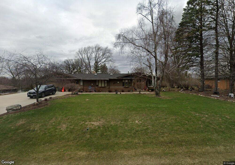
S65W12686 Byron Rd Muskego, WI 53150
Estimated Value: $462,000 - $597,000
3
Beds
3
Baths
2,304
Sq Ft
$224/Sq Ft
Est. Value
About This Home
This home is located at S65W12686 Byron Rd, Muskego, WI 53150 and is currently estimated at $516,353, approximately $224 per square foot. S65W12686 Byron Rd is a home located in Waukesha County with nearby schools including Bay Lane Elementary School, Lake Denoon Middle School, and Creative and Performing Arts.
Ownership History
Date
Name
Owned For
Owner Type
Purchase Details
Closed on
Sep 30, 1999
Sold by
Mlachnik Duane A and Mlachnik Mary Clare
Bought by
Mlachnik Dean A and Mlachnik Marie L
Current Estimated Value
Home Financials for this Owner
Home Financials are based on the most recent Mortgage that was taken out on this home.
Original Mortgage
$148,000
Interest Rate
7.37%
Create a Home Valuation Report for This Property
The Home Valuation Report is an in-depth analysis detailing your home's value as well as a comparison with similar homes in the area
Home Values in the Area
Average Home Value in this Area
Purchase History
| Date | Buyer | Sale Price | Title Company |
|---|---|---|---|
| Mlachnik Dean A | $185,000 | -- |
Source: Public Records
Mortgage History
| Date | Status | Borrower | Loan Amount |
|---|---|---|---|
| Closed | Mlachnik Dean A | $148,000 |
Source: Public Records
Tax History Compared to Growth
Tax History
| Year | Tax Paid | Tax Assessment Tax Assessment Total Assessment is a certain percentage of the fair market value that is determined by local assessors to be the total taxable value of land and additions on the property. | Land | Improvement |
|---|---|---|---|---|
| 2024 | $3,609 | $318,100 | $74,600 | $243,500 |
| 2023 | $3,560 | $318,100 | $74,600 | $243,500 |
| 2022 | $3,479 | $318,100 | $74,600 | $243,500 |
| 2021 | $3,447 | $318,100 | $74,600 | $243,500 |
| 2020 | $3,807 | $274,900 | $65,300 | $209,600 |
| 2019 | $3,776 | $274,900 | $65,300 | $209,600 |
| 2018 | $3,820 | $274,900 | $65,300 | $209,600 |
| 2017 | $3,813 | $274,900 | $65,300 | $209,600 |
| 2016 | $3,743 | $240,300 | $62,600 | $177,700 |
| 2015 | $3,781 | $240,300 | $62,600 | $177,700 |
| 2014 | $4,116 | $240,300 | $62,600 | $177,700 |
| 2013 | $4,116 | $240,300 | $62,600 | $177,700 |
Source: Public Records
Map
Nearby Homes
- 6180 Preston Ln
- W137S6834 Dunstan Ct
- 11931 W Janesville Rd
- Lt8 Twin Silos Ct
- W140S6982 Twin Silos Ct
- Lt17 W Old Farm Rd
- 11310 Haleco Ln
- 5701 S 121st St
- 11216 Bridget Ln
- 13615 W Deer Park Dr
- 7084 S Fieldstone Ct Unit 43
- 6749 S Prairie Wood Ln
- 6741 S Prairie Wood Ln
- Lt10 Norbert Ct
- 12230 W Grange Ave
- 11470 W Tess Creek St
- 11532 W Tess Creek St
- 5622 S Fox Tail Ct
- 11415 W Tess Creek St
- 10464 W Whitnall Edge Dr Unit 203
- S65W12714 Byron Rd
- S65W12697 Byron Rd
- S65W12659 Byron Rd
- S65W12648 Byron Rd
- W127S6576 Longfellow Ln
- W126S6530 Chesterton Ct
- S65W12749 Byron Rd
- S65W12636 Byron Rd
- S65W12621 Byron Rd
- W126S6525 Chesterton Ct
- W127S6544 Longfellow Ln
- 13010 W Janesville Rd
- S65W12587 Byron Rd
- W125S6543 Whittier Terrace
- S66W12690 Somerset Dr
- W127S6575 Longfellow Ln
- S66W12652 Somerset Dr
- W127S6603 Longfellow Ln
- S66W12726 Somerset Dr
- W126S6497 Chesterton Ct