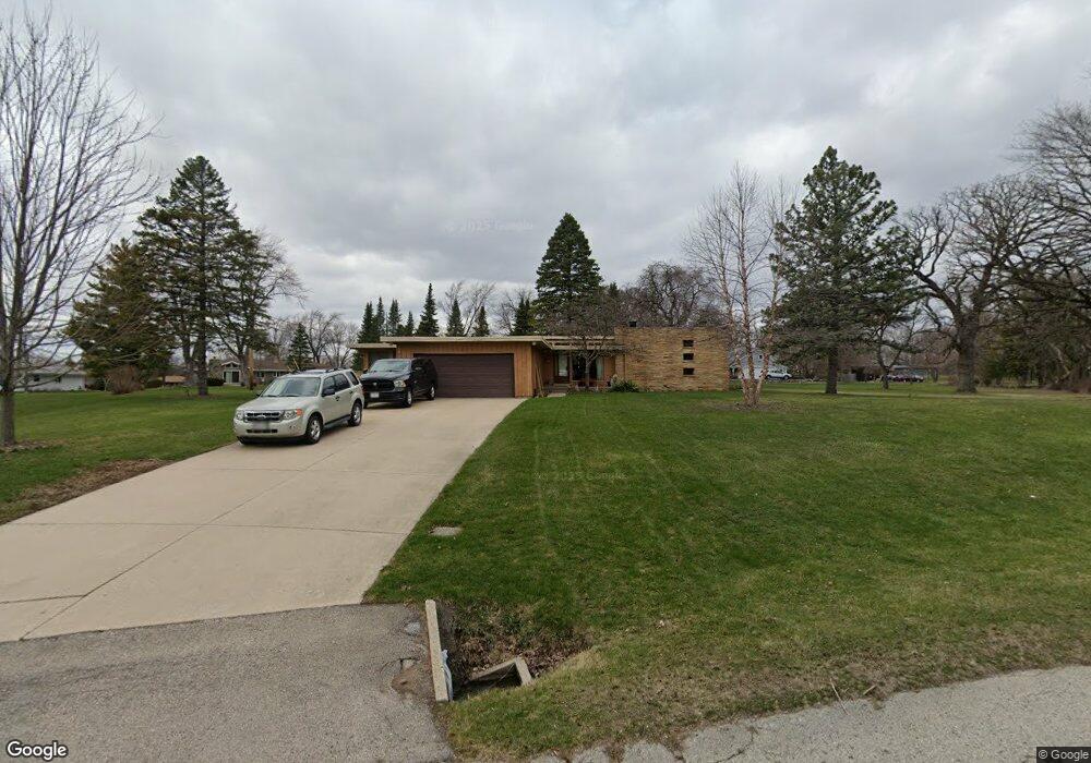
S65W12902 Longfellow Ln Muskego, WI 53150
Estimated Value: $317,000 - $363,000
2
Beds
1
Bath
1,316
Sq Ft
$258/Sq Ft
Est. Value
About This Home
This home is located at S65W12902 Longfellow Ln, Muskego, WI 53150 and is currently estimated at $339,450, approximately $257 per square foot. S65W12902 Longfellow Ln is a home located in Waukesha County with nearby schools including Bay Lane Elementary School, Lake Denoon Middle School, and Creative and Performing Arts.
Ownership History
Date
Name
Owned For
Owner Type
Purchase Details
Closed on
Jun 27, 2023
Sold by
Mcculloch Matthew
Bought by
Rivera Anna
Current Estimated Value
Purchase Details
Closed on
Jun 22, 2012
Sold by
Dacouisto Celeste M
Bought by
Mcculloch Matthew
Purchase Details
Closed on
Sep 14, 2007
Sold by
Cinquemani Nick
Bought by
Dacquisto Celeste M
Create a Home Valuation Report for This Property
The Home Valuation Report is an in-depth analysis detailing your home's value as well as a comparison with similar homes in the area
Home Values in the Area
Average Home Value in this Area
Purchase History
| Date | Buyer | Sale Price | Title Company |
|---|---|---|---|
| Rivera Anna | $225,000 | None Listed On Document | |
| Mcculloch Matthew | $95,000 | None Available | |
| Dacquisto Celeste M | -- | None Available |
Source: Public Records
Tax History Compared to Growth
Tax History
| Year | Tax Paid | Tax Assessment Tax Assessment Total Assessment is a certain percentage of the fair market value that is determined by local assessors to be the total taxable value of land and additions on the property. | Land | Improvement |
|---|---|---|---|---|
| 2024 | $2,824 | $238,800 | $73,400 | $165,400 |
| 2023 | $3,036 | $238,800 | $73,400 | $165,400 |
| 2022 | $3,660 | $238,800 | $73,400 | $165,400 |
| 2021 | $3,571 | $238,800 | $73,400 | $165,400 |
| 2020 | $3,619 | $192,000 | $64,200 | $127,800 |
| 2019 | $3,658 | $192,000 | $64,200 | $127,800 |
| 2018 | $3,668 | $192,000 | $64,200 | $127,800 |
| 2017 | $3,134 | $192,000 | $64,200 | $127,800 |
| 2016 | $3,412 | $156,100 | $61,600 | $94,500 |
| 2015 | $3,422 | $156,100 | $61,600 | $94,500 |
| 2014 | $2,728 | $156,100 | $61,600 | $94,500 |
| 2013 | $2,728 | $156,100 | $61,600 | $94,500 |
Source: Public Records
Map
Nearby Homes
- 6180 Preston Ln
- W137S6834 Dunstan Ct
- Lt17 W Old Farm Rd
- 11931 W Janesville Rd
- Lt8 Twin Silos Ct
- W140S6982 Twin Silos Ct
- 13615 W Deer Park Dr
- 5701 S 121st St
- 11310 Haleco Ln
- Lt10 Norbert Ct
- 11216 Bridget Ln
- 5622 S Fox Tail Ct
- 12230 W Grange Ave
- S70W14872 Dartmouth Cir
- 6749 S Prairie Wood Ln
- 6741 S Prairie Wood Ln
- 7084 S Fieldstone Ct Unit 43
- 11470 W Tess Creek St
- 5310 S Nicolet Dr
- 11532 W Tess Creek St
- S65W12926 Longfellow Ln
- S65W12895 Longfellow Ln
- S65W12962 Longfellow Ln
- S64W12979 Kipling Ct
- S65W12931 Longfellow Ln
- S65W12845 Longfellow Ln
- S64W12991 Kipling Ct
- W128S6473 Berger Ln
- S64W12978 Kipling Ct
- S65W13004 Longfellow Ln
- S65W12963 Longfellow Ln
- W128S6481 Tennyson Ln
- W129S6622 Somerset Cir
- S64W13021 Kipling Ct
- 13010 W Janesville Rd
- W127S6575 Longfellow Ln
- W127S6544 Longfellow Ln
- S64W12990 Kipling Ct
- S65W13048 Longfellow Ln
- W128S6626 Somerset Cir