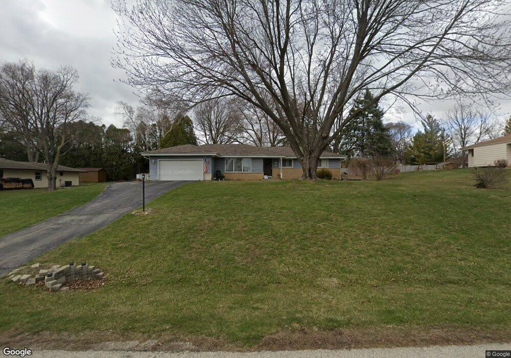
S65W13772 Hemming Way Muskego, WI 53150
Estimated Value: $381,000 - $411,000
3
Beds
2
Baths
1,405
Sq Ft
$281/Sq Ft
Est. Value
About This Home
This home is located at S65W13772 Hemming Way, Muskego, WI 53150 and is currently estimated at $394,105, approximately $280 per square foot. S65W13772 Hemming Way is a home located in Waukesha County with nearby schools including Bay Lane Elementary School, Lake Denoon Middle School, and Creative and Performing Arts.
Ownership History
Date
Name
Owned For
Owner Type
Purchase Details
Closed on
Apr 30, 2001
Sold by
Hutchinson Eunice L
Bought by
Kazmierski Michael A and Kazmierski Jenny R
Current Estimated Value
Home Financials for this Owner
Home Financials are based on the most recent Mortgage that was taken out on this home.
Original Mortgage
$110,000
Outstanding Balance
$40,952
Interest Rate
6.99%
Estimated Equity
$353,153
Create a Home Valuation Report for This Property
The Home Valuation Report is an in-depth analysis detailing your home's value as well as a comparison with similar homes in the area
Home Values in the Area
Average Home Value in this Area
Purchase History
| Date | Buyer | Sale Price | Title Company |
|---|---|---|---|
| Kazmierski Michael A | $154,900 | -- |
Source: Public Records
Mortgage History
| Date | Status | Borrower | Loan Amount |
|---|---|---|---|
| Open | Kazmierski Michael A | $110,000 |
Source: Public Records
Tax History Compared to Growth
Tax History
| Year | Tax Paid | Tax Assessment Tax Assessment Total Assessment is a certain percentage of the fair market value that is determined by local assessors to be the total taxable value of land and additions on the property. | Land | Improvement |
|---|---|---|---|---|
| 2024 | $2,991 | $266,800 | $71,300 | $195,500 |
| 2023 | $3,904 | $266,800 | $71,300 | $195,500 |
| 2022 | $3,811 | $266,800 | $71,300 | $195,500 |
| 2021 | $3,706 | $266,800 | $71,300 | $195,500 |
| 2020 | $3,986 | $227,400 | $62,400 | $165,000 |
| 2019 | $3,304 | $227,400 | $62,400 | $165,000 |
| 2018 | $3,467 | $227,400 | $62,400 | $165,000 |
| 2017 | $3,799 | $227,400 | $62,400 | $165,000 |
| 2016 | $3,946 | $196,600 | $59,900 | $136,700 |
| 2015 | $3,744 | $196,600 | $59,900 | $136,700 |
| 2014 | $3,333 | $196,600 | $59,900 | $136,700 |
| 2013 | $3,333 | $196,600 | $59,900 | $136,700 |
Source: Public Records
Map
Nearby Homes
- W137S6834 Dunstan Ct
- 6180 Preston Ln
- Lt17 W Old Farm Rd
- Lt8 Twin Silos Ct
- W140S6982 Twin Silos Ct
- Lt10 Norbert Ct
- S70W14872 Dartmouth Cir
- 13615 W Deer Park Dr
- 5622 S Fox Tail Ct
- 11931 W Janesville Rd
- W142S7571 Freedom Ave
- S73W15032 Cherrywood Dr
- 5701 S 121st St
- 5315 S Maryknoll Dr
- S70W15770 Sandalwood Dr
- W145S7644 Durham Dr
- W150S7586 Dorothy Dr
- 12230 W Grange Ave
- S66W16256 Chestnut Ridge Ct
- 11310 Haleco Ln
- S65W13748 Hemming Way
- S65W13704 Hemming Way
- S65W13802 Hemming Way
- S66W13747 Hemming Way
- S66W13775 Hemming Way
- S66W13715 Hemming Way
- S65W13805 Sherwood Cir
- S65W13837 Sherwood Cir
- S66W13687 Hemming Way
- S65W13773 Sherwood Cir
- S66W13809 Hemming Way
- W138S6552 Sherwood Cir
- W138S6607 Hemming Way
- S65W13727 Sherwood Cir
- S65W13679 Hemming Way
- S65W13836 Sherwood Cir
- S66W13848 Hemming Way
- S65W13808 Sherwood Cir
- W136S6607 Conrad Ct
- W138S6625 Hemming Way