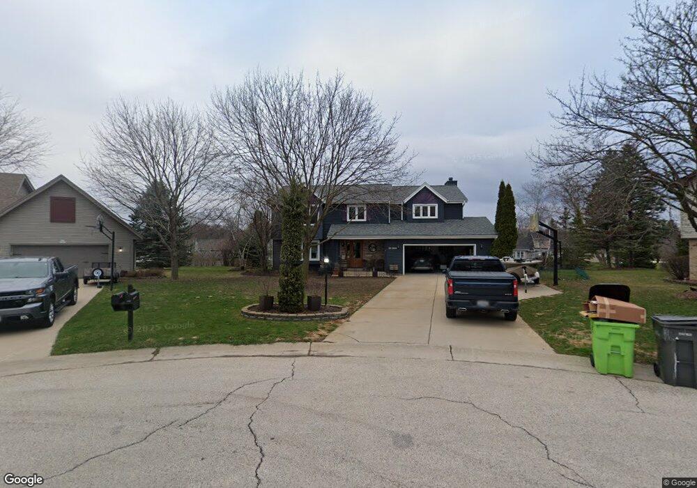
S67W14972 Koso Dr Muskego, WI 53150
Estimated Value: $532,474 - $635,000
4
Beds
3
Baths
2,102
Sq Ft
$284/Sq Ft
Est. Value
About This Home
This home is located at S67W14972 Koso Dr, Muskego, WI 53150 and is currently estimated at $597,619, approximately $284 per square foot. S67W14972 Koso Dr is a home located in Waukesha County with nearby schools including Bay Lane Elementary School, Lake Denoon Middle School, and Muskego High School.
Ownership History
Date
Name
Owned For
Owner Type
Purchase Details
Closed on
Apr 15, 2025
Sold by
Floryance Peter A and Floryance Cheryl L
Bought by
Peter A Floryance And Cheryl L Floryance Join and Floryance
Current Estimated Value
Purchase Details
Closed on
Apr 30, 1998
Sold by
Zender Daniel D and Zender Daria
Bought by
Floryance Peter A and Floryance Cheryl L
Home Financials for this Owner
Home Financials are based on the most recent Mortgage that was taken out on this home.
Original Mortgage
$159,900
Interest Rate
7.19%
Create a Home Valuation Report for This Property
The Home Valuation Report is an in-depth analysis detailing your home's value as well as a comparison with similar homes in the area
Home Values in the Area
Average Home Value in this Area
Purchase History
| Date | Buyer | Sale Price | Title Company |
|---|---|---|---|
| Peter A Floryance And Cheryl L Floryance Join | -- | None Listed On Document | |
| Floryance Peter A | $183,000 | -- |
Source: Public Records
Mortgage History
| Date | Status | Borrower | Loan Amount |
|---|---|---|---|
| Previous Owner | Floryance Peter A | $159,900 |
Source: Public Records
Tax History Compared to Growth
Tax History
| Year | Tax Paid | Tax Assessment Tax Assessment Total Assessment is a certain percentage of the fair market value that is determined by local assessors to be the total taxable value of land and additions on the property. | Land | Improvement |
|---|---|---|---|---|
| 2024 | $4,379 | $382,000 | $74,500 | $307,500 |
| 2023 | $4,326 | $382,000 | $74,500 | $307,500 |
| 2022 | $4,224 | $382,000 | $74,500 | $307,500 |
| 2021 | $4,188 | $382,000 | $74,500 | $307,500 |
| 2020 | $4,050 | $291,600 | $64,500 | $227,100 |
| 2019 | $4,019 | $291,600 | $64,500 | $227,100 |
| 2018 | $4,065 | $291,600 | $64,500 | $227,100 |
| 2017 | $4,055 | $291,600 | $64,500 | $227,100 |
| 2016 | $4,270 | $272,400 | $61,100 | $211,300 |
| 2015 | $4,310 | $272,400 | $61,100 | $211,300 |
| 2014 | $4,692 | $272,400 | $61,100 | $211,300 |
| 2013 | $4,692 | $272,400 | $61,100 | $211,300 |
Source: Public Records
Map
Nearby Homes
- S67W14570 Gaulke Ct
- S70W14845 Dartmouth Cir
- Lt8 Twin Silos Ct
- S66W16256 Chestnut Ridge Ct
- W162S7043 Olive Cir Unit 22
- Lt17 W Old Farm Rd
- S68W13611 Hale Park Cir
- Lt0 College Ave
- Lt1 College Ave
- S76W15088 Roger Dr
- N51W19119 Quietwood Dr
- W163S7358 Bay Lane Dr
- W145S7644 Durham Dr
- 6180 Preston Ln
- S63W13178 Windsor Rd
- Lt10 Norbert Ct
- W169S7219 Avon Ct
- 6060 S Conservancy Dr
- S75W16788 Jacob Ct Unit 12
- W170S7361 Parkland Dr Unit 13
- S67W14968 Koso Dr
- S67W14976 Koso Dr
- S67W15083 Golden Country Dr
- S67W15079 Golden Country Dr
- W151S6788 Golden Country Dr
- S67W14964 Koso Dr
- S67W14979 Koso Dr
- S67W14973 Golden Country Dr
- W151S6794 Golden Country Dr
- S67W14969 Golden Country Dr
- W149S6791 Golden Country Dr
- S68W15082 Koso Dr
- S68W15089 Koso Dr
- W149S6795 Golden Country Dr
- S67W15024 Golden Country Dr
- S67W15050 Golden Country Dr
- S67W14970 Golden Country Dr
- S68W15093 Koso Dr
- S67W14950 Golden Country Dr
- S67W15090 Golden Ct