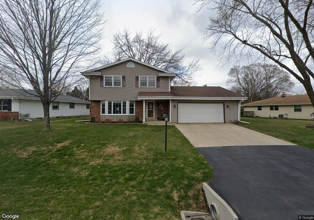
S68W13548 Bristlecone Ln Muskego, WI 53150
Estimated Value: $429,000 - $472,000
4
Beds
2
Baths
1,908
Sq Ft
$235/Sq Ft
Est. Value
About This Home
This home is located at S68W13548 Bristlecone Ln, Muskego, WI 53150 and is currently estimated at $447,520, approximately $234 per square foot. S68W13548 Bristlecone Ln is a home located in Waukesha County with nearby schools including Bay Lane Elementary School, Lake Denoon Middle School, and Creative and Performing Arts.
Ownership History
Date
Name
Owned For
Owner Type
Purchase Details
Closed on
Aug 7, 1997
Sold by
Peterson Dennis C and Peterson Cindy A
Bought by
Boyle Thomas J and Boyle Kathleen E
Current Estimated Value
Home Financials for this Owner
Home Financials are based on the most recent Mortgage that was taken out on this home.
Original Mortgage
$105,000
Outstanding Balance
$15,974
Interest Rate
7.71%
Estimated Equity
$431,546
Create a Home Valuation Report for This Property
The Home Valuation Report is an in-depth analysis detailing your home's value as well as a comparison with similar homes in the area
Home Values in the Area
Average Home Value in this Area
Purchase History
| Date | Buyer | Sale Price | Title Company |
|---|---|---|---|
| Boyle Thomas J | $145,000 | -- |
Source: Public Records
Mortgage History
| Date | Status | Borrower | Loan Amount |
|---|---|---|---|
| Open | Boyle Thomas J | $105,000 |
Source: Public Records
Tax History Compared to Growth
Tax History
| Year | Tax Paid | Tax Assessment Tax Assessment Total Assessment is a certain percentage of the fair market value that is determined by local assessors to be the total taxable value of land and additions on the property. | Land | Improvement |
|---|---|---|---|---|
| 2024 | $3,398 | $300,600 | $65,100 | $235,500 |
| 2023 | $3,350 | $300,600 | $65,100 | $235,500 |
| 2022 | $3,276 | $300,600 | $65,100 | $235,500 |
| 2021 | $3,244 | $300,600 | $65,100 | $235,500 |
| 2020 | $3,418 | $248,200 | $56,400 | $191,800 |
| 2019 | $3,387 | $248,200 | $56,400 | $191,800 |
| 2018 | $3,428 | $248,200 | $56,400 | $191,800 |
| 2017 | $3,425 | $248,200 | $56,400 | $191,800 |
| 2016 | $3,565 | $229,400 | $53,600 | $175,800 |
| 2015 | $3,602 | $229,400 | $53,600 | $175,800 |
| 2014 | $3,921 | $229,400 | $53,600 | $175,800 |
| 2013 | $3,921 | $229,400 | $53,600 | $175,800 |
Source: Public Records
Map
Nearby Homes
- S68W13586 Bristlecone Ln
- W137S6834 Dunstan Ct
- Lt8 Twin Silos Ct
- W140S6982 Twin Silos Ct
- 6180 Preston Ln
- S70W14872 Dartmouth Cir
- Lt17 W Old Farm Rd
- 13615 Kelton Ct
- W142S7571 Freedom Ave
- S73W15032 Cherrywood Dr
- W145S7644 Durham Dr
- W150S7586 Dorothy Dr
- Lt10 Norbert Ct
- S70W15770 Sandalwood Dr
- 13615 W Deer Park Dr
- 6575 S Carroll Cir
- 11931 W Janesville Rd
- 11532 W Tess Creek St
- 5622 S Fox Tail Ct
- 11470 W Tess Creek St
- S68W13554 Bristlecone Ln
- S69W13563 Bristlecone Ln
- S69W13551 Bristlecone Ln
- S68 W 13586 Bristlecone Ln
- 13586 W S68 Bristlecone Ln
- S69W13597 Bristlecone Ln
- S69W13525 Bristlecone Ln
- S68W13539 Hale Park Cir
- S69W13499 Bristlecone Ln
- S68W13612 Bristlecone Ln
- S68W13551 Hale Park Cir
- W135S6866 Hale Park Cir
- S68W13492 Bristlecone Ln
- S69W13617 Bristlecone Ln
- S69W13487 Bristlecone Ln
- S68W13476 Bristlecone Ln
- W136S6928 Hale Park Dr
- S68W13585 Hale Park Cir
- W136S6936 Hale Park Dr
- W135S6948 Hale Park Dr