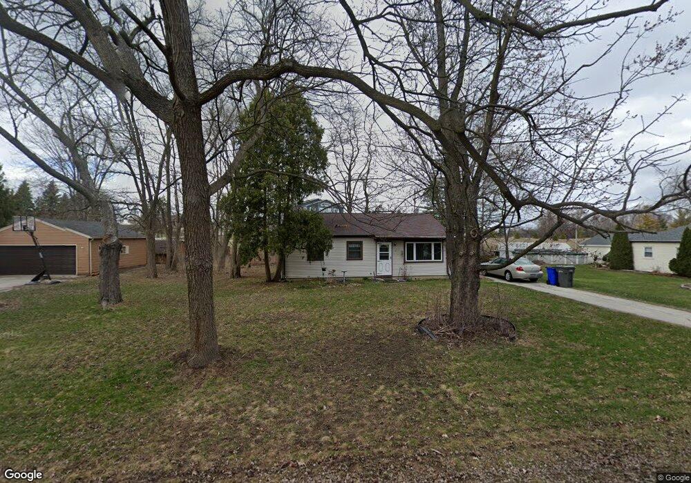
S69W14752 Cornell Dr Muskego, WI 53150
Estimated Value: $268,000 - $309,000
3
Beds
1
Bath
875
Sq Ft
$325/Sq Ft
Est. Value
About This Home
This home is located at S69W14752 Cornell Dr, Muskego, WI 53150 and is currently estimated at $284,502, approximately $325 per square foot. S69W14752 Cornell Dr is a home located in Waukesha County with nearby schools including Bay Lane Elementary School, Lake Denoon Middle School, and Muskego High School.
Ownership History
Date
Name
Owned For
Owner Type
Purchase Details
Closed on
Feb 1, 2021
Sold by
Spilka Eileen and Verburgt Debora
Bought by
Verburgt Debora and Ambacher Donna J
Current Estimated Value
Purchase Details
Closed on
Jul 16, 1996
Sold by
Paulson Antoinette
Bought by
Spilka Eileen and Verburgt Debora
Create a Home Valuation Report for This Property
The Home Valuation Report is an in-depth analysis detailing your home's value as well as a comparison with similar homes in the area
Home Values in the Area
Average Home Value in this Area
Purchase History
| Date | Buyer | Sale Price | Title Company |
|---|---|---|---|
| Verburgt Debora | $43,300 | None Available | |
| Spilka Eileen | $58,000 | -- |
Source: Public Records
Tax History Compared to Growth
Tax History
| Year | Tax Paid | Tax Assessment Tax Assessment Total Assessment is a certain percentage of the fair market value that is determined by local assessors to be the total taxable value of land and additions on the property. | Land | Improvement |
|---|---|---|---|---|
| 2024 | $1,993 | $169,800 | $70,000 | $99,800 |
| 2023 | $1,982 | $169,800 | $70,000 | $99,800 |
| 2022 | $1,926 | $169,800 | $70,000 | $99,800 |
| 2021 | $1,916 | $169,800 | $70,000 | $99,800 |
| 2020 | $1,864 | $131,900 | $60,800 | $71,100 |
| 2019 | $1,861 | $131,900 | $60,800 | $71,100 |
| 2018 | $1,874 | $131,900 | $60,800 | $71,100 |
| 2017 | $1,850 | $131,900 | $60,800 | $71,100 |
| 2016 | $1,948 | $123,000 | $57,700 | $65,300 |
| 2015 | $1,958 | $123,000 | $57,700 | $65,300 |
| 2014 | $2,134 | $123,000 | $57,700 | $65,300 |
| 2013 | $2,134 | $123,000 | $57,700 | $65,300 |
Source: Public Records
Map
Nearby Homes
- S70W14872 Dartmouth Cir
- S70W14845 Dartmouth Cir
- S67W14570 Gaulke Ct
- Lt8 Twin Silos Ct
- S68W13611 Hale Park Cir
- W145S7644 Durham Dr
- Lt17 W Old Farm Rd
- W162S7043 Olive Cir Unit 22
- S66W16256 Chestnut Ridge Ct
- N51W19119 Quietwood Dr
- W163S7358 Bay Lane Dr
- S63W13178 Windsor Rd
- 6180 Preston Ln
- Lt0 College Ave
- Lt1 College Ave
- 6060 S Conservancy Dr
- S63W12878 Emerson Dr
- Lt10 Norbert Ct
- W169S7219 Avon Ct
- S75W16788 Jacob Ct Unit 12
- S69W14724 Cornell Dr
- S69W14780 Cornell Dr
- W147S6942 Durham Place
- S69W14690 Cornell Dr
- S69W14827 Cornell Cir
- S69W14825 Cornell Cir
- W146S6943 Catalina Dr
- W147S6960 Durham Place
- S69W14820 Cornell Cir
- S69W14843 Cornell Cir
- S69W14841 Cornell Cir
- S69W14842 Cornell Cir
- S69W14654 Cornell Dr
- W146S6957 Catalina Dr
- S69W14840 Cornell Cir
- S69W14830 Dartmouth Cir
- S69W14871 Cornell Cir
- S69W14869 Cornell Cir
- W147S6984 Durham Place
- W146S6971 Catalina Dr