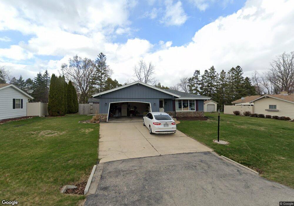
S69W14830 Dartmouth Cir Muskego, WI 53150
Estimated Value: $382,000 - $444,624
3
Beds
2
Baths
1,380
Sq Ft
$300/Sq Ft
Est. Value
About This Home
This home is located at S69W14830 Dartmouth Cir, Muskego, WI 53150 and is currently estimated at $414,406, approximately $300 per square foot. S69W14830 Dartmouth Cir is a home located in Waukesha County with nearby schools including Bay Lane Elementary School, Lake Denoon Middle School, and Muskego High School.
Ownership History
Date
Name
Owned For
Owner Type
Purchase Details
Closed on
Nov 28, 2017
Sold by
Brown Genevieve G
Bought by
Feurt Denise K
Current Estimated Value
Home Financials for this Owner
Home Financials are based on the most recent Mortgage that was taken out on this home.
Original Mortgage
$213,573
Outstanding Balance
$177,724
Interest Rate
3.5%
Mortgage Type
FHA
Estimated Equity
$236,682
Create a Home Valuation Report for This Property
The Home Valuation Report is an in-depth analysis detailing your home's value as well as a comparison with similar homes in the area
Home Values in the Area
Average Home Value in this Area
Purchase History
| Date | Buyer | Sale Price | Title Company |
|---|---|---|---|
| Feurt Denise K | $224,900 | None Available |
Source: Public Records
Mortgage History
| Date | Status | Borrower | Loan Amount |
|---|---|---|---|
| Open | Feurt Denise K | $213,573 |
Source: Public Records
Tax History Compared to Growth
Tax History
| Year | Tax Paid | Tax Assessment Tax Assessment Total Assessment is a certain percentage of the fair market value that is determined by local assessors to be the total taxable value of land and additions on the property. | Land | Improvement |
|---|---|---|---|---|
| 2024 | $3,202 | $284,300 | $58,800 | $225,500 |
| 2023 | $3,155 | $284,300 | $58,800 | $225,500 |
| 2022 | $3,086 | $284,300 | $58,800 | $225,500 |
| 2021 | $3,055 | $284,300 | $58,800 | $225,500 |
| 2020 | $4,357 | $216,600 | $51,400 | $165,200 |
| 2019 | $2,926 | $216,600 | $51,400 | $165,200 |
| 2018 | $2,963 | $216,600 | $51,400 | $165,200 |
| 2017 | $2,967 | $216,600 | $51,400 | $165,200 |
| 2016 | $2,958 | $192,400 | $48,700 | $143,700 |
| 2015 | $2,992 | $192,400 | $48,700 | $143,700 |
| 2014 | $3,257 | $192,400 | $48,700 | $143,700 |
| 2013 | $3,257 | $192,400 | $48,700 | $143,700 |
Source: Public Records
Map
Nearby Homes
- S70W14845 Dartmouth Cir
- S67W14570 Gaulke Ct
- Lt8 Twin Silos Ct
- S68W13611 Hale Park Cir
- S76W15088 Roger Dr
- W145S7644 Durham Dr
- W162S7043 Olive Cir Unit 22
- S66W16256 Chestnut Ridge Ct
- N51W19119 Quietwood Dr
- Lt17 W Old Farm Rd
- W163S7358 Bay Lane Dr
- Lt0 College Ave
- Lt1 College Ave
- S63W13178 Windsor Rd
- 6180 Preston Ln
- W169S7219 Avon Ct
- S75W16788 Jacob Ct Unit 12
- 6060 S Conservancy Dr
- Lt10 Norbert Ct
- S63W12878 Emerson Dr
- S69W14862 Dartmouth Cir
- S69W14849 Dartmouth Cir
- S69W14833 Dartmouth Cir
- S69W14875 Dartmouth Cir
- S69W14892 Dartmouth Cir
- S69W14895 Dartmouth Cir
- S69W14843 Cornell Cir
- W147S6960 Durham Place
- W147S6942 Durham Place
- S69W14827 Cornell Cir
- S69W14841 Cornell Cir
- S69W14871 Cornell Cir
- W148S6991 Durham Place
- S69W14825 Cornell Cir
- S69W14869 Cornell Cir
- S69W14934 Dartmouth Cir
- S69W14893 Cornell Cir
- W147S6984 Durham Place
- S69W14929 Dartmouth Cir
- S69W14780 Cornell Dr