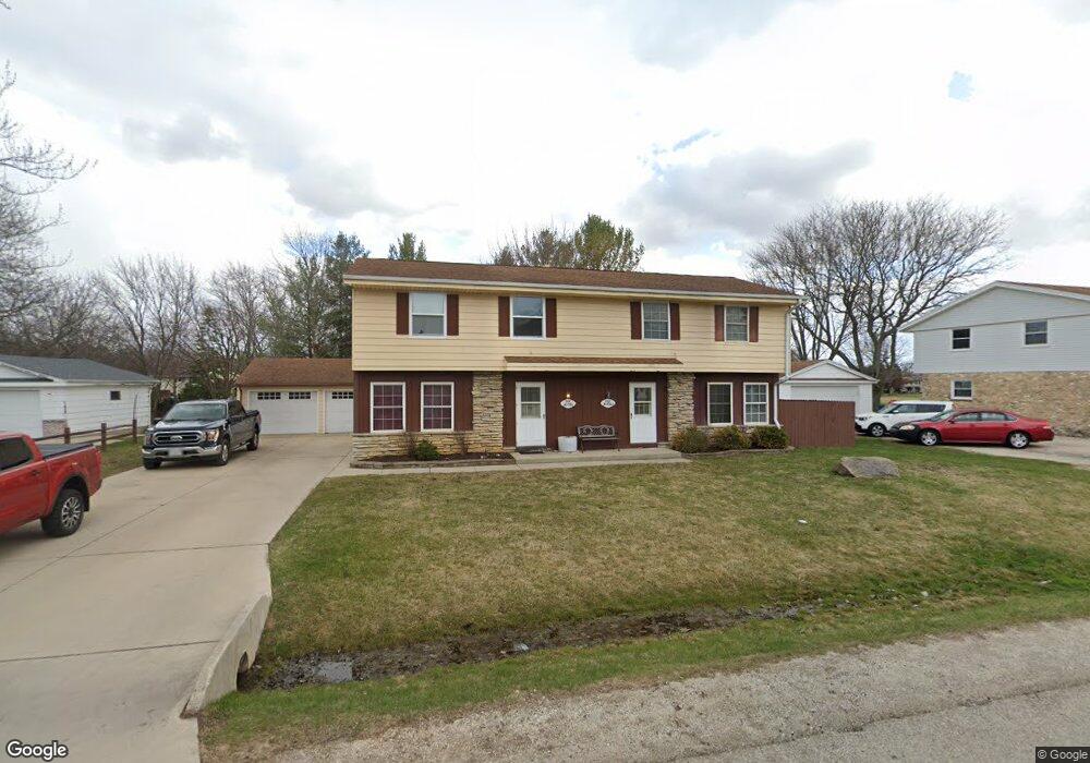
S69W14981 Cornell Cir Muskego, WI 53150
Estimated Value: $400,000 - $493,000
--
Bed
4
Baths
2,238
Sq Ft
$197/Sq Ft
Est. Value
About This Home
This home is located at S69W14981 Cornell Cir, Muskego, WI 53150 and is currently estimated at $441,370, approximately $197 per square foot. S69W14981 Cornell Cir is a home located in Waukesha County with nearby schools including Bay Lane Elementary School, Lake Denoon Middle School, and Muskego High School.
Ownership History
Date
Name
Owned For
Owner Type
Purchase Details
Closed on
May 15, 2015
Sold by
Pierzchala Kevin M
Bought by
Pierzchala Properties Llc
Current Estimated Value
Purchase Details
Closed on
Jun 11, 2002
Sold by
Balson Wade T and Balson Gail L
Bought by
Pierzchala Kevin M
Home Financials for this Owner
Home Financials are based on the most recent Mortgage that was taken out on this home.
Original Mortgage
$162,000
Outstanding Balance
$68,981
Interest Rate
6.91%
Estimated Equity
$372,389
Purchase Details
Closed on
Jan 19, 1998
Sold by
Nelson Tim E and Nelson Susan M
Bought by
Balson Wade T and Balson Gail L
Home Financials for this Owner
Home Financials are based on the most recent Mortgage that was taken out on this home.
Original Mortgage
$153,000
Interest Rate
7.25%
Create a Home Valuation Report for This Property
The Home Valuation Report is an in-depth analysis detailing your home's value as well as a comparison with similar homes in the area
Home Values in the Area
Average Home Value in this Area
Purchase History
| Date | Buyer | Sale Price | Title Company |
|---|---|---|---|
| Pierzchala Properties Llc | -- | None Available | |
| Pierzchala Kevin M | $202,500 | -- | |
| Balson Wade T | $170,000 | -- |
Source: Public Records
Mortgage History
| Date | Status | Borrower | Loan Amount |
|---|---|---|---|
| Open | Pierzchala Kevin M | $162,000 | |
| Previous Owner | Balson Wade T | $153,000 |
Source: Public Records
Tax History Compared to Growth
Tax History
| Year | Tax Paid | Tax Assessment Tax Assessment Total Assessment is a certain percentage of the fair market value that is determined by local assessors to be the total taxable value of land and additions on the property. | Land | Improvement |
|---|---|---|---|---|
| 2024 | $3,259 | $274,900 | $58,800 | $216,100 |
| 2023 | $3,242 | $274,900 | $58,800 | $216,100 |
| 2022 | $3,151 | $274,900 | $58,800 | $216,100 |
| 2021 | $3,136 | $274,900 | $58,800 | $216,100 |
| 2020 | $3,336 | $232,900 | $51,400 | $181,500 |
| 2019 | $3,333 | $232,900 | $51,400 | $181,500 |
| 2018 | $3,358 | $232,900 | $51,400 | $181,500 |
| 2017 | $3,316 | $232,900 | $51,400 | $181,500 |
| 2016 | $3,312 | $206,200 | $48,700 | $157,500 |
| 2015 | $3,328 | $206,200 | $48,700 | $157,500 |
| 2014 | -- | $206,200 | $48,700 | $157,500 |
| 2013 | -- | $206,200 | $48,700 | $157,500 |
Source: Public Records
Map
Nearby Homes
- S70W14845 Dartmouth Cir
- S67W14570 Gaulke Ct
- Lt8 Twin Silos Ct
- W162S7043 Olive Cir Unit 22
- S66W16256 Chestnut Ridge Ct
- S68W13611 Hale Park Cir
- W145S7644 Durham Dr
- N51W19119 Quietwood Dr
- Lt17 W Old Farm Rd
- W163S7358 Bay Lane Dr
- Lt0 College Ave
- Lt1 College Ave
- 6180 Preston Ln
- W169S7219 Avon Ct
- S63W13178 Windsor Rd
- S75W16788 Jacob Ct Unit 12
- W170S7361 Parkland Dr Unit 13
- Lt10 Norbert Ct
- 6060 S Conservancy Dr
- W171S7452 Lannon Dr
- S69W15011 Cornell Cir
- S69W14961 Cornell Cir
- S69W15010 Cornell Cir
- S69W15012 Cornell Cir
- S69W15040 Cornell Cir
- S69W15033 Cornell Cir
- S69W15031 Cornell Cir
- S69W14984 Cornell Cir
- S69W15042 Cornell Cir
- S69W14921 Cornell Cir
- S69W14923 Cornell Cir
- S69W14960 Cornell Cir
- S69W15060 Cornell Cir
- S69W15062 Cornell Cir
- S69W14891 Cornell Cir
- S69W14934 Dartmouth Cir
- S69W14893 Cornell Cir
- S69W14920 Cornell Cir
- S69W14962 Dartmouth Cir
- S69W14922 Cornell Cir