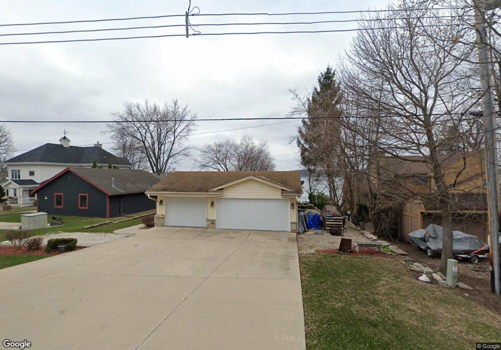
S70W17697 Muskego Dr Muskego, WI 53150
Estimated Value: $580,000 - $857,000
3
Beds
2
Baths
1,444
Sq Ft
$504/Sq Ft
Est. Value
About This Home
This home is located at S70W17697 Muskego Dr, Muskego, WI 53150 and is currently estimated at $727,520, approximately $503 per square foot. S70W17697 Muskego Dr is a home located in Waukesha County with nearby schools including Muskego Lakes Middle School, Muskego High School, and St. Leonard School.
Ownership History
Date
Name
Owned For
Owner Type
Purchase Details
Closed on
Feb 22, 2016
Sold by
Root Thomas A and Root Jean
Bought by
Root Jean M
Current Estimated Value
Purchase Details
Closed on
Dec 17, 2004
Sold by
Stoll Robert A and Stoll David M
Bought by
Root Thomas A and Root Jean M
Home Financials for this Owner
Home Financials are based on the most recent Mortgage that was taken out on this home.
Original Mortgage
$200,000
Interest Rate
5.77%
Mortgage Type
Purchase Money Mortgage
Purchase Details
Closed on
Mar 20, 2002
Sold by
Krawczyk Gary J and Stoll Robert A
Bought by
Stoll Robert A and Stoll David M
Create a Home Valuation Report for This Property
The Home Valuation Report is an in-depth analysis detailing your home's value as well as a comparison with similar homes in the area
Home Values in the Area
Average Home Value in this Area
Purchase History
| Date | Buyer | Sale Price | Title Company |
|---|---|---|---|
| Root Jean M | -- | None Available | |
| Root Thomas A | $415,000 | -- | |
| Stoll Robert A | -- | -- |
Source: Public Records
Mortgage History
| Date | Status | Borrower | Loan Amount |
|---|---|---|---|
| Closed | Root Thomas A | $200,000 |
Source: Public Records
Tax History Compared to Growth
Tax History
| Year | Tax Paid | Tax Assessment Tax Assessment Total Assessment is a certain percentage of the fair market value that is determined by local assessors to be the total taxable value of land and additions on the property. | Land | Improvement |
|---|---|---|---|---|
| 2024 | $6,264 | $499,000 | $248,600 | $250,400 |
| 2023 | $6,204 | $499,000 | $248,600 | $250,400 |
| 2022 | $6,063 | $499,000 | $248,600 | $250,400 |
| 2021 | $6,021 | $499,000 | $248,600 | $250,400 |
| 2020 | $6,184 | $412,300 | $217,400 | $194,900 |
| 2019 | $5,778 | $412,300 | $217,400 | $194,900 |
| 2018 | $5,838 | $412,300 | $217,400 | $194,900 |
| 2017 | $5,807 | $412,300 | $217,400 | $194,900 |
| 2016 | $6,365 | $400,200 | $210,200 | $190,000 |
| 2015 | $6,414 | $400,200 | $210,200 | $190,000 |
| 2014 | $6,983 | $400,200 | $210,200 | $190,000 |
| 2013 | $6,983 | $400,200 | $210,200 | $190,000 |
Source: Public Records
Map
Nearby Homes
- W171S7452 Lannon Dr
- W170S7361 Parkland Dr Unit 13
- Lt4 Lannon Dr
- S73W16773 Briargate Ln
- W183S6558 Jewel Crest Dr
- S75W16788 Jacob Ct Unit 12
- S75W16775 Jacob Ct Unit 24
- S70W19133 Kenwood Dr
- Brookhaven Plan at Kirkland Crossing
- The Sycamore Plan at Kirkland Crossing
- The Maple Plan at Kirkland Crossing
- Essex Plan at Kirkland Crossing
- Harlow Plan at Kirkland Crossing
- The Lavender Plan at Kirkland Crossing
- The Savannah Plan at Kirkland Crossing
- Danbury Plan at Kirkland Crossing
- Hawthorne Plan at Kirkland Crossing
- The Clare Plan at Kirkland Crossing
- The Kendall Plan at Kirkland Crossing
- Waterford Plan at Kirkland Crossing
- S70W17683 Muskego Dr
- S70W17711 Muskego Dr
- S70W17671 Muskego Dr
- S70W17725 Muskego Dr
- S70W17682 Muskego Dr
- S70W17668 Muskego Dr
- S70W17702 Muskego Dr
- S70W17739 Muskego Dr
- S70W17655 Muskego Dr
- S70W17716 Muskego Dr
- S71W17665 Lake Dr
- S70W17635 Muskego Dr
- S70W17624 Muskego Dr
- S70W17669 Wildwood Dr
- S70W17734 Muskego Dr
- W176S7045 Hiawatha Dr
- S70W17653 Wildwood Dr
- S71W17659 Lake Dr
- W176S7068 Hiawatha Dr
- S70W17764 Muskego Dr