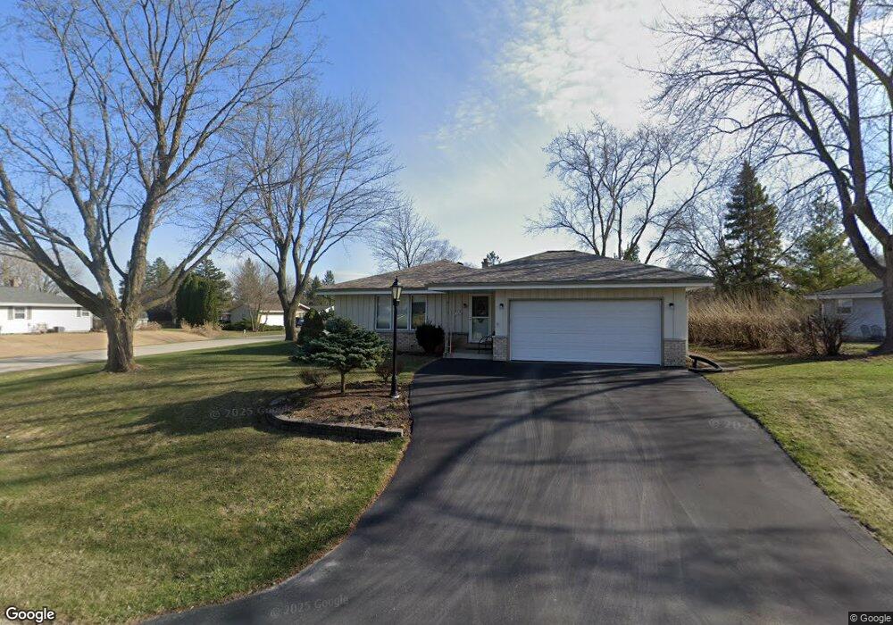
S71W16853 Foxcroft Ct Muskego, WI 53150
Estimated Value: $342,000 - $410,432
3
Beds
2
Baths
1,222
Sq Ft
$312/Sq Ft
Est. Value
About This Home
This home is located at S71W16853 Foxcroft Ct, Muskego, WI 53150 and is currently estimated at $381,608, approximately $312 per square foot. S71W16853 Foxcroft Ct is a home located in Waukesha County with nearby schools including Muskego Lakes Middle School, Muskego High School, and St. Leonard School.
Ownership History
Date
Name
Owned For
Owner Type
Purchase Details
Closed on
Oct 31, 2007
Sold by
Schwanke Jean L
Bought by
Price Randall L
Current Estimated Value
Home Financials for this Owner
Home Financials are based on the most recent Mortgage that was taken out on this home.
Original Mortgage
$138,400
Outstanding Balance
$87,838
Interest Rate
6.44%
Mortgage Type
Purchase Money Mortgage
Estimated Equity
$293,770
Create a Home Valuation Report for This Property
The Home Valuation Report is an in-depth analysis detailing your home's value as well as a comparison with similar homes in the area
Home Values in the Area
Average Home Value in this Area
Purchase History
| Date | Buyer | Sale Price | Title Company |
|---|---|---|---|
| Price Randall L | $173,000 | None Available |
Source: Public Records
Mortgage History
| Date | Status | Borrower | Loan Amount |
|---|---|---|---|
| Open | Price Randall L | $138,400 |
Source: Public Records
Tax History Compared to Growth
Tax History
| Year | Tax Paid | Tax Assessment Tax Assessment Total Assessment is a certain percentage of the fair market value that is determined by local assessors to be the total taxable value of land and additions on the property. | Land | Improvement |
|---|---|---|---|---|
| 2024 | $2,843 | $254,500 | $62,200 | $192,300 |
| 2023 | $2,797 | $254,500 | $62,200 | $192,300 |
| 2022 | $2,738 | $254,500 | $62,200 | $192,300 |
| 2021 | $2,709 | $254,500 | $62,200 | $192,300 |
| 2020 | $2,874 | $210,900 | $54,400 | $156,500 |
| 2019 | $2,843 | $210,900 | $54,400 | $156,500 |
| 2018 | $2,880 | $210,900 | $54,400 | $156,500 |
| 2017 | $2,884 | $210,900 | $54,400 | $156,500 |
| 2016 | $2,917 | $189,900 | $51,800 | $138,100 |
| 2015 | $2,951 | $189,900 | $51,800 | $138,100 |
| 2014 | $3,212 | $189,900 | $51,800 | $138,100 |
| 2013 | $3,212 | $189,900 | $51,800 | $138,100 |
Source: Public Records
Map
Nearby Homes
- S73W16773 Briargate Ln
- W170S7361 Parkland Dr Unit 13
- W162S7043 Olive Cir Unit 22
- W163S7358 Bay Lane Dr
- W171S7452 Lannon Dr
- S73W17268 Lake Dr
- S75W16788 Jacob Ct Unit 12
- Lt4 Lannon Dr
- S70W15770 Sandalwood Dr
- S66W16256 Chestnut Ridge Ct
- N51W19119 Quietwood Dr
- W177S7495 Harbor Cir Unit 6D
- Lt0 College Ave
- Brookhaven Plan at Kirkland Crossing
- The Sycamore Plan at Kirkland Crossing
- The Maple Plan at Kirkland Crossing
- Essex Plan at Kirkland Crossing
- Harlow Plan at Kirkland Crossing
- The Lavender Plan at Kirkland Crossing
- The Savannah Plan at Kirkland Crossing
- S71W16881 Foxcroft Ct
- W168S7167 Parkland Dr
- S71W16801 Lynoak Ct
- S71W16903 Foxcroft Ct
- S71W16870 Foxcroft Ct
- S71W16816 Lynoak Ct
- S71W16892 Foxcroft Ct
- S71W16775 Lynoak Ct
- W168S7186 Parkland Dr
- S71W16894 Avon Ct
- S71W16790 Lynoak Ct
- S71W16908 Foxcroft Ct
- S71W16872 Avon Ct
- S71W16935 Foxcroft Ct
- W168S7098 Parkland Dr
- W168S7190 Parkland Dr
- S71W16760 Lynoak Ct
- S71W16763 Lynoak Ct
- W168S7084 Parkland Dr
- S71W16910 Avon Ct