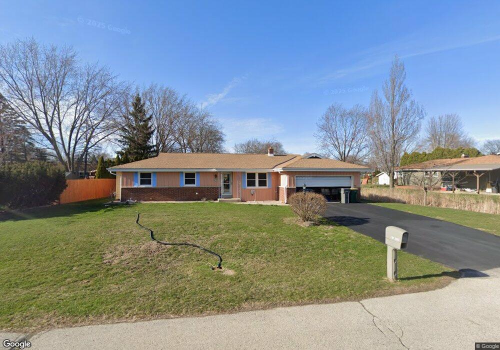
S73W16834 Briargate Ln Muskego, WI 53150
Estimated Value: $407,000 - $437,000
3
Beds
2
Baths
1,325
Sq Ft
$315/Sq Ft
Est. Value
About This Home
This home is located at S73W16834 Briargate Ln, Muskego, WI 53150 and is currently estimated at $417,976, approximately $315 per square foot. S73W16834 Briargate Ln is a home located in Waukesha County with nearby schools including Muskego Lakes Middle School, Muskego High School, and St. Leonard School.
Ownership History
Date
Name
Owned For
Owner Type
Purchase Details
Closed on
Oct 22, 2019
Sold by
Dangers Anne
Bought by
Lauder Daniel
Current Estimated Value
Purchase Details
Closed on
Jun 13, 2007
Sold by
Bowen Rickie G and Bowen Betsy H
Bought by
Dangers Anne
Home Financials for this Owner
Home Financials are based on the most recent Mortgage that was taken out on this home.
Original Mortgage
$223,500
Interest Rate
6.37%
Mortgage Type
Purchase Money Mortgage
Create a Home Valuation Report for This Property
The Home Valuation Report is an in-depth analysis detailing your home's value as well as a comparison with similar homes in the area
Home Values in the Area
Average Home Value in this Area
Purchase History
| Date | Buyer | Sale Price | Title Company |
|---|---|---|---|
| Lauder Daniel | $254,000 | None Available | |
| Dangers Anne | $223,500 | None Available |
Source: Public Records
Mortgage History
| Date | Status | Borrower | Loan Amount |
|---|---|---|---|
| Previous Owner | Dangers Anne | $223,500 |
Source: Public Records
Tax History Compared to Growth
Tax History
| Year | Tax Paid | Tax Assessment Tax Assessment Total Assessment is a certain percentage of the fair market value that is determined by local assessors to be the total taxable value of land and additions on the property. | Land | Improvement |
|---|---|---|---|---|
| 2024 | $3,103 | $276,100 | $61,000 | $215,100 |
| 2023 | $3,056 | $276,100 | $61,000 | $215,100 |
| 2022 | $2,990 | $276,100 | $61,000 | $215,100 |
| 2021 | $2,960 | $276,100 | $61,000 | $215,100 |
| 2020 | $2,844 | $208,800 | $53,400 | $155,400 |
| 2019 | $2,813 | $208,800 | $53,400 | $155,400 |
| 2018 | $2,849 | $208,800 | $53,400 | $155,400 |
| 2017 | $3,408 | $208,800 | $53,400 | $155,400 |
| 2016 | $2,860 | $186,400 | $50,900 | $135,500 |
| 2015 | $2,894 | $186,400 | $50,900 | $135,500 |
| 2014 | $3,150 | $186,400 | $50,900 | $135,500 |
| 2013 | $3,150 | $186,400 | $50,900 | $135,500 |
Source: Public Records
Map
Nearby Homes
- W170S7361 Parkland Dr Unit 13
- W171S7452 Lannon Dr
- S75W16788 Jacob Ct Unit 12
- S73W17268 Lake Dr
- W163S7358 Bay Lane Dr
- Lt4 Lannon Dr
- W162S7043 Olive Cir Unit 22
- W177S7495 Harbor Cir Unit 6D
- N51W19119 Quietwood Dr
- S66W16256 Chestnut Ridge Ct
- Lt0 College Ave
- Brookhaven Plan at Kirkland Crossing
- The Sycamore Plan at Kirkland Crossing
- The Maple Plan at Kirkland Crossing
- Essex Plan at Kirkland Crossing
- Harlow Plan at Kirkland Crossing
- The Lavender Plan at Kirkland Crossing
- The Savannah Plan at Kirkland Crossing
- Danbury Plan at Kirkland Crossing
- Hawthorne Plan at Kirkland Crossing
- S73W16802 Briargate Ln
- W168S7284 Parkland Dr
- S73W16825 Briargate Ln
- S73W16849 Briargate Ln
- W167S7293 Briargate Ln
- S73W16878 Briargate Ln
- S73W16873 Briargate Ln
- S73W16797 Briargate Ln
- W167S7277 Briargate Ln
- S73W16899 Briargate Ln
- W168S7278 Parkland Dr
- W168S7262 Parkland Dr
- W169S7299 Parkland Dr
- W167S7265 Briargate Ln
- S72W16942 Briargate Ln
- W167S7294 Briargate Ln
- W169S7275 Parkland Dr
- W169S7338 Parkland Dr
- W169S7255 Parkland Dr
- W167S7284 Briargate Ln