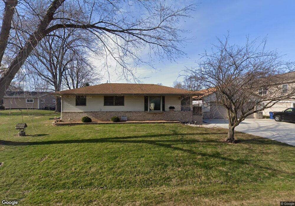
S74W17380 Richard Ln Muskego, WI 53150
Estimated Value: $403,748 - $463,000
3
Beds
2
Baths
1,025
Sq Ft
$428/Sq Ft
Est. Value
About This Home
This home is located at S74W17380 Richard Ln, Muskego, WI 53150 and is currently estimated at $438,937, approximately $428 per square foot. S74W17380 Richard Ln is a home located in Waukesha County with nearby schools including Muskego Lakes Middle School, Muskego High School, and St. Leonard School.
Ownership History
Date
Name
Owned For
Owner Type
Purchase Details
Closed on
Aug 29, 1997
Sold by
Coubal Charlotte and Klimek Janet
Bought by
Coubal Jeffrey L and Coubal Lori A
Current Estimated Value
Home Financials for this Owner
Home Financials are based on the most recent Mortgage that was taken out on this home.
Original Mortgage
$99,750
Outstanding Balance
$15,418
Interest Rate
7.44%
Estimated Equity
$423,519
Create a Home Valuation Report for This Property
The Home Valuation Report is an in-depth analysis detailing your home's value as well as a comparison with similar homes in the area
Home Values in the Area
Average Home Value in this Area
Purchase History
| Date | Buyer | Sale Price | Title Company |
|---|---|---|---|
| Coubal Jeffrey L | $105,000 | -- |
Source: Public Records
Mortgage History
| Date | Status | Borrower | Loan Amount |
|---|---|---|---|
| Open | Coubal Jeffrey L | $99,750 |
Source: Public Records
Tax History Compared to Growth
Tax History
| Year | Tax Paid | Tax Assessment Tax Assessment Total Assessment is a certain percentage of the fair market value that is determined by local assessors to be the total taxable value of land and additions on the property. | Land | Improvement |
|---|---|---|---|---|
| 2024 | $3,233 | $279,000 | $65,400 | $213,600 |
| 2023 | $3,186 | $279,000 | $65,400 | $213,600 |
| 2022 | $3,119 | $279,000 | $65,400 | $213,600 |
| 2021 | $3,089 | $279,000 | $65,400 | $213,600 |
| 2020 | $3,417 | $243,000 | $57,000 | $186,000 |
| 2019 | $3,311 | $243,000 | $57,000 | $186,000 |
| 2018 | $3,311 | $234,500 | $57,000 | $177,500 |
| 2017 | $3,134 | $228,100 | $57,000 | $171,100 |
| 2016 | $3,020 | $196,200 | $54,200 | $142,000 |
| 2015 | $3,030 | $194,700 | $54,200 | $140,500 |
| 2014 | $3,298 | $194,700 | $54,200 | $140,500 |
| 2013 | $3,298 | $194,700 | $54,200 | $140,500 |
Source: Public Records
Map
Nearby Homes
- S73W17268 Lake Dr
- W171S7452 Lannon Dr
- Lt4 Lannon Dr
- W170S7361 Parkland Dr Unit 13
- S75W16788 Jacob Ct Unit 12
- S73W16773 Briargate Ln
- W163S7358 Bay Lane Dr
- W162S7043 Olive Cir Unit 22
- N51W19119 Quietwood Dr
- W188S7598 Oak Grove Dr
- S70W15770 Sandalwood Dr
- W179S8246 Pioneer Dr
- S66W16256 Chestnut Ridge Ct
- S70W19133 Kenwood Dr
- Lt0 College Ave
- W183S6558 Jewel Crest Dr
- S77W19351 Lakewood Dr Unit 31
- Brookhaven Plan at Kirkland Crossing
- The Sycamore Plan at Kirkland Crossing
- The Maple Plan at Kirkland Crossing
- S74W17381 Richard Ln
- S74W17360 Richard Ln
- S74W17405 Lake Dr
- S74W17365 Richard Ln
- S74W17407 Richard Ln
- S74W17408 Lake Dr
- S74W17426 Lake Dr
- W174S7482 Michi Dr
- S74W17382 Lake Dr
- S74W17398 Lake Dr
- W172S7441 Center Dr
- W172S7455 Center Dr
- W172S7433 Center Dr
- W172S7463 Center Dr
- S74W17364 Lake Dr
- W173S7488 Michi Dr
- W172S7473 Center Dr
- S74W17476 Lake Dr
- S74W17330 Lake Dr
- W172S7421 Center Dr