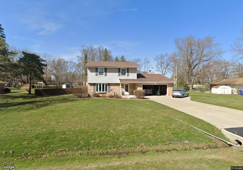
S76W14902 Roger Dr Muskego, WI 53150
Estimated Value: $496,000 - $540,000
4
Beds
3
Baths
1,968
Sq Ft
$260/Sq Ft
Est. Value
About This Home
This home is located at S76W14902 Roger Dr, Muskego, WI 53150 and is currently estimated at $512,514, approximately $260 per square foot. S76W14902 Roger Dr is a home located in Waukesha County with nearby schools including Bay Lane Elementary School, Lake Denoon Middle School, and Muskego High School.
Ownership History
Date
Name
Owned For
Owner Type
Purchase Details
Closed on
Oct 18, 2004
Sold by
Schmidt Jacqueline A
Bought by
Schmidt John P and Schmidt Jacqueline A
Current Estimated Value
Home Financials for this Owner
Home Financials are based on the most recent Mortgage that was taken out on this home.
Original Mortgage
$176,000
Outstanding Balance
$87,631
Interest Rate
5.85%
Mortgage Type
New Conventional
Estimated Equity
$424,883
Purchase Details
Closed on
Nov 21, 2001
Sold by
Schmidt Jacqueline A
Bought by
Schmidt John P and Schmidt Jacqueline A
Home Financials for this Owner
Home Financials are based on the most recent Mortgage that was taken out on this home.
Original Mortgage
$174,500
Interest Rate
7.07%
Purchase Details
Closed on
Oct 29, 1999
Sold by
Jeziorski Jeffrey S and Jeziorski Elizabeth C
Bought by
Schmidt Jacqueline A
Home Financials for this Owner
Home Financials are based on the most recent Mortgage that was taken out on this home.
Original Mortgage
$156,750
Interest Rate
7.88%
Create a Home Valuation Report for This Property
The Home Valuation Report is an in-depth analysis detailing your home's value as well as a comparison with similar homes in the area
Home Values in the Area
Average Home Value in this Area
Purchase History
| Date | Buyer | Sale Price | Title Company |
|---|---|---|---|
| Schmidt John P | -- | -- | |
| Schmidt John P | -- | -- | |
| Schmidt Jacqueline A | $165,000 | -- |
Source: Public Records
Mortgage History
| Date | Status | Borrower | Loan Amount |
|---|---|---|---|
| Open | Schmidt John P | $176,000 | |
| Closed | Schmidt John P | $174,500 | |
| Closed | Schmidt Jacqueline A | $156,750 |
Source: Public Records
Tax History Compared to Growth
Tax History
| Year | Tax Paid | Tax Assessment Tax Assessment Total Assessment is a certain percentage of the fair market value that is determined by local assessors to be the total taxable value of land and additions on the property. | Land | Improvement |
|---|---|---|---|---|
| 2024 | $3,732 | $328,300 | $66,300 | $262,000 |
| 2023 | $3,682 | $328,300 | $66,300 | $262,000 |
| 2022 | $3,598 | $328,300 | $66,300 | $262,000 |
| 2021 | $3,565 | $328,300 | $66,300 | $262,000 |
| 2020 | $3,683 | $266,400 | $58,000 | $208,400 |
| 2019 | $3,652 | $266,400 | $58,000 | $208,400 |
| 2018 | $3,695 | $266,400 | $58,000 | $208,400 |
| 2017 | $3,690 | $266,400 | $58,000 | $208,400 |
| 2016 | $3,442 | $221,900 | $55,500 | $166,400 |
| 2015 | $3,478 | $221,900 | $55,500 | $166,400 |
| 2014 | $3,786 | $221,900 | $55,500 | $166,400 |
| 2013 | $3,786 | $221,900 | $55,500 | $166,400 |
Source: Public Records
Map
Nearby Homes
- W145S7644 Durham Dr
- N51W19119 Quietwood Dr
- S70W14845 Dartmouth Cir
- S70W14872 Dartmouth Cir
- W163S7358 Bay Lane Dr
- Lt8 Twin Silos Ct
- W162S7043 Olive Cir Unit 22
- S67W14570 Gaulke Ct
- S75W16788 Jacob Ct Unit 12
- S78W16730 Spinnaker Dr
- S68W13611 Hale Park Cir
- W170S7361 Parkland Dr Unit 13
- W169S7219 Avon Ct
- S76W12788 Cambridge Ct E
- S76W12739 Cambridge Ct E
- W171S7452 Lannon Dr
- S66W16256 Chestnut Ridge Ct
- Lt4 Lannon Dr
- S73W17268 Lake Dr
- Lt0 College Ave
- S75W14826 Kathryn Dr
- S76W14942 Roger Dr
- S76W14923 Roger Dr
- S76W14895 Roger Dr
- S75W14869 Kathryn Dr
- S75W14901 Kathryn Dr
- S76W14851 Roger Dr
- W149S7594 Dorothy Dr
- S76W14979 Roger Dr
- S76W14821 Roger Dr
- W150S7586 Dorothy Dr
- S75W14850 Kathryn Ct
- S76W14938 Velva Dr
- S76W14774 Roger Dr
- S75W14882 Kathryn Dr
- S76W14888 Velva Dr
- S76W14779 Roger Dr
- S75W14927 Kathryn Dr
- W148S7568 Kathryn Ct
- S76W14840 Velva Dr