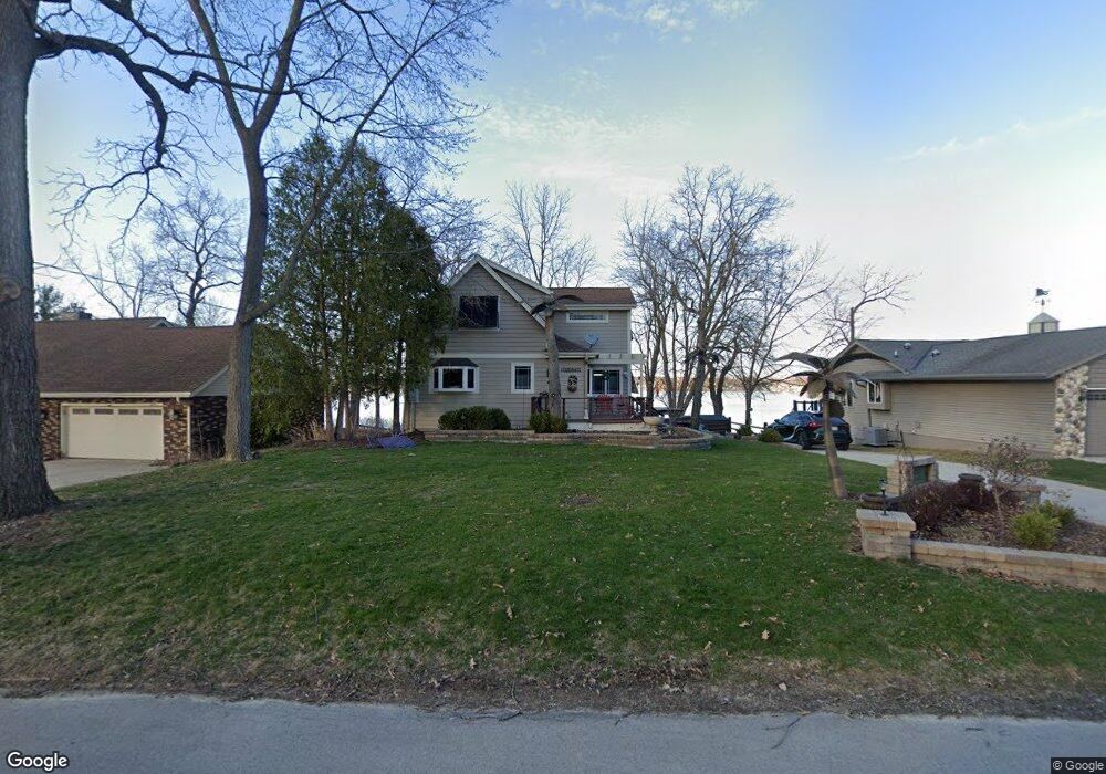
S76W18458 Kingston Dr Muskego, WI 53150
Estimated Value: $864,145 - $1,351,000
3
Beds
2
Baths
1,799
Sq Ft
$621/Sq Ft
Est. Value
About This Home
This home is located at S76W18458 Kingston Dr, Muskego, WI 53150 and is currently estimated at $1,117,286, approximately $621 per square foot. S76W18458 Kingston Dr is a home located in Waukesha County with nearby schools including Muskego Lakes Middle School, Muskego High School, and St. Leonard School.
Ownership History
Date
Name
Owned For
Owner Type
Purchase Details
Closed on
Dec 5, 2012
Sold by
White James P
Bought by
White James P and White Deboah A
Current Estimated Value
Purchase Details
Closed on
Dec 29, 1999
Sold by
White Patrick C and White Marion L
Bought by
White James P and White Cynthia H
Home Financials for this Owner
Home Financials are based on the most recent Mortgage that was taken out on this home.
Original Mortgage
$102,000
Outstanding Balance
$32,042
Interest Rate
7.69%
Estimated Equity
$1,085,244
Create a Home Valuation Report for This Property
The Home Valuation Report is an in-depth analysis detailing your home's value as well as a comparison with similar homes in the area
Home Values in the Area
Average Home Value in this Area
Purchase History
| Date | Buyer | Sale Price | Title Company |
|---|---|---|---|
| White James P | -- | None Available | |
| White James P | $102,000 | -- |
Source: Public Records
Mortgage History
| Date | Status | Borrower | Loan Amount |
|---|---|---|---|
| Open | White James P | $102,000 |
Source: Public Records
Tax History Compared to Growth
Tax History
| Year | Tax Paid | Tax Assessment Tax Assessment Total Assessment is a certain percentage of the fair market value that is determined by local assessors to be the total taxable value of land and additions on the property. | Land | Improvement |
|---|---|---|---|---|
| 2024 | $7,210 | $577,500 | $293,300 | $284,200 |
| 2023 | $7,145 | $577,500 | $293,300 | $284,200 |
| 2022 | $6,978 | $577,500 | $293,300 | $284,200 |
| 2021 | $6,931 | $577,500 | $293,300 | $284,200 |
| 2020 | $6,819 | $455,900 | $256,600 | $199,300 |
| 2019 | $6,413 | $455,900 | $256,600 | $199,300 |
| 2018 | $6,479 | $455,900 | $256,600 | $199,300 |
| 2017 | $6,440 | $455,900 | $256,600 | $199,300 |
| 2016 | $6,481 | $407,300 | $248,100 | $159,200 |
| 2015 | $6,531 | $407,300 | $248,100 | $159,200 |
| 2014 | $6,815 | $407,300 | $248,100 | $159,200 |
| 2013 | $6,815 | $390,800 | $248,100 | $142,700 |
Source: Public Records
Map
Nearby Homes
- W186S7576 Kingston Dr
- W188S7634 Oak Grove Dr
- W188S7598 Oak Grove Dr
- W179S7953 Scenic Dr
- W177S7495 Harbor Cir Unit 6D
- S75W17553 Harbor Cir Unit 1B
- S76W19414 Prospect Dr
- Lt4 Lannon Dr
- S73W17268 Lake Dr
- W171S7452 Lannon Dr
- S70W19133 Kenwood Dr
- W169S7647 Gregory Dr Unit D
- W170S7361 Parkland Dr Unit 13
- S75W16788 Jacob Ct Unit 12
- S83W17591 Cedarcrest Ln
- W169S7219 Avon Ct
- S78W16730 Spinnaker Dr
- S70W20099 Adrian Dr
- Lt2 Racine Ave
- W163S7358 Bay Lane Dr
- S76W18440 Kingston Dr
- S76W18484 Kingston Dr
- S76W18475 Kingston Dr
- S76W18420 Kingston Dr
- S76W18400 Kingston Dr
- S76W18498 Kingston Dr
- W183S7693 Kingston Dr
- S76W18505 Kingston Dr
- S76W18384 Kingston Dr
- S76W18514 Cook Dr
- W183S7682 Kingston Dr
- S76W18516 Kingston Dr
- S76W18550 Cook Dr
- S76W18530 Kingston Dr
- S77W18543 Cook Dr
- S76W18553 Kingston Dr
- S76W18538 Kingston Dr
- S77W18314 Janesville Rd
- W185S7652 Lincoln Dr
- S76W18550 Kingston Dr